Junius, New York
| Junius, New York | |
|---|---|
| Town | |
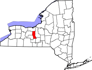
 Junius, New York Location within the state of New York | |
| Coordinates: 42°59′N 76°55′W / 42.983°N 76.917°WCoordinates: 42°59′N 76°55′W / 42.983°N 76.917°W | |
| Country | United States |
| State | New York |
| County | Seneca |
| Area | |
| • Total | 26.9 sq mi (69.5 km2) |
| • Land | 26.7 sq mi (69.3 km2) |
| • Water | 0.1 sq mi (0.3 km2) |
| Elevation | 518 ft (158 m) |
| Population (2000) | |
| • Total | 1,362 |
| • Density | 50.9/sq mi (19.7/km2) |
| Time zone | Eastern (EST) (UTC-5) |
| • Summer (DST) | EDT (UTC-4) |
| ZIP code | 13165 |
| Area code(s) | 315 |
| FIPS code | 36-38858 |
| GNIS feature ID | 0979112 |
Junius is a town in Seneca County, New York, United States. The population was 1,362 at the 2000 census.
The Town of Junius is in the northwest corner of the county and is east of Geneva, New York.
History
Junius was part of the Central New York Military Tract used to pay soldiers of the American Revolution. The region was first settled around 1795.
The town was set apart from the Town of Fayette in 1803. Junius was subsequently divided to form new towns: Wolcott, in Wayne County (1807), Galen also in Wayne County (1812), Seneca Falls (1829), Tyre (1829), and Waterloo (1829).
The Cobblestone Farmhouse at 1027 Stone Church Rd., Cobblestone Farmhouse at 1111 Stone Church Road, Cobblestone Farmhouse at 1229 Birdsey Road, and John Graves Cobblestone Farmhouse are listed on the National Register of Historic Places.[1]
Geography
According to the United States Census Bureau, the town has a total area of 26.9 square miles (70 km2), of which, 26.7 square miles (69 km2) of it is land and 0.1 square miles (0.26 km2) of it (0.41%) is water.
The west town line is the border of Ontario County, and the north town line is the border of Wayne County.
The New York State Thruway (Interstate 90) passes across the town. New York State Route 318 is an east-west highway in the town running parallel to the Thruway. New York State Route 414 is a north-south highway crossing a few arces in the far north-eastern part of Junius.
Demographics
As of the census[2] of 2000, there were 1,362 people, 494 households, and 375 families residing in the town. The population density was 50.9 people per square mile (19.7/km²). There were 532 housing units at an average density of 19.9 per square mile (7.7/km²). The racial makeup of the town was 97.50% White, 0.51% African American, 0.07% Native American, 0.44% Asian, 0.44% from other races, and 1.03% from two or more races. Hispanic or Latino of any race were 1.84% of the population.
There were 494 households out of which 33.4% had children under the age of 18 living with them, 60.7% were married couples living together, 7.9% had a female householder with no husband present, and 23.9% were non-families. 17.6% of all households were made up of individuals and 5.9% had someone living alone who was 65 years of age or older. The average household size was 2.76 and the average family size was 3.06.
In the town the population was spread out with 26.7% under the age of 18, 7.7% from 18 to 24, 29.9% from 25 to 44, 26.3% from 45 to 64, and 9.4% who were 65 years of age or older. The median age was 37 years. For every 100 females there were 99.1 males. For every 100 females age 18 and over, there were 100.8 males.
The median income for a household in the town was $38,317, and the median income for a family was $44,444. Males had a median income of $28,828 versus $22,440 for females. The per capita income for the town was $15,806. About 5.1% of families and 7.9% of the population were below the poverty line, including 7.7% of those under age 18 and 11.1% of those age 65 or over.
Communities and locations in Junius
- Dublin – A hamlet in the central part of the town, formerly called "Junius Post Office." The community is at the junction of County Roads 108 and 109.
- Junius Ponds – A cluster of ponds near the west town line. The name is also used for a nearby service area on the Thruway.
- Malcom – A location on NY-414 in the northeast of the town.
- Stone Church Corner – A hamlet on NY-318.
- Thompson – A hamlet at the west town line in the northwest of Junius on County Road 109.
- West Junius is a hamlet, not in the Town of Junius, but just west of the west town line in Ontario County
References
- ↑ "National Register Information System". National Register of Historic Places. National Park Service. 2009-03-13.
- ↑ "American FactFinder". United States Census Bureau. Retrieved 2008-01-31.
External links
| |||||||||||||||||||||||||||||||||