Julliberrie's Grave
| Julliberrie's Grave | |
|---|---|
|
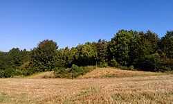
Julliberrie's Grave, viewed from the north. | |
 Location within Kent | |
| Coordinates | 51°14′26″N 0°58′30″E / 51.240479°N 0.974888°E |
| Type | Long barrow |
Julliberrie's Grave is an unchambered earthen Neolithic long barrow in the English county of Kent. It is situated near Chilham overlooking the River Stour on the Julliberrie Downs at Ordnance Survey, grid reference TR077532. The Stour Valley Walk passes close to the site.
It is 44 metres (144 ft) in length, 2 metres (6 ft 7 in) high and measures 15 metres (49 ft) at its widest although it was originally longer. Eighteenth century chalk extraction has destroyed the northern end. This lost part is likely to have been where burials would have been placed although the mound may not have contained any inhumations at all. The north-northeast- south-southwest-oriented earthwork has produced some evidence of Neolithic activity at the site but considerably more evidence of later activity.
It is one of a number of prehistoric barrows overlooking the Stour Valley including recently identified long barrows at Elmsted and Boughton Aluph and the Jacket's Field long barrow in the Wye Forest along with a number of later round barrows. The Julliberrie name is most likely derived from antiquarian speculation; the folk etymology is that it is the burial site of a giant named Julaber. A popular early explanation was that it was the grave of a Roman tribune, Quintus Laberius Durus, mentioned in Julius Caesar's Gallic Wars as being slain by the Britons and Jul Laber therefore being a corruption of '[the grave of] Julius' [tribune], Laberius'.
Background
The Early Neolithic was a revolutionary period in British history. Beginning in the fifth millennium BCE, the British Isles saw a widespread change in lifestyle as communities adopted agriculture as their primary form of subsistence, abandoning the hunter-gatherer lifestyle that had characterised the preceding Mesolithic period.[1] Archaeologists have been unable to prove whether this adoption of farming was because of a new influx of migrants from continental Europe or because the indigenous Mesolithic Britons came to adopt the agricultural practices of continental societies.[1] Between 4500 and 3800 BCE, all of the British Isles came to abandon the Mesolithic hunter-gatherer lifestyle, replacing it with the new agricultural subsistence of the Neolithic Age.[2]
There is archaeological evidence of violence and warfare in Early Neolithic Britain from such sites as West Kennet Long Barrow and Hambledon Hill, with some groups constructing fortifications to defend themselves from attackers.[3] Contemporary archaeologists have no direct proof of gender relations on the island at this time, although most believe that it was probably a male-dominated society, in keeping with all recorded societies that practice large-scale animal husbandry.[4]
Megalithic tombs
"It seems that the role of ancestors in Neolithic society was much more important than in the world of the hunter-gatherer. Clans and forebears began to have symbolic importance to the settled farming communities of the Neolithic. Dead ancestors were celebrated through funerals, feasts and grave goods, and their carefully selected body-parts were housed in specially built monuments, often symbolising 'houses' of the dead... The tombs provide the earliest and most tangible evidence of Neolithic people and their customs, and are some of the most impressive and aesthetically distinctive constructions of prehistoric Britain."
Across Western Europe, the Early Neolithic marked the first period in history when humans began to build monumental structures in the landscape.[4] These monumental structures were tombs designed for holding the physical remains of the dead, and while they were sometimes built out of timber, many were instead constructed out of large stones, known as "megaliths".[4] Individuals were rarely buried alone in the Early Neolithic, instead being interned in collective burials with other members of their community.[5] The construction of these collective monumental burial tombs, sometimes wooden but often megalithic, began in continental Europe before being adopted by people in Britain.[6]
The Early Neolithic people of Britain placed a far greater emphasis on the ritualised burial of the dead than their Mesolithic forebears had done.[5] Many archaeologists have suggested that this is because Early Neolithic people were adherents of an ancestor cult that venerated the spirits of the dead, believing that they could intercede with the forces of nature for the benefit of their living descendants.[5][7] It has furthermore been suggested that Early Neolithic people entered into the tombs – which doubled as temples or shrines – to perform rituals that would honour the dead and ask for their assistance.[7]
In Britain, the tombs themselves were typically located on prominent hills and slopes overlooking the surrounding landscape, particularly at the junction between different territories.[8] Archaeologist Caroline Malone noted that the tombs would have served as one of a variety of markers in the landscape that conveyed information on "territory, political allegiance, ownership, and ancestors."[9]
Archaeologists have differentiated these Early Neolithic tombs into a variety of different architectural styles, which were typically associated with specific regions within the British Isles.[7] Passage graves, characterised by their narrow passage made of large stones and one or multiple burial chambers covered in earth or stone, were predominantly located in northern Britain and southern and central Ireland. Alternately, across northern Ireland and central Britain long chambered mounds predominated, while in the east and south-east of Britain, earthen long barrows represented the dominant architectural trend.[10] These earthen long barrows were typically constructed of timber because building stone was scarce in southern Britain; archaeologist Aubrey Burl argued that these timber tombs might have been "even more eye-catching" than their stone counterparts, perhaps consisting of "towering carved poles, flamboyantly painted", but that evidence of such sculptures has not survived.[7] Nonetheless, there are five known examples of stone tombs having been built in this southern region during the Neolithic, termed the "Medway megaliths" because of their proximity to the River Medway, the Coldrum long barrow being the best surviving example among them.
Construction
The inclusion of an axe within the monument is not unique to Julliberrie's Grave; elsewhere in Britain, axes have been found deposited inside causewayed enclosures and chambered tombs, thus testifying to their ceremonial treatment during the Early Neolithic.[11]
Antiquarian and archaeological investigation
Early investigations
The Neolithic long barrow known as Julliberrie's Grave was investigated by antiquarians in the eighteenth and nineteenth centuries including an excavation by Heneage Finch, later the 5th Earl of Winchelsea, in 1702. Finch dug a shaft through the middle of the mound and then expanded it into a trench along the barrow's length in what was one of the earliest organised 'barrow openings' ever undertaken. He found a few bones he thought were from animals and described a core of dark earth within the barrow covered by a chalk cap.
Finch's friend, William Stukeley, visited the site several times during the 1720s and made drawings that recorded the damage caused by the neighbouring chalk pit. The Wildman family who owned the land also conducted their own excavation around this time whilst a Roman coin hoard was found at the site during fence digging in the nineteenth century.
One nineteenth century antiquarian suggested that the lack of human remains encountered by Finch meant that the barrow was in fact a defensive earthwork whilst other theories included ideas that it was a place for Roman games or the remains of a turf maze. By the early twentieth century, its status as a long barrow was increasingly uncertain.
In 1880, Flinders Petrie recorded the site among a list of Kentish earthworks, referring to it as "Julaber's Grave".[12]
Jessup's excavation

Julliberrie's Grave was partially excavated between 1936 and 1937 by Ronald Jessup. This work showed that it was a long barrow after all. Jessup found a silted-up ditch surrounding the southern, eastern and western sides of the barrow. Chalk excavated from the ditch had been used to cover the earth core of the barrow. The ditch fill contained prehistoric struck flints and also four early Romano-British burials, one cremated, that had presumably been placed at what was still considered a significant site several thousand years after its construction. Further finds of Roman coins and Roman and Iron Age pottery indeed suggest an interest in the site during the period. Two coarse Neolithic pottery fragments were found in the base of the ditch, providing evidence of the initial construction. No evidence of a kerb, chambers or other stonework was found.
At the core of the barrow, Jessup found a Neolithic polished axe, similar to examples from Scandinavia, Germany and the Netherlands and it is likely to have been an exotic import. Bones of oxen and sheep lay within the earth centre. What the excavators interpreted as a ritual pit containing flint tools was also found to the northwest of the western side of the long barrow, .
Jessup also identified areas of burning as well as oyster shell, Roman coins, glass and Samian ware on the southeast side of the barrow. Roman activity at prehistoric sites is not unattested, but such a degree of apparently ritual funerary behaviour is unusual.
Later assessment
Vere Gordon Childe thought that Julliberrie's Grave showed signs of being influenced by Germanic types whilst Stuart Piggott preferred a kinship with the Wessex barrows. Jessup himself saw parallels with Dorset tombs. Later assessments have incorporated the move away from the role of the long barrow as a funerary monument and focused on its position in the landscape.
References
Footnotes
- ↑ 1.0 1.1 Hutton 1991. p. 16.
- ↑ Hutton 1991. p. 17.
- ↑ Hutton 1991. pp. 18–19.
- ↑ 4.0 4.1 4.2 Hutton 1991. p. 19.
- ↑ 5.0 5.1 5.2 5.3 Malone 2001. p. 103.
- ↑ Malone 2001. pp. 103–104.
- ↑ 7.0 7.1 7.2 7.3 Burl 1981. p. 61.
- ↑ Malone 2001. pp. 106–107.
- ↑ Malone 2001. p. 107.
- ↑ Burl 1981. pp. 61–62.
- ↑ Bradley 1990, p. 67.
- ↑ Petrie 1880, p. 11.
Bibliography
- Bradley, Richard (1990). The Passage of Arms: An Archaeological Analysis of Prehistoric Hoards and Votive Deposits. Cambridge: Cambridge University Press. ISBN 9780521384469.
- Petrie, W.M. Flinders (1880). "Notes on Kentish Earthworks". Archaeologia Cantiana 13: 8–16.
- "Coldrum Stones". The National Trust. Retrieved 27 August 2012.
- Bennett, F.J. (January–June 1913). "Coldrum Monument and Exploration 1910". Journal of the Royal Anthropological Institute 43: 76–85. JSTOR 2843160.
- Burl, Aubrey (1981). Rites of the Gods. London: Weidenfeld & Nicolson. ISBN 978-0460043137.
- Clinch, George (1904). "Coldrum, Kent, and Its Relation to Stonehenge". Man 4: 20–23. JSTOR 2840863.
- Grinsell, Leslie V. (1976). Folklore of Prehistoric Sites in Britain. London: David & Charles. ISBN 0-7153-7241-6.
- Hutton, Ronald (1991). The Pagan Religions of the Ancient British Isles: Their Nature and Legacy. Oxford, U.K. and Cambridge, U.S.: Blackwell. ISBN 978-0-631-17288-8.
- Keith, A. (January–June 1913). "Report on the Human Remains Found by F. J. Bennett, Esq., F.G.S., in the Central Chamber of a Megalithic Monument at Coldrum, Kent". Journal of the Royal Anthropological Institute 43: 86–100. JSTOR 2843161.
- Lewis, A.L. (1878). "On a Rude Stone Monument in Kent". The Journal of the Anthropological Institute of Great Britain and Ireland 7: 140–142. JSTOR 2841379.
- Lewis, A.L. (1904). "The Coldrum Monument". Man 4: 395. JSTOR 2839987.
- Malone, Caroline (2001). Neolithic Britain and Ireland. Stroud, Gloucestershire: Tempus. ISBN 0-7524-1442-9.
- Philp, Brian; Dutto, Mike (2005). The Medway Megaliths (Third Edition). Kent: Kent Archaeological Trust.
- Smith, Martin; Brickley, Megan (2009). People of the Long Barrows: Life, Death and Burial in the Early Neolithic. Stroud: The History Press. ISBN 978-0752447339.
- Ashbee, P Julliberrie's Grave, Chilham in Archaeologia Cantiana, Vol CXVI, 1996