Jonaswalde
| Jonaswalde | |
|---|---|
 Jonaswalde | |
Location of Jonaswalde within Altenburger Land district 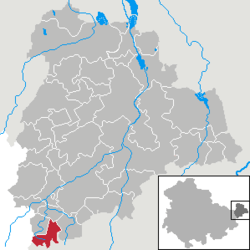 | |
| Coordinates: 50°50′21″N 12°17′16″E / 50.83917°N 12.28778°ECoordinates: 50°50′21″N 12°17′16″E / 50.83917°N 12.28778°E | |
| Country | Germany |
| State | Thuringia |
| District | Altenburger Land |
| Municipal assoc. | Oberes Sprottental |
| Government | |
| • Mayor | André Vohß |
| Area | |
| • Total | 6.65 km2 (2.57 sq mi) |
| Population (2013-12-31)[1] | |
| • Total | 308 |
| • Density | 46/km2 (120/sq mi) |
| Time zone | CET/CEST (UTC+1/+2) |
| Postal codes | 04626 |
| Dialling codes | 034496 |
| Vehicle registration | ABG |
| Website | www.jonaswalde.de |
Jonaswalde is a municipality in the Thuringian district of Altenburger Land. It belongs to the Verwaltungsgemeinschaft of Oberes Sprottental.
Geography
Neighboring municipalities
Nearby municipalities are Heukewalde, Thonhausen, and Vollmershain in the district of Altenburger Land; Rückersdorf in the district of Greiz; as well as the city of Crimmitschau in the Saxon district of Zwickauer Land.
Municipal arrangement
The community is divided into two subdivisions: Jonaswalde and Nischwitz.
History
From 1826-1920, Jonaswalde was part of Saxe-Altenburg.
References
- ↑ "Bevölkerung der Gemeinden, erfüllenden Gemeinden und Verwaltungsgemeinschaften nach Geschlecht in Thüringen". Thüringer Landesamt für Statistik (in German). 13 July 2013.
External links
- (German) a private website from Jonaswalde
- (German) FOSAVIS, a private website from Dirk Salomon, Jonaswalde