Johnston Parish, New Brunswick
| Johnston | |
|---|---|
| Parish | |
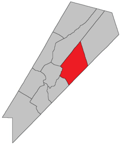 Location within Queens County, New Brunswick. | |
| Coordinates: 45°50′N 64°35′W / 45.84°N 64.59°W | |
| Country |
|
| Province |
|
| County | Queens County |
| Established | 1839 |
| Area[1] | |
| • Land | 359.18 km2 (138.68 sq mi) |
| Population (2011)[1] | |
| • Total | 660 |
| • Density | 1.8/km2 (5/sq mi) |
| • Pop 2006-2011 |
|
| • Dwellings | 432 |
| Time zone | AST (UTC-4) |
| • Summer (DST) | ADT (UTC-3) |
This article is about the parish. For the community, consult Johnston, New Brunswick.
Johnston Parish is a Canadian parish in Queens County, New Brunswick.
History
Johnston Parish established in 1839 from Wickham Parish: named for Hugh Johnston (1790-1850), who was a Member of the Legislative Assembly of New Brunswick: his father, Hugh Johnston (1756-1829), was also a Member of the Legislative Assembly.
Delineation
Johnston Parish is defined in the Territorial Division Act as:
Communities
Parish population total does not include incorporated municipalities (in bold).
|
|
|
Bodies of water & Islands
This is a list of rivers, lakes, streams, creeks, marshes and Islands that are at least partially in this parish
Demographics
PopulationPopulation trend[2]
|
LanguageMother tongue language (2006)[3]
|
Access Routes
Highways and numbered routes that run through the parish, including external routes that start or finish at the parish limits:[4]
|
|
|
See also
References
- ↑ 1.0 1.1 2011 Statistics Canada Census Profile: Johnston Parish, New Brunswick
- ↑ Statistics Canada: 2001, 2006 census
- ↑ Profile: Johnston Parish, New Brunswick
- ↑ Atlantic Canada Back Road Atlas ISBN 978-1-55368-618-7
 |
Wickham Parish | Waterborough Parish | Brunswick Parish | |
| Cambridge Parish | |
Studholm Parish | ||
| ||||
| | ||||
| Kars Parish | Springfield Parish | Sussex Parish |
| ||||||||||||||||||
Coordinates: 45°52′31″N 65°47′43″W / 45.87519°N 65.795403°W