Jijel Province
| Jijel Province ولاية جيجل | |
|---|---|
| Province | |
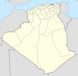 Map of Algeria highlighting Jijel | |
| Coordinates: 36°48′N 5°46′E / 36.800°N 5.767°ECoordinates: 36°48′N 5°46′E / 36.800°N 5.767°E | |
| Country |
|
| Capital | Jijel |
| Area | |
| • Total | 2,577 km2 (995 sq mi) |
| Population (2008)[1] | |
| • Total | 634,412 |
| • Density | 250/km2 (640/sq mi) |
| Time zone | CET (UTC+01) |
| Area Code | +213 (0) 34 |
| ISO 3166 code | DZ-18 |
| Districts | 11 |
| Municipalities | 28 |
Jijel (Berber: ⵉⵖⵉⵍ ⴳⵉⵍⵉ, Arabic: ولاية جيجل) is a province (wilaya) in Algeria in the eastern Mediterranean coast. The capital is Jijel (Berber Igilgili). Taza National Park is there.
Administrative divisions
The province is divided into 11 districts, which are further divided into 28 communes or municipalities.
Districts
Communes
- Bordj T'har
- Boucif Ouled Askeur
- Boudriaa Ben Yadjis
- Bouraoui Belhadef
- Chahna
- Chekfa
- Djemaa Beni Habibi
- Djimla
- El Ancer
- El Aouana
- El Kennar Nouchfi
- El Milia
- Emir Abdelkader
- Eraguene
- Ghebala
- Jijel
- Kaous
- Kheïri Oued Adjoul
- Ouadjana
- Ouled Rabah
- Ouled Yahia Khedrouche
- Selma Benziada
- Settara
- Sidi Abdelaziz
- Sidi Maarouf
- Taher
- Texenna
- Ziama Mansouriah
References
- ↑ Office National des Statistiques, Recensement General de la Population et de l’Habitat 2008 Preliminary results of the 2008 population census. Accessed on 2008-07-02.
External links
- (French) Official website of the Province
- (French) Jijel local on-line news
- (French) Jijel news
- (French) Jijel on-line
- (French) Djidjelli.com
| ||||||||