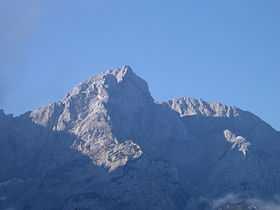
Jezerska Kočna
| Jezerska Kočna | |
|---|---|
 | |
| Elevation | 2,540 m (8,330 ft) |
| Location | |
 Jezerska Kočna | |
| Range | Kamnik–Savinja Alps |
| Coordinates | 46°21′31.320″N 14°31′19.416″E / 46.35870000°N 14.52206000°ECoordinates: 46°21′31.320″N 14°31′19.416″E / 46.35870000°N 14.52206000°E |
| Climbing | |
| First ascent | 1840 Jernik & Suhadolnik |
Jezerska Kočna[1] at 2,540 metres (8,330 ft) high, is the second highest mountain in the Kamnik–Savinja Alps and the most western peak of so-called Grintovci. Its prominent and easily recognized peak is visible from far around. Kočna mountain actually consists of two peak the higher Jezerska Kočna and lower but not far apart Kokrska Kočna.
Cojzova Koča - Zois hut
Starting points
Routes
- 4½-5h: from Kokra: the Suhadolnik Route
- 3¼h: from the Czech Lodge at Spodnje Ravni (Slovene: Češka koča na Spodnjih Ravneh; 1542 m): the Kremžar Route
- 3½h: from the Zois Lodge at Kokra Saddle (Slovene: Cojzova koča na Kokrskem sedlu; 1793 m)
- 1¾h: from the top of Mount Grintovec: the Šprem Route
References
External links
| ||||||||