Jesenje, Litija
| Jesenje | |
|---|---|
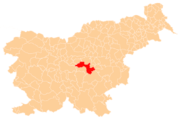
_location_map.svg.png) Jesenje Location in Slovenia | |
| Coordinates: 46°6′6.08″N 14°48′21.07″E / 46.1016889°N 14.8058528°ECoordinates: 46°6′6.08″N 14°48′21.07″E / 46.1016889°N 14.8058528°E | |
| Country |
|
| Traditional region | Lower Styria |
| Statistical region | Central Sava |
| Municipality | Litija |
| Area | |
| • Total | 0.99 km2 (0.38 sq mi) |
| Elevation | 409 m (1,342 ft) |
| Population (2002) | |
| • Total | 97 |
| [1] | |
Jesenje is a settlement in the hills above the left bank of the Sava River in the Municipality of Litija in central Slovenia. Traditionally the area was part of Lower Styria and is now included with the rest of the municipality in the Central Sava Statistical Region; until January 2014 the municipality was part of the Central Slovenia Statistical Region.[2] It includes the hamlets of Mežnar and Ravne (German: Raune)[3] to the south, and Špeličnik to the north.