Jerilderie Shire
| Jerilderie Shire New South Wales | |||||||||||||
|---|---|---|---|---|---|---|---|---|---|---|---|---|---|
|
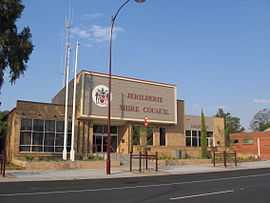
Jerilderie Shire Council office and chambers. | |||||||||||||
|
Location of Jerilderie Shire in New South Wales | |||||||||||||
| Coordinates | 35°21′S 145°44′E / 35.350°S 145.733°ECoordinates: 35°21′S 145°44′E / 35.350°S 145.733°E | ||||||||||||
| Population | 1,526 (2012)[1] | ||||||||||||
| • Density | 0.45242/km2 (1.1718/sq mi) | ||||||||||||
| Established | 1918 | ||||||||||||
| Area | 3,373 km2 (1,302.3 sq mi) | ||||||||||||
| Mayor | Cr. Terry Hogan AM (Unaligned) | ||||||||||||
| Council seat | Jerilderie[2] | ||||||||||||
| Region | Riverina | ||||||||||||
| State electorate(s) | Albury | ||||||||||||
| Federal Division(s) | Farrer | ||||||||||||
| Website | Jerilderie Shire | ||||||||||||
| |||||||||||||

Jerilderie Shire is a local government area in the Riverina region of southern New South Wales, Australia. The Shire is located adjacent to the Newell Highway. The Shire was declared in 1918 after the amalgamation of the former Municipality of Jerilderie (1889 - 1918) and Wunnamurra Shire (1906 - 1918). Jerilderie Shire is the second smallest local government area in New South Wales, in terms of population.
The mayor of Jerilderie Shire is Cr. Terry Hogan AM, an unaligned politician. The seat of the Council is located in Jerilderie, the only significant town in the Shire.
Current composition and election method
Jerilderie Shire Council is composed of seven councillors elected proportionally as one entire ward. All councillors are elected for a fixed four-year term of office. The mayor is elected by the councillors at the first meeting of the Council. The most recent election was held on 8 September 2012 and the makeup of the Council is as follows:[3]
| Party | Councillors | |
|---|---|---|
| Independents and Unaligned | 7 | |
| Total | 7 | |
The current Council, elected in 2012, in order of election, is:[3]
| Councillor | Party | Notes | |
|---|---|---|---|
| Terry Hogan AM | Unaligned | Mayor | |
| Faith Bryce | Independent | ||
| Ruth McRae | Unaligned | Deputy Mayor | |
| Laurie Henery | Independent | ||
| John Hudson | Unaligned | ||
| Tim Sheed | Unaligned | ||
| Gaila Smith | Independent | ||
References
- ↑ "3218.0 - Regional Population Growth, Australia, 2012". Australian Bureau of Statistics. 30 August 2013. Retrieved 27 March 2014. Estimated resident population (ERP) at 30 June 2012.
- ↑ "Jerilderie Shire Council". Department of Local Government. Retrieved 2006-12-01.
- ↑ 3.0 3.1 "Jerilderie Shire Council: Summary of First Preference Votes for each Candidate". Local Government Elections 2012. Electoral Commission of New South Wales. 13 September 2012. Retrieved 29 September 2012.
| ||||||||||||||
| ||||||||||||||||||||||||||||||||||||||||||||||||||||||||||||