Jemison, Alabama
| Jemison, Alabama | |
|---|---|
| City | |
| Motto: Community - Government - Agriculture | |
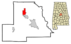 Location in Chilton County and the state of Alabama | |
| Coordinates: 32°57′32″N 86°44′37″W / 32.95889°N 86.74361°W | |
| Country | United States |
| State | Alabama |
| County | Chilton |
| Government | |
| • Mayor | Eddie Reed |
| Area | |
| • Total | 11.3 sq mi (29.2 km2) |
| • Land | 11.2 sq mi (29.0 km2) |
| • Water | 0.08 sq mi (0.2 km2) |
| Elevation | 719 ft (219 m) |
| Population (2010) | |
| • Total | 2,585 |
| • Density | 231/sq mi (89.2/km2) |
| Time zone | Central (CST) (UTC-6) |
| • Summer (DST) | CDT (UTC-5) |
| ZIP code | 35085 |
| Area code(s) | 205 |
| FIPS code | 01-38608 |
| GNIS feature ID | 0151885 |
| Website |
www |
Jemison is a city in Chilton County, Alabama, United States. At the 2010 census the population was 2,585.[1] The center of population of Alabama is located outside of Jemison, an area known as Jemison Division.[2]
Geography
Jemison is located in northern Chilton County at 32°57'31.792" North, 86°44'36.841" West (32.958831, -86.743567).[3]
According to the U.S. Census Bureau, the town has a total area of 11.3 square miles (29.2 km2), of which 11.2 square miles (29.0 km2) is land and 0.077 square miles (0.2 km2), or 0.65%, is water.[1]
Demographics
| Historical population | |||
|---|---|---|---|
| Census | Pop. | %± | |
| 1900 | 245 | — | |
| 1910 | 413 | 68.6% | |
| 1920 | 419 | 1.5% | |
| 1930 | 459 | 9.5% | |
| 1940 | 456 | −0.7% | |
| 1950 | 847 | 85.7% | |
| 1960 | 977 | 15.3% | |
| 1970 | 1,423 | 45.6% | |
| 1980 | 1,828 | 28.5% | |
| 1990 | 1,898 | 3.8% | |
| 2000 | 2,248 | 18.4% | |
| 2010 | 2,585 | 15.0% | |
| Est. 2013 | 2,642 | 2.2% | |
| U.S. Decennial Census[4] 2013 Estimate[5] | |||
As of the census[6] of 2000, there were 2,248 people, 840 households, and 636 families residing in the city. The population density was 276.9 people per square mile (106.9/km²). There were 916 housing units at an average density of 112.8 per square mile (43.6/km²). The racial makeup of the city was 77.54% White, 19.48% Black or African American, 0.58% Native American, 0.18% Asian, 1.60% from other races, and 0.62% from two or more races. 2.94% of the population were Hispanic or Latino of any race.
There were 840 households out of which 35.8% had children under the age of 18 living with them, 59.6% were married couples living together, 11.4% had a female householder with no husband present, and 24.2% were non-families. 21.2% of all households were made up of individuals and 8.2% had someone living alone who was 65 years of age or older. The average household size was 2.66 and the average family size was 3.10.
In the city the population was spread out with 26.6% under the age of 18, 8.5% from 18 to 24, 28.2% from 25 to 44, 25.6% from 45 to 64, and 11.1% who were 65 years of age or older. The median age was 36 years. For every 100 females there were 91.3 males. For every 100 females age 18 and over, there were 87.9 males.
The median income for a household in the city was $33,250, and the median income for a family was $41,202. Males had a median income of $30,958 versus $21,083 for females. The per capita income for the city was $15,288. About 12.4% of families and 14.1% of the population were below the poverty line, including 18.8% of those under age 18 and 15.6% of those age 65 or over.
Schools
Elementary
Jemison Elementary School has about 950 students enrolled. It ranks scholastically among the best of Alabama's schools. In late 2006, the test scores at Jemison Elementary outperformed all but one school in Alabama.
Middle
Grades 5–7 are taught at Jemison Middle School.
High
Grades 8–12 are taught at Jemison High School.
Notable native
- Ruby Sales, African-American social activist
- Winston M. Scott, former Central Intelligence Agency officer
- Reynolds Wolf, meteorologist and journalist
References
- ↑ 1.0 1.1 "Geographic Identifiers: 2010 Demographic Profile Data (G001): Jemison city, Alabama". U.S. Census Bureau, American Factfinder. Retrieved June 4, 2014.
- ↑ "Population and Population Centers by State: 2000". United States Census. Retrieved 10 May 2013.
- ↑ "US Gazetteer files: 2010, 2000, and 1990". United States Census Bureau. 2011-02-12. Retrieved 2011-04-23.
- ↑ "U.S. Decennial Census". Census.gov. Retrieved June 6, 2013.
- ↑ "Annual Estimates of the Resident Population: April 1, 2010 to July 1, 2013". Retrieved June 3, 2014.
- ↑ "American FactFinder". United States Census Bureau. Retrieved 2008-01-31.
External links
Coordinates: 32°57′32″N 86°44′37″W / 32.958831°N 86.743567°W
| |||||||||||||||||||||||||
