Jebel Akhdar, Libya


The Jebel Akhdar (Arabic: الجبل الأخضر al-Jabal al-Akhḍar, English: The Green Mountain) is a heavily forested, fertile upland area in northeastern Libya. It is located in the modern Shabiyahs or Districts of Derna, Jabal al Akhdar, and Marj.
Geography
The Jebel Akhdar consists of a mountainous plateau rising to an altitude of 500 metres (1,600 ft), cut by several valleys and wadis. It lies northeast of Benghazi and south of Derna and the Mediterranean Sea. The region is one of the very few forested areas of Libya, which taken as a whole is one of the least forested countries on Earth. It is the wettest part of Libya, receiving some 600 millimetres (24 in) of precipitation annually. The high rainfall contributes to the area's large forests containing Chammari, and enables rich fruit, potato, and cereal agriculture, something of a rarity in the arid country.
The city of Bayda is the capital of Jabal al Akdhar District and one of the region's largest cities.
History
- Ancient
The ancient Greek colony of Cyrene was located in a lush valley in the Jebel Akhdar, with the ruins remaining.
- Liberation
The Libyan leader Omar Mukhtar used this heavily forested mountainous region to resist the Italian military occupation of Libya as Italian colony for more than twenty years, where he organized and devised strategies for the Libyan resistance against Italian Libya.
See also
| Wikimedia Commons has media related to Jebel Akhdar. |
- Mediterranean dry woodlands and steppe – lower elevations
- Mediterranean woodlands and forests – higher elevations
Photo gallery
-
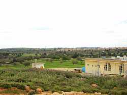
Eastern end of Jebel Akhdar, (The outskirts of the city of Bayda).
-

Eastern end of Jebel Akhdar, (near Derna).
-

Marj escarpment area.
-

Al Bakour escarpment area.
-

Al Bakour at the western end of Jebel Akhdar, near Taucheira).
-

A severe deforestation of Jebel Akhdar (near Wadi el Kuf Bridge).
Coordinates: 32°35′52″N 21°28′22″E / 32.597734°N 21.472778°E