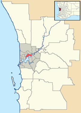
Jandabup, Western Australia
| Jandabup Perth, Western Australia | |||||||||||||
|---|---|---|---|---|---|---|---|---|---|---|---|---|---|
 Jandabup Location in metropolitan Perth | |||||||||||||
| Coordinates | 31°44′28″S 115°51′04″E / 31.741°S 115.851°ECoordinates: 31°44′28″S 115°51′04″E / 31.741°S 115.851°E | ||||||||||||
| Population | 341 (2011 census)[1] | ||||||||||||
| • Density | 18.84/km2 (48.79/sq mi) | ||||||||||||
| Postcode(s) | 6077 | ||||||||||||
| Area | 18.1 km2 (7.0 sq mi) | ||||||||||||
| Location | |||||||||||||
| LGA(s) | City of Wanneroo | ||||||||||||
| State electorate(s) | Wanneroo | ||||||||||||
| Federal Division(s) | Cowan | ||||||||||||
| |||||||||||||
Jandabup is a suburb of Perth, Western Australia, located within the City of Wanneroo. The suburb takes its name from the nearby Jandabup Lake (now a nature reserve) on the Swan coastal plain.
References
- ↑ Australian Bureau of Statistics (31 October 2012). "Jandabup (State Suburb)". 2011 Census QuickStats. Retrieved 16 February 2014.
| |||||||||||||||||||||
