Jamieson, Victoria
| Jamieson Victoria | |
|---|---|
|
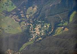
Aerial photo from west | |
 Jamieson | |
| Coordinates | 37°19′0″S 146°08′0″E / 37.31667°S 146.13333°ECoordinates: 37°19′0″S 146°08′0″E / 37.31667°S 146.13333°E |
| Population | 384 (2011 census)[1] |
| Postcode(s) | 3723 |
| Location | |
| LGA(s) | Shire of Mansfield |
| State electorate(s) | Eildon |
| Federal Division(s) | Indi |
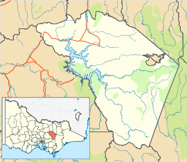
Jamieson is a small town in Victoria, Australia. It is located at the junction of the Goulburn River and Jamieson River, 199 kilometres (124 mi) north-east of Melbourne. The name is believed to have been derived from George Jamieson, a shepherd who grazed sheep in the area in the 1850s. At the time of the 2011 census, Jamieson had a population of 384.[1]
The area was first settled in 1860 and by 1861 there were approximately 300 people working the goldfields. The Post Office opened on 18 January 1858.[2]
The town site was surveyed in 1862, and a borough council was established in 1864. By 1865 the town had a Catholic chapel, an Anglican church, a school, a court house and police station, two banks, two insurance offices, five hotels and several stores. Jamieson reached its peak in the 1870s, but a sharp decline soon followed. Most mining operations had ceased by the beginning of the First World War, and Black Friday bushfires destroyed many mine workings in 1939.
By the 1990s, the town had become a popular tourist destination, boosted by Lake Eildon (situated adjacent to the Jamieson township and formed by the damming of the Goulburn River) reaching 100% capacity in 1996. However the tourism industry suffered in the early 2000s following a drought which affected Lake Eildon. The drought has proven to be long term and in March 2007, the capacity of the lake reached a historic low of 7.9%.
Today, Jamieson has a permanent population of around 250. It is a popular destination for four wheel drive enthusiasts, fishers, and amateur gold diggers. It is close to Lake Eildon and the Mount Buller snowfields. The town has two hotels, a caravan park, and several bed and breakfast establishments.
2006-07 Victorian Bushfires
In December 2006, Victoria's North-East was affected by many bushfires that would threaten to all merge into fewer, but bigger firefronts. Jamieson was one town at the centre of attention during these times, used as a major post for firefighters and media (Free-to-Air, Pay TV and newspaper journalists were based in the town). Luckily for Jamieson, fire breaks helped the Mount Terrible fire stay away from the town centre. It was also helped by a late Southerly Change that brought rain. However a short distance, both East and South East (Jamieson-Licola and Mansfield-Woods Point Roads) of the town were burnt in the blaze.
References
- ↑ 1.0 1.1 Australian Bureau of Statistics (31 October 2012). "Jamieson (State Suburb)". 2011 Census QuickStats. Retrieved 2 December 2014.
- ↑ Premier Postal History, Post Office List, retrieved 11 April 2008
External links
![]() Media related to Jamieson, Victoria at Wikimedia Commons
Media related to Jamieson, Victoria at Wikimedia Commons
| ||||||
