Jamestown, Missouri
| Jamestown, Missouri | |
|---|---|
| Village | |
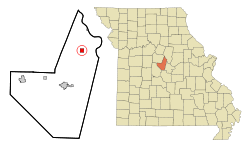 Location of Jamestown, Missouri | |
| Coordinates: 38°45′57″N 92°28′41″W / 38.76583°N 92.47806°WCoordinates: 38°45′57″N 92°28′41″W / 38.76583°N 92.47806°W | |
| Country | United States |
| State | Missouri |
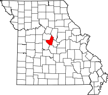
| County | Moniteau |
| Area[1] | |
| • Total | 1.01 sq mi (2.62 km2) |
| • Land | 1.00 sq mi (2.59 km2) |
| • Water | 0.01 sq mi (0.03 km2) |
| Elevation | 869 ft (265 m) |
| Population (2010)[2] | |
| • Total | 386 |
| • Estimate (2012[3]) | 387 |
| • Density | 386.0/sq mi (149.0/km2) |
| Time zone | Central (CST) (UTC-6) |
| • Summer (DST) | CDT (UTC-5) |
| ZIP code | 65046 |
| Area code(s) | 660 |
| FIPS code | 29-36368[4] |
| GNIS feature ID | 0720255[5] |
Jamestown is a village in Moniteau County, Missouri, United States. The population was 386 at the 2010 census. It is part of the Jefferson City, Missouri Metropolitan Statistical Area.
Incorporated in 1873, Jamestown was named after Edward and Samuel James who established a trading post there in 1846.[6] The village traces its roots to 1837 when John, William and Joshua Hightower built a tobacco factory at the site. The location was desirable as it was at an intersection of roads leading from the river towns of Sandy Hook and Lupus, Missouri.
Geography
Jamestown is located at 38°45′57″N 92°28′41″W / 38.76583°N 92.47806°W (38.765754, -92.477960).[7]
According to the United States Census Bureau, the village has a total area of 1.01 square miles (2.62 km2), of which, 1.00 square mile (2.59 km2) of it is land and 0.01 square miles (0.03 km2) is water.[1]
There is one high school in Jamestown, Jamestown C-1.
Demographics
2010 census
As of the census[2] of 2010, there were 386 people, 161 households, and 100 families residing in the village. The population density was 386.0 inhabitants per square mile (149.0/km2). There were 187 housing units at an average density of 187.0 per square mile (72.2/km2). The racial makeup of the village was 97.9% White and 2.1% from two or more races. Hispanic or Latino of any race were 1.0% of the population.
There were 161 households of which 34.2% had children under the age of 18 living with them, 48.4% were married couples living together, 11.2% had a female householder with no husband present, 2.5% had a male householder with no wife present, and 37.9% were non-families. 36.6% of all households were made up of individuals and 18.6% had someone living alone who was 65 years of age or older. The average household size was 2.40 and the average family size was 3.16.
The median age in the village was 36.6 years. 28.5% of residents were under the age of 18; 5.7% were between the ages of 18 and 24; 24.3% were from 25 to 44; 22% were from 45 to 64; and 19.4% were 65 years of age or older. The gender makeup of the village was 49.2% male and 50.8% female.
2000 census
As of the census[4] of 2000, there were 382 people, 175 households, and 103 families residing in the town. The population density was 381.2 people per square mile (147.5/km²). There were 191 housing units at an average density of 190.6 per square mile (73.7/km²). The racial makeup of the town was 97.12% White, 0.79% Native American, 0.26% Asian, 0.26% Pacific Islander, and 1.57% from two or more races. Hispanic or Latino of any race were 0.52% of the population.
There were 175 households out of which 27.4% had children under the age of 18 living with them, 44.6% were married couples living together, 9.7% had a female householder with no husband present, and 40.6% were non-families. 36.0% of all households were made up of individuals and 16.0% had someone living alone who was 65 years of age or older. The average household size was 2.18 and the average family size was 2.81.
In the town the population was spread out with 23.0% under the age of 18, 8.9% from 18 to 24, 27.0% from 25 to 44, 24.3% from 45 to 64, and 16.8% who were 65 years of age or older. The median age was 38 years. For every 100 females there were 94.9 males. For every 100 females age 18 and over, there were 86.1 males.
The median income for a household in the town was $31,667, and the median income for a family was $41,389. Males had a median income of $27,917 versus $20,461 for females. The per capita income for the town was $16,498. About 3.7% of families and 8.1% of the population were below the poverty line, including 10.6% of those under age 18 and 9.8% of those age 65 or over.
References
- ↑ 1.0 1.1 "US Gazetteer files 2010". United States Census Bureau. Retrieved 2012-07-08.
- ↑ 2.0 2.1 "American FactFinder". United States Census Bureau. Retrieved 2012-07-08.
- ↑ "Population Estimates". United States Census Bureau. Retrieved 2013-05-30.
- ↑ 4.0 4.1 "American FactFinder". United States Census Bureau. Retrieved 2008-01-31.
- ↑ "US Board on Geographic Names". United States Geological Survey. 2007-10-25. Retrieved 2008-01-31.
- ↑ Eaton, David Wolfe (1917). How Missouri Counties, Towns and Streams Were Named. The State Historical Society of Missouri. p. 333.
- ↑ "US Gazetteer files: 2010, 2000, and 1990". United States Census Bureau. 2011-02-12. Retrieved 2011-04-23.
| |||||||||||||||||||||