Itahari
| Itahari इटहरी Eastern Heart | |
|---|---|
| Sub-Metropolitan City | |
| Motto: Green, Peace, Green City Itahari, Pollution free City Of Nepal | |
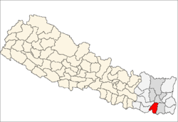
 Itahari Location in Nepal | |
| Coordinates: 26°40′N 87°17′E / 26.667°N 87.283°ECoordinates: 26°40′N 87°17′E / 26.667°N 87.283°E | |
| Country |
|
| Zone | Koshi Zone |
| District | Sunsari District |
| Government | |
| • Type | Itahari sub-metropolitan City |
| Area | |
| • Total | 87.3301 km2 (33.7183 sq mi) |
| Population (2011) | |
| • Total | 146,549 |
| • Ethnicities | Brahmin, Chhetri, Limbu, Rai, Tharu, Gurung, people |
| • Religions | Hinduism, Buddhist |
| Time zone | Nepal Time (UTC+5:45) |
| Postal Code | 56705 |
| Area code(s) | 025 |
| Website | itahari.gov.np |
Itahari (Nepali: इटहरी ) is a Sub-Metropolitan and largest city in Sunsari District in the Koshi Zone of south-eastern Nepal. It is located at the main transportation junction of eastern Nepal. It is the center of the west-east Mahendra Highway and south-north Koshi Highway and thus is a town of emerging importance. At the time of the 2011 Nepal census it had a population of 74,501 people living in 18,270 individual households.[1]
History
There are many arguments about the naming of Itahari. Some argue that the name was derived from the Itahar meaning bricks because the people had found ancient Multani coins and bricks at Itahari. Itahari is also mentioned in old government documents of Nepal. The current town of Itahari was the Mauja of old Rana family of Nepal and it once belonged to General Subarna Samser Rana. The Nepali Maithil community is the oldest community of Itahari.
Geography
Located in the Eastern Region of Nepal, the town and metropolitan area of Itahari is developing rapidly. One of the reasons for the rapid expansion of Itahari is the fact that it lies on both the south-north, from hill to tarai, Koshi rajmarga (highway) and Mahendra rajmarga (highway) has been crossed Itahari city from wet to east. Hence, Itahari is known as an important transportation junction of Eastern Nepal. Itahari is located in the fertile Tarai region. There are two small rivers, Sunsari khola (river) and Tengra khola (river) flow from the mid-part of Itahri, Budikhola, lies in east part, is the larger in size with comparison to Sunsari and Tengra Khola that flows from the east-border side of Itahari which separates Sunsari and Morang district. Although it is completely plain area, there is a dense forest range, known as Charkose Jhadi, of Nepal can be found just seven kilometer (approximately) far from the city to the north side.
Transport
- Road: Itahari is roughly 478 kilometres (300 mi) by road from Kathmandu. It is also well connected to other parts of the country by bus services.
- Intracity: Cycle rickshaws and taxis serve the city center. Auto rickshaws (Tempos) are available for longer distances outside the center as well.
News/Media
Itahari is the television hub of the Eastern Region. Makalu Television was the first television in the region, but others such as Arena Television are growing up. Some daily national magazines are Jana Bidhroha, Aauser, Pubeli Hotlines and Blast. Many FM stations are growing rapidly. There are more than four FM stations located in Itahari. Saptakoshi FM which is most popular and listened Fm radio of Eastern Development Region other Fm radio like Itahari FM Radio Pariwartan & Namaste FM are popular.kchhakhabar.com, Purbelinews.com are Popular Online Media from Ithari.
Education and literature
There were very few private schools until the early 1990s. Many more private schools and colleges have opened since. Itahari also houses a culture centre and library which was built with the help of the Government of Luxembourg and is currently being managed by Itahari sub-metropolitian city.
Schools:
- Modern Preparatory Secondary Boarding School
- Peace Zone Boarding School
- Sacred Heart Secondary School
- North Point Secondary Boarding School
- Secondary Boarding School
- SOS School
- Hamro English Boarding School
- Bhrikuti Secondary Boarding School
- Godawari Vidhya Mandir
Colleges:
- Vishwa Adarsha College, Aitabare [2]
- Kasturi Higher Secondary School
- Susma Engineering College
- Janta Multiple Campus
Sports
National level football championships are held each year in Itahari.
References
- ↑ "Nepal Census 2001". Nepal's Village Development Committees. Digital Himalaya. Retrieved 2 December 2008.
- ↑ http://www.vac.edu.np