Isu, Nigeria
| Isu Local Government Area isu formerly Isu/Njaba (Nkwerre Isu) local government area | |
|---|---|
| LGA | |
| Nickname(s): isu umu-oma | |
 Isu Local Government Area | |
| Coordinates: 5°41′2″N 7°4′8″E / 5.68389°N 7.06889°ECoordinates: 5°41′2″N 7°4′8″E / 5.68389°N 7.06889°E | |
| Country |
|
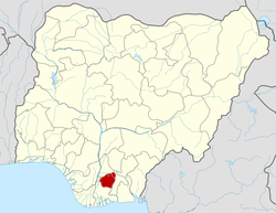
| State | Imo State |
| Headquarters | Umundugba |
| Time zone | WAT (UTC+1) |
| Website | http://www.isu.gov.ng/ |
Isu is a local government area in the Imo State of Nigeria. Its headquarters are in the town of Umundugba. Other communities are Amandugba, Ekwe, Uburu Ekwe, Isunjaba, Amurie Omanze, Ebenator Ekwe and Oboro Amurie.[1] The name comes from the Isu people, a subgroup of the Igbo people.[2]
Amandugba and neighboring Umundugba used to be one town.[3] Both communities have suffered from an unreliable water supply from streams and brooks that often dry up, and that are breeding grounds for malaria-carrying mosquitoes and sources of diseases such as cholera, diarrhea, dysentery, guinea worm, tape worm, and night blindness. A recent project by Africa We Care, a charity, has started to develop a supply based on a bore-hole.[4]
References
- ↑ "Education & Schools". Isu LGA. Retrieved 2011-06-02.
- ↑ Olson 1996, pp. 245.
- ↑ Egbe Ifie, ed. (2000). Africa, our times and culture, Volume 1, Part 2. Oputoru Books. p. 194. ISBN 978-35285-9-9.
- ↑ "The Water for Life Project". Africa We Care. Retrieved 12011-06-02. Check date values in:
|accessdate=(help)
| |||||||||||||