Islands Region
| Islands Region | |
|---|---|
| Region | |
 | |
| Coordinates: 4°21′S 152°16′E / 4.350°S 152.267°ECoordinates: 4°21′S 152°16′E / 4.350°S 152.267°E | |
| Country |
|
| Largest city | Arawa |
| Area | |
| • Total | 89,803 km2 (34,673 sq mi) |
| Population (2000) | |
| • Total | 918,151 |
| • Density | 10/km2 (26/sq mi) |
| Time zone | AEST (UTC+10) |
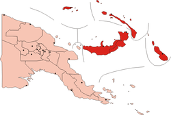
The Islands Region is one of four regions of Papua New Guinea (PNG) comprising the Bismarck Archipelago and northeastern Solomon Islands Archipelago, located northeast of the mainland on eastern New Guinea island.
This is the least densely inhabited region of the country with a population of 750,000 (14% of PNG).[1]
It is distinct through its prehistory and history, as shown by the prevalence of Austronesian languages, and archeological findings of Lapita pottery culture.
Subdivision
The Region is administratively divided into five provinces:
- East New Britain
- Manus
- New Ireland
- Autonomous Region of Bougainville
- West New Britain
References
- ↑ PNG Census 2000