Island Beach, South Australia
| Island Beach South Australia | |
|---|---|
|
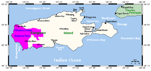
Map of Kangaroo Island | |
 Island Beach | |
| Coordinates | 35°39′11″S 137°38′03″E / 35.65306°S 137.63417°ECoordinates: 35°39′11″S 137°38′03″E / 35.65306°S 137.63417°E |
| Population | 166 (2006 census)[1] |
| Time zone | ACST (UTC+9:30) |
| • Summer (DST) | ACDT (UTC+10:30) |
| Location | 21 km (13 mi) from Penneshaw |
| LGA(s) | Kangaroo Island Council |
| State electorate(s) | Finniss |
| Federal Division(s) | Mayo |
Island Beach is a 4 km white sand swimming beach in Eastern Cove approximately 15 minutes from Penneshaw, South Australia, and approximately 45 minutes from Kingscote. Island Beach has a small permanent population, and many rental houses. At the 2006 census, Island Beach had a population of 166.[1]
John Stewart Browne subdivided Island Beach in 1961 into 254 allotments, with average block sizes exceeding 1000 square metres. Development stalled for a number of years, due largely to a reluctance of the local council to construct roads through the estate, which under planning regulations of the time were not the responsibility of the developer.
In the late 1970s a separate land subdivision occurred to the south of the original estate. Known locally as Carter's Estate, these allotments were more traditionally under 1000 square metres in size. Throughout the late 1980s and beyond, development accelerated with substantial seafront residences being erected, and land values beginning to rise.
Facilities at Island Beach include a general store and fuel station.There is limited access to the beach for boat launching and retrieval.[2]
Notes
- ↑ 1.0 1.1 Australian Bureau of Statistics (25 October 2007). "Island Beach (State Suburb)". 2006 Census QuickStats. Retrieved 2 August 2011.
- ↑ "Kangaroo Island boat ramps". Archived from the original on 2007-07-01. Retrieved 2007-07-15.
| ||||||||||||||||||||||||||||||||||||||||||