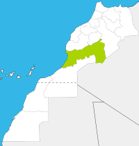
Iriqui National Park
| Iriqui National Park | |
|---|---|
|
IUCN category II (national park) | |
|
L’Oasis sacrée d’oum Lâalag in the Iriqui National Park | |
 | |
| Location | Morocco |
| Coordinates | 29°50′29.936322″N 6°31′2.110519″W / 29.84164897833°N 6.51725292194°WCoordinates: 29°50′29.936322″N 6°31′2.110519″W / 29.84164897833°N 6.51725292194°W |
| Area | 123,000 hectares |
| Established | 1994 |
| Governing body | Kingdom of Morocco: High Commission for Water, Forests and Desertification Control |
Iriqui National Park was set up in 1994 as a national park in Morocco with 123,000 hectares.
Location
The National Park lriqui occupies the space between the river Draa and the South foothills of the Anti-Atlas, in the provinces of Zagora and Tata.
Flora and fauna
The park is characterized by typical desert landscape of southern Morocco. The vegetation is represented by a wooded steppe and savanna with acacias. Some of its dunes are covered by tamarix.[1]
During wet periods, Lake lriqui becomes a temporary wetland and a port of call and wintering site for many migratory water birds, including flamingos, coots and geese), which gives the park an important ecological character. The rehabilitation of the wetland was one of the main objectives, when the park was created.[1]
In the park there are houbara bustards, ostrichs, barbary sheep, dorcas gazelles, oryxes and hyenas.[2] There is also a large number of reptiles such as lizard, wyches, monitor lizards, chameleons, geckos and different varieties of snakes.[1]
Human population
Apart from a few families settled inside the park, the entire human population of the area are nomadic. The latter, mostly from M'hamid El Ghouzlane practice transhumance along the circuit Figuig - Tan-Tan. The lriqui area is the main place for grazing because of its good grazing potential.[1]
Tourism
The rich landscape and cultural heritage of the region gives the park an important ecotourism potential that will be a lever for local economic development. In addition, the National Park lriqui fits into the development effort tour of the deep south, linking Merzouga, Zagora, M’Hamid El Ghouzlane, Foum Zguid, Tata, Guelmim and Tan-Tan. There is now a remarkable boost of discovery and adventure tourism in these regions, which might become ultimately an important lever for the promotion and development of the Saharan areas.[1]
References
| Wikimedia Commons has media related to Iriqui National Park. |
- ↑ 1.0 1.1 1.2 1.3 1.4 Parc National d’lriqui
- ↑ Sylvie Jourjon: L’Oasis Sacrée d’Oum Lâalag. 5 December 2012 (French).
| |||||||||||||||||
