Iranduba
| Iranduba | |
|---|---|
| Municipality | |
| Municipality of Iranduba | |
|
Iranduba near Solimões River | |
| Nickname(s): "Cidade das Chaminés" ("City of Chimneys") | |
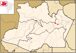 Location of Jutaí in the State of Amazonas | |
| Coordinates: 03°17′06″S 60°11′09″W / 3.28500°S 60.18583°W | |
| Country |
|
| Region | North |
| State |
|
| Emancipated | 1981 |
| Government | |
| • Mayor | Raymundo Nonato (PMDB) |
| Area | |
| • Total | 2,215,033 km2 (855,229 sq mi) |
| Elevation | 92 m (302 ft) |
| Population (2012) | |
| • Total | 41,947 |
| • Density | 18.94/km2 (49.1/sq mi) |
| [1] | |
| Time zone | AST (UTC-4) |
| • Summer (DST) | DST no longer used (UTC-4) |
| Area code(s) | +55 92 |
| HDI (2000) | 0.694 – medium[2] |
| Website | Manaus, Amazonas |

Coordinates: 03°17′06″S 60°11′09″W / 3.28500°S 60.18583°W Iranduba is a municipality located in the Brazilian state of Amazonas. Its population in 2012 was 41,947 and its area is 2,215 km²,[3] making it the smallest municipality in Amazonas in terms of area. However, among the smallest municipalities of each Brazilian state, it is the largest. It is located directly south of Manaus, across the Rio Negro. It is connected to Manaus by the Manaus Iranduba Bridge, a cable-stayed bridge which opened in 2011.
References
- ↑ "2012 Populational Estimate". Censo Populacional 2012. Instituto Brasileiro de Geografia e Estatística (IBGE). July 2012. Retrieved August 31, 2012.
- ↑ - UNDP
- ↑ IBGE -