Irakleia, Cyclades
| Irakleia Ηρακλειά | |
|---|---|
|
Satellite image of Irakleia. Island at the edge of the image on the right (east) is Schoinoussa, islets on the left (west) are Avelonisia | |
 Irakleia | |
|
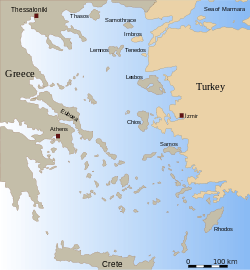
Location within the Cyclades  | |
| Coordinates: 36°50′N 25°27′E / 36.833°N 25.450°ECoordinates: 36°50′N 25°27′E / 36.833°N 25.450°E | |
| Country | Greece |
| Administrative region | South Aegean |
| Regional unit | Naxos |
| Municipality | Naxos and Lesser Cyclades |
| • Municipal unit | 17.795 km2 (6.871 sq mi) |
| Population (2001)[1] | |
| • Municipal unit | 151 |
| • Municipal unit density | 8.5/km2 (22/sq mi) |
| Time zone | EET (UTC+2) |
| • Summer (DST) | EEST (UTC+3) |
| Postal code | 843 00 |
| Area code(s) | 22870 |
| Vehicle registration | EM |
| Website | www.iraklia.gr |

Irakleia (Greek: Ηρακλειά) is an island and a former community in the Cyclades, Greece. Since the 2011 local government reform it is part of the municipality Naxos and Lesser Cyclades, of which it is a municipal unit.[2] Its population was officially 151 inhabitants at the 2001 census, and its land area 17.795 square kilometres (6.9 sq mi). It is a small island between the islands of Naxos and Ios. In close proximity to Schoinoussa, Koufonisi, Donoussa, and Keros islands, together they form the Small Cyclades. The port is called Agios Georgios, while the "capital"/chora on the top of the island is called Panagia (Madonna). The biggest caves in the Cyclades are located on Irakleia. Irakleia can be reached by ferries from Athens, Naxos and Paros.
References
- ↑ De Facto Population of Greece Population and Housing Census of March 18th, 2001 (PDF 39 MB). National Statistical Service of Greece. 2003.
- ↑ Kallikratis law Greece Ministry of Interior (Greek)
External links
- Official website (English) (Greek)
| ||||||||||
| ||||||||||||||||||||||||||