Iowa Highway 934
| ||||
|---|---|---|---|---|
| University Avenue | ||||
 | ||||
| Route information | ||||
| Maintained by Iowa DOT | ||||
| Length: | 2.829 mi[1] (4.553 km) | |||
| Existed: | March 1998 – present | |||
| History: | Truncated in 2014 | |||
| Major junctions | ||||
| West end: | Cedar Falls–Waterloo city limits | |||
| East end: |
| |||
| Location | ||||
| Counties: | Black Hawk | |||
| Highway system | ||||
| ||||

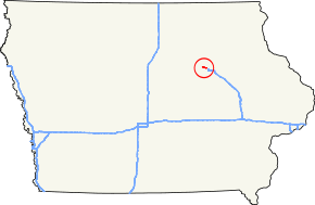
Iowa Highway 934 (Iowa 934) is an unsigned state highway in Waterloo, Iowa. Iowa 934 was created in 1998 after University Avenue was vacated by U.S. Highway 218 (US 218), which had recently moved to a new freeway a few miles north. Iowa 934 extends from the Cedar Falls–Waterloo boundary to US 63 (Sergeant Road).
Route description
Iowa 934 begins at the Cedar Falls–Waterloo boundary, in a commercial area. Just three-quarters mile (1,200 m) into Waterloo, University Avenue meets Greenhill Road at an unusual partial cloverleaf interchange. From Greenhill Road, Iowa 934 continues southeast, passing many restaurants which serve as a buffer from the road. Just before Ansborough Avenue, Iowa 934 turns to the east, straightening out for the rest of the trip. One-half mile (800 m) from its eastern end, University Avenue crosses Black Hawk Creek, a tributary of the Cedar River. Iowa 934 ends at an intersection with Sergeant Road, which serves US 63. The intersection with US 63 is less than one-quarter mile (400 m) away from US 63's interchange with US 218.[1]
History
Prior to the creation of Iowa 934, US 218 followed University Avenue.[2] As the Leo P. Rooff Expressway was being built, US 218 was gradually rerouted off of University.[3] US 218 had been completely removed from University Avenue by 1997.[4] In 1998, the Iowa Department of Transportation took over the segment of University Avenue from the Iowa 58 expressway to US 63, designating it Iowa 934.[5]
On May 12, 2014, the Cedar Falls city council accepted an agreement with the Iowa DOT to transfer control of Iowa 934 within the city limits.[6] The DOT paid the City of Cedar Falls $20 million to complete the transfer on July 21.[7] A similar agreement in Waterloo is expected later in 2014.[8]
Major intersections
The entire route is in Waterloo, Black Hawk County.
| mi[1] | km | Destinations | Notes | ||
|---|---|---|---|---|---|
| 0.000 | 0.000 | University Avenue – Cedar Falls | |||
| 0.673 | 1.083 | Greenhill Road | Non-freeway interchange | ||
| 2.829 | 4.553 | ||||
| 1.000 mi = 1.609 km; 1.000 km = 0.621 mi | |||||
References
- ↑ 1.0 1.1 1.2 "2013 Volume of Traffic on the Primary Road System of Iowa" (PDF). Iowa Department of Transportation. January 1, 2013. Retrieved July 31, 2014.
- ↑ Iowa State Highway Map (PDF) (Map). Iowa Department of Transportation. 1986. Retrieved June 4, 2010.
- ↑ Iowa State Highway Map (PDF) (Map). Iowa Department of Transportation. 1988. Retrieved June 4, 2010.
- ↑ Iowa State Highway Map (PDF) (Map). Iowa Department of Transportation. 1997. Retrieved June 4, 2010.
- ↑ Iowa State Highway Map (PDF) (Map). Iowa Department of Transportation. 1999. Retrieved June 4, 2010.
- ↑ "City Council Agenda" (PDF). City of Cedar Falls, Iowa. p. 3. Retrieved June 18, 2014.
- ↑ Anderson, Mike (July 22, 2014). "University Avenue a Done Deal". The Waterloo-Cedar Falls Courier. Retrieved July 31, 2014.
- ↑ Anderson, Mike (May 28, 2014). "All University Avenue options still on table". Ames Tribune. Retrieved June 18, 2014.
External links
Route map: Bing