Iowa Highway 62
| ||||
|---|---|---|---|---|
| Ansel Briggs Memorial Highway | ||||
 | ||||
| Route information | ||||
| Maintained by Iowa DOT | ||||
| Length: | 19.633 mi[1] (31.596 km) | |||
| Existed: | 1920s – present | |||
| Major junctions | ||||
| South end: |
| |||
| North end: |
| |||
| Location | ||||
| Counties: | Jackson | |||
| Highway system | ||||
| ||||

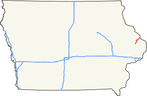
Iowa Highway 62 is a short highway in eastern Iowa. It has a length of 19.64 miles (31.61 km). Iowa 62 has a southern terminus at Iowa Highway 64 in Maquoketa and a northern terminus at U.S. Route 52 in Bellevue, just feet from the Mississippi River.
Route description
Iowa Highway 62 begins in Maquoketa at a T intersection with Iowa Highway 64 and adjacent to the Jackson County fairgrounds. Just northeast of Maquoketa, Iowa 62 crosses the Maquoketa River. Cutting through Jackson County farmland, Highway 62 travels north-northeast 7 miles (11 km) until it reaches the small town of Andrew. North of Andrew, Iowa 62 turns more northeast towards Bellevue. Just west of Bellevue, Highway 62 enters the southern edge of the Driftless Area, a geologically-distinct area of the upper Mississippi River valley characterized by high bluffs and deep valleys.[1]
History
Before becoming a primary highway, Iowa Highway 62 north of Andrew was the Ansel Briggs Memorial Highway.[2] Briggs was the first governor of Iowa. By 1926, the route had been designated Primary Road No. 62. It connected Primary Road No. 117, now Iowa 64, to the Mississippi River Scenic Highway.[3]
Major intersections
The entire route is in Jackson County.
| Location | mi[1] | km | Destinations | Notes | |
|---|---|---|---|---|---|
| Maquoketa | 0.000 | 0.000 | |||
| Bellevue | 19.633 | 31.596 | |||
| 1.000 mi = 1.609 km; 1.000 km = 0.621 mi | |||||
References
- ↑ 1.0 1.1 1.2 "2009 Volume of Traffic on the Primary Road System of Iowa" (PDF). Iowa Department of Transportation. January 1, 2009. Retrieved January 15, 2011.
- ↑ Iowa Department of Transportation. "Historic County Routes". Retrieved March 4, 2010.
- ↑ Junior Road Map: Iowa (Map). Rand McNally. 1926. Retrieved March 4, 2010.
Route map: Bing