Inzigkofen
| Inzigkofen | ||
|---|---|---|
| ||
 Inzigkofen | ||
Location of Inzigkofen within Sigmaringen district 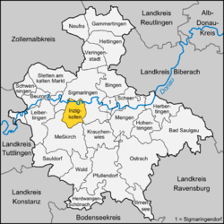 | ||
| Coordinates: 48°4′18″N 9°10′32″E / 48.07167°N 9.17556°ECoordinates: 48°4′18″N 9°10′32″E / 48.07167°N 9.17556°E | ||
| Country | Germany | |
| State | Baden-Württemberg | |
| Admin. region | Tübingen | |
| District | Sigmaringen | |
| Government | ||
| • Mayor | Bernd Gombold | |
| Area | ||
| • Total | 28.76 km2 (11.10 sq mi) | |
| Population (2012-12-31)[1] | ||
| • Total | 2,707 | |
| • Density | 94/km2 (240/sq mi) | |
| Time zone | CET/CEST (UTC+1/+2) | |
| Postal codes | 72514 | |
| Dialling codes | 07571 | |
| Vehicle registration | SIG | |
| Website | www.inzigkofen.de | |

Inzigkofen is a municipality in the district of Sigmaringen in Baden-Württemberg in Germany. Historically, it is part of the Swabian north Alpine foreland basin.[2]
It consists of three districts:
| Coat of Arms | District (Teilort) | Population[3] | Area[3] |
|---|---|---|---|
| | Inzigkofen with Nickhof und Pault | 1372 | 931 hectares (2,300 acres) |
| | Engelswies | 611 | 749 hectares (1,850 acres) |
| | Vilsingen with Dietfurt | 845 | 1,196 hectares (2,960 acres) |
Within Engelswies is the now-abandoned Talsberg quarry, known for its fossiliferous layers, and the site of evidence of the oldest Eurasian hominoids; a molar tooth found there in June 1973 was reported in June 2011 to have been "dated with relative precision at 17 to 17.1 Ma" (million years ago).[2]
References
- ↑ "Gemeinden in Deutschland mit Bevölkerung am 31.12.2012 (Einwohnerzahlen auf Grundlage des Zensus 2011)". Statistisches Bundesamt (in German). 12 November 2013.
- ↑ 2.0 2.1 "Oldest Eurasian Hominoids Lived in Swabia: Molar Tooth Dated at 17 Million Years Old". Science Daily. June 22, 2011. Retrieved 2011-06-23.
- ↑ 3.0 3.1 Sonja Köser, Inzigkofen Community Office, 18 January 2011.
| ||||||||