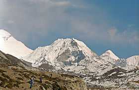
Imja Tse
| Imja Tse | |
|---|---|
| Island Peak | |
 An island in a sea of ice | |
| Elevation | 6,189 m (20,305 ft)[1] |
| Location | |
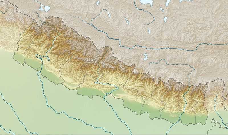 Imja Tse Location in Nepal | |
| Location | Khumbu, Nepal |
| Range | Khumbu Himal |
| Coordinates | 27°55′21″N 86°56′10″E / 27.92250°N 86.93611°ECoordinates: 27°55′21″N 86°56′10″E / 27.92250°N 86.93611°E |
| Climbing | |
| First ascent | 1956 by a Swiss team |
| Easiest route | Scramble/glacier/ice climb |
Imja Tse, better known as Island Peak, is a mountain in the Himalayas of eastern Nepal. The peak was named Island Peak in 1951 by Eric Shipton's party since it appears as an island in a sea of ice when viewed from Dingboche. The peak was later renamed in 1983 to Imja Tse but Island Peak remains the popular choice.[2] The peak is actually an extension of the ridge coming down off the south end of Lhotse Shar.
Imja Tse summit was first climbed in 1956 by a Swiss team as a training exercise in preparation for Mount Everest and Lhotse.
Imja Tse is one of the most popular trekking peaks given its difficulty (alpine PD+) and accessibility especially when supported by a Nepalese climbing guide.
Climbing route
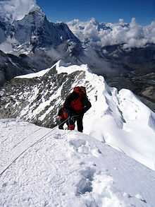
To climb Island Peak, one has the option of starting from a base camp at 5,087 metres (16,690 ft) called Pareshaya Gyab and starting the climb between 2 and 3 am. Another popular option is to ascend to High Camp at around 5,600 metres (18,400 ft) to reduce the amount of effort and time needed for summit day. However, adequate water supply and concerns about sleeping at a higher altitude may dictate starting from base camp. Base camp to high camp is basically a hike but just above high camp, some rocky steps require moderate scrambling and up through a broad open gully. At the top of the gully, glacier travel begins and proceeds up to a steep snow and ice slope. From here, fixed ropes may be set up by the guides for the strenuous ascent of nearly 100 metres (330 ft) to the summit ridge. The climb to the summit is somewhat difficult due to steep climbing. On top, while Mount Everest is a mere ten kilometres away to the north, the view will be blocked by the massive wall of Lhotse, towering 2,300 m (7,500 ft) above the summit.
Headwall crevasse
A substantial crevasse along most of the headwall leading to the summit ridge has sometimes caused teams to turn back. In April 2009, the Nepal Mountaineering Association tasked the Nepal Mountaineering Instructors' Association with installing stairs (ladders) at the crevasse[3] but these have not been required since then.
See also
References
- ↑ 1.0 1.1 "Nepal Mountaineering Association". web page. 2008. Retrieved 2 June 2011.
- ↑ "Imja Tse". Nepal Mountaineering Association. Retrieved 2009-05-23.
- ↑ "Newsletter of the Nepal Mountaineering Association". NMA. Retrieved 2009-05-23.
| Wikimedia Commons has media related to Imja Tse. |