Imeľ
| Imeľ | |
| Ímely | |
| Village | |
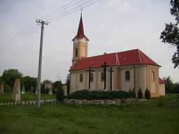 Catholic church in Imeľ | |
| Country | Slovakia |
|---|---|
| Region | Nitra |
| District | Komárno |
| Elevation | 111 m (364 ft) |
| Coordinates | 47°54′N 18°09′E / 47.900°N 18.150°ECoordinates: 47°54′N 18°09′E / 47.900°N 18.150°E |
| Area | 21.96 km2 (8.48 sq mi) |
| Population | 2,054 (2011) |
| Density | 94 / km2 (243 / sq mi) |
| First mentioned | 1404 |
| Postal code | 946 52 |
| Area code | +421-35 |
| Car plate | KN |
  Location of Imeľ in Slovakia
| |
  Location of Imeľ in the Nitra Region
| |
| Statistics: MOŠ/MIS | |
| Website: www.obecimel.sk | |
Imeľ (Hungarian: Ímely, Hungarian pronunciation:[ˈiːmɛj]) is a village and municipality in the Komárno District in the Nitra Region of southwest Slovakia.
History
In historical records the village was first mentioned in 1404. After the Austro-Hungarian army disintegrated in November 1918, Czechoslovak troops occupied the area, later acknowledged internationally by the Treaty of Trianon. Between 1938 and 1945 Imeľ once more became part of Miklós Horthy's Hungary through the First Vienna Award. From 1945 until the Velvet Divorce, it was part of Czechoslovakia. Since then it has been part of Slovakia.
Geography
The village lies at an altitude of 111 metres and covers an area of 21.96 km².
Population
According to the 2011 census, the municipality had 2,054 inhabitants. 1,125 of inhabitants were Slovaks, 878 Hungarians and 51 others and unspecified.[1]
Facilities
The village has a public library, a gym and a football pitch. It also has a cinema.
See also
References
Genealogical resources
The records for genealogical research are available at the state archive "Statny Archiv in Nitra, Slovakia"
- Roman Catholic church records (births/marriages/deaths): 1705-1895 (parish A)
- Reformated church records (births/marriages/deaths): 1786-1936 (parish B)