Illhorn
| Illhorn | |
|---|---|
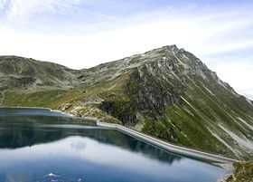 View from the Illsee (east side) | |
| Elevation | 2,717 m (8,914 ft) |
| Prominence | 235 m (771 ft)[1] |
| Location | |
 Illhorn Location in Switzerland | |
| Location | Valais, Switzerland |
| Range | Pennine Alps |
| Coordinates | 46°15′45.9″N 7°36′58.4″E / 46.262750°N 7.616222°ECoordinates: 46°15′45.9″N 7°36′58.4″E / 46.262750°N 7.616222°E |
The Illhorn is a mountain of the Swiss Pennine Alps, overlooking Chandolin in the canton of Valais. With a height of 2,717 metres above seal level, it is the highest point of the Illgraben valley.
Illgraben debris flows
Illgraben is best known for its literal breaking apart as the ancient mud that forms the mountain breaks apart and causes the resulting debris flows and mud slides.[2] The areas is a popular hiking spot and these geomorphological processes are visible most years.[3]
References
- ↑ Retrieved from the Swisstopo topographic maps. The key col is the Illpass (2,482 m).
- ↑ http://www.quanterra.org/guide/guide1_16.htm
- ↑ http://www.myswitzerland.com/en/illgraben-bhutan-bridge.html