Iller
| Iller | |
|---|---|
 Origin of the Iller (Photo from an aircraft] | |
| Origin | Northern Limestone Alps |
| Mouth |
Danube 48°22′53″N 9°58′23″E / 48.38139°N 9.97306°ECoordinates: 48°22′53″N 9°58′23″E / 48.38139°N 9.97306°E |
| Basin countries | Germany, Austria |
| Length | 147 km |
| Avg. discharge | 90 m³/s |
| Basin area | 2,152 km² |
- İller means provinces in Turkish, see Provinces of Turkey
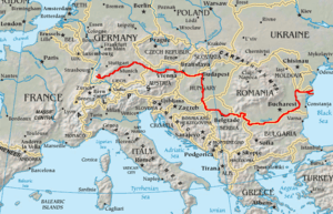
The ![]() Iller (ancient name Ilargus) is a river in Bavaria and Baden-Württemberg in Germany. It is a right tributary of the Danube, 147 km in length.
Iller (ancient name Ilargus) is a river in Bavaria and Baden-Württemberg in Germany. It is a right tributary of the Danube, 147 km in length.
The source is located near Oberstdorf in the Allgäu region of the Alps, close to the Austrian border. From there it runs northwards, passing the towns of Sonthofen, Immenstadt, and Kempten.

Between Lautrach near Memmingen and Ulm it forms the border between the two German States Bavaria and Baden-Württemberg for about 50 km. The river flows into the Danube in the city of Ulm.
The Iller has a catchment area of 2,152 km². It ranks as the seventh of Bavaria's rivers by water flow, with an averaged throughput of 75 m³/s at Senden, a short distance upstream from the Danube. The power of the river is used for the production of hydroelectricity via eight power stations with a total net capacity of 51 MW (1998).
A bicycle route follows the Iller, which is also a popular location for rafting and trekking.
Sources
- Bogner, Franz X. (2009). Allgäu und Iller aus der Luft. Theiss-Verlag 2009. ISBN 978-3-8062-2236-4.
- Kettemann, Otto and Winkler, Ursula (ed.): Die Iller, 2000, ISBN 3-931915-05-0 (2. erweiterte Auflage)
- Nowotny, Peter (1999). Die Iller und ihr Tal, 1999, Verlag Eberl, ISBN 3-920269-08-X
| Wikisource has the text of the 1911 Encyclopædia Britannica article Iller. |
| |||||||||||||||||||||||||
| Wikimedia Commons has media related to Iller. |
