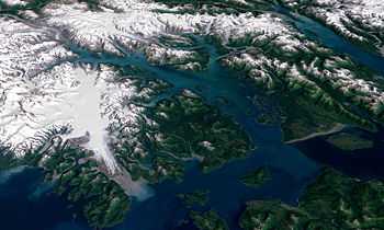
Icy Strait

The Icy Strait is a strait in the Alexander Archipelago in southeastern Alaska, at about 58°16′41″N 135°38′48″W / 58.27806°N 135.64667°WCoordinates: 58°16′41″N 135°38′48″W / 58.27806°N 135.64667°W. The strait separates Chichagof Island to the south and the Alaska mainland to the north. The strait is 64 km (40 mi) from its west side at the intersection of the Cross Sound and Glacier Bay to its east side at Chatham Strait and the Lynn Canal. The two largest islands in the strait are Pleasant Island and Lemesurier Island.
The Cape Spencer Light is an important former lighthouse and currently active aid-to-navigation.
The cruise ship Empress of the North ran aground near Rocky Island [1] and took on some water here on May 14, 2007, causing the evacuation of its passengers. None were injured.
The nearby cruise ship destination Icy Strait Point is named in reference to it.