Iñuma
| Iñuma | |
|---|---|
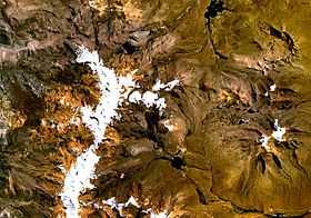 Barroso mountain range (on the left) as seen from space (NASA Landsat). Iñuma is visible in the upper part of the range. | |
| Elevation | 5,675 m (18,619 ft) |
| Location | |
 Iñuma Peru | |
| Location | Peru, Tacna Region |
| Range | Andes, Barroso |
| Coordinates | 17°27′38″S 69°50′18″W / 17.46056°S 69.83833°WCoordinates: 17°27′38″S 69°50′18″W / 17.46056°S 69.83833°W[1] |
Iñuma (Aymara, hispanicized spelling Inuma) is a mountain in the Barroso mountain range in the Andes of Peru, about 5,675 metres (18,619 ft) high. It is situated in the Tacna Region, Tacna Province, Palca District, and in the Tarata Province, Tarata District.[2] Iñuma lies northeast of the mountain Khuruña, north of the mountain Awkitaypi (Auquitaipe) and northwest of the Q'asiri massif.

Map of the area showing the location of Iñuma
See also
References
- ↑ geographic.org ""Nevado Iñuma", retrieved on January 22, 2014
- ↑ escale.minedu.gob.pe - UGEL map of the Tarata Province (Tacna Region)