Hung Shui Kiu
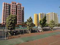
Hung Shui Kiu (simplified Chinese: 洪水桥; traditional Chinese: 洪水橋; literally: "Floody Bridge") is an area between Ping Shan and Lam Tei, in the western part of the New Territories of Hong Kong. It covers parts of Yuen Long and Tuen Mun districts. It is largely rural residential.
The "Planning and Development Study on North West New Territories", conducted from 1997 to 2003, identified Hung Shui Kiu and its vicinity as a potential site for a New Town which may accommodate up to 160,000 population in the future. This proposal has since been recommended for implementation and would involve construction of a new Hung Shui Kiu railway station along the existing West Rail Line between Siu Hong and Tin Shui Wai stations.[1][2] Several Housing Authority blocks are presently under construction on a 6.5-hectare site bounded by Tin Sum, Hung Tin, Hung Chi and Hung Yuen roads.
Transportation
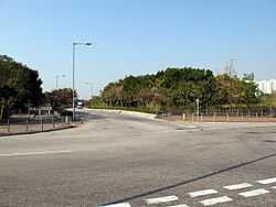
Hung Shui Kiu is reachable by Castle Peak Road. There is also a Light Rail stop, served by routes 610, 614, 615, and 751. There is a proposed MTR station on the West Rail Line for Hung Shui Kiu.
See also
References
- ↑ "Hung Shui Kiu New Development Area Project Profile". Civil Engineering and Development Department. HKSAR Government. Retrieved 5 August 2013.
- ↑ "Background". Hung Shui Kiu New Development Area Planning and Engineering Study. Planning Department. Retrieved 5 August 2013.
External links
| Wikimedia Commons has media related to Hung Shui Kiu. |
Coordinates: 22°25′42″N 113°59′54″E / 22.4282°N 113.9983°E