Humberston
| Humberston | |
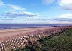
 Humberston Beach |
|
 Humberston |
|
| Population | 5,384 (2001) |
|---|---|
| OS grid reference | TA310053 |
| – London | 140 mi (230 km) S |
| Civil parish | Humberston |
| District | North East Lincolnshire |
| Unitary authority | North East Lincolnshire |
| Shire county | Lincolnshire |
| Ceremonial county | Lincolnshire |
| Region | East Midlands |
| Country | England |
| Sovereign state | United Kingdom |
| Post town | GRIMSBY |
| Postcode district | DN36 |
| Police | Lincolnshire |
| Fire | Lincolnshire |
| Ambulance | East Midlands |
| EU Parliament | East Midlands |
| UK Parliament | Cleethorpes |
|
|
Coordinates: 53°31′41″N 0°01′30″W / 53.52807°N 0.02489°W
Humberston is a village and civil parish south of Cleethorpes in North East Lincolnshire, England.
Boundary and population
The village's boundary with Cleethorpes runs along North Sea Lane and Humberston Road. Its population in the 2001 census was 5,384.[1] The Prime Meridian runs east of Humberston, through the Thorpe Park caravan site.
History
The Danes landed at the site of the village in 870.[2] Humberston (or Humberstone, as the village was first known) takes its name from a large boulder, the "Humber Stone", which was deposited on the site of the former Midfield Farm during the last Ice Age. The boulder may be seen at the entrance to the village library, near St Peter's Church. The "e" at the end of the name was later dropped to avoid confusion with a place with the same name.
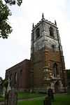
The oldest (and tallest) building in Humberston is St Peter's Church. Although the church was rebuilt about 1710, the tower is over seven hundred years old.[3] At the rear of the church is the site of the former Humberston Abbey of Benedictine monks, which was founded during the reign of Henry II and dedicated to Saints Mary and Peter. Although nearly all that remains is the monks' mound in the manor-house garden, stone sarcophagi have been excavated.[4] The Wesleyan Methodists built a small chapel on Humberston Avenue in 1835, and a larger replacement chapel was built in 1907.[5] An early wireless station was built in 1910.
Education, sports and government
A comprehensive school, Humberston Academy (formerly known as the Humberston School and the Humberston Maths and Computing College) is located on Humberston Avenue.[6] Next to the academy is one of the village's primary schools, Humberston Cloverfields Primary School. Humberston FC play in the Grimsby, Cleethorpes and District Sunday League.[7]
Council members
The North East Lincolnshire Council has one ward (Humberston and New Waltham Ward) encompassing the village. Humberston's representatives are:
- Stephen Harness (UK Independence Party)
- Steve Norton (Conservative Party)
- John S Fenty (Conservative Party)
Places of interest
A man-made lake off North Sea Lane is in the centre of Cleethorpes Country Park. The park has picnic benches, fishing jetties and dog-swimming and wildlife areas. It is home to Canada Geese and other wild birds.
The Humberston Fitties conservation area, known as Fitties Field during the late 1940s and early 1950s, is in the village.[8] Also in Humberston is Thorpe Park, a Haven Holidays caravan park.
Gallery
-

Greenwich Meridian Line
-

North Sea Lane
-

St Peter's Church
References
- ↑ Office for National Statistics : Census 2001 : Parish Headcounts : North East Lincolnshire. Retrieved 18 September 2009
- ↑ "Humberston". Genuki. Retrieved 3 June 2014.
- ↑ Historic England. "St Peters Church (81888 )". PastScape. Retrieved 27 April 2013.
- ↑ Historic England. "Humberston Abbey (81877 )". PastScape. Retrieved 27 April 2013.
- ↑ Historic England. "Wesleyan chapel (1378878 )". PastScape. Retrieved 27 April 2013.
- ↑ "Humberston Academy".
- ↑ Grimsby, Cleethorpes and District Sunday League
- ↑ "Humberston Fitties". N E Lincolnshire council. Retrieved 28 April 2013.
External links
 Media related to Humberston at Wikimedia Commons
- Humberston Happening
- Article about building in the Fittes conservation area
| ||||||||||||||||||||||
| ||||||||||