Hueypoxtla (municipality)
| Hueypoxtla | |
|---|---|
| Municipality | |
| Country | Mexico |
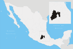
| State | Mexico State |
| Municipal seat | Hueypoxtla |
| Time zone | CST (UTC-6) |
| • Summer (DST) | CDT (UTC-5) |
Hueypoxtla is a municipality in the State of Mexico. Its municipal seat is also called Hueypoxtla: The area was settled by Mexicas in 1220.
Geography
It is located between the parallels 99° 27’ 51” and 99° 37’ 32” west longitude, and 18° 41’ 35” and 18° 55’ 22” north latitude. Hueypoxtla borders Zumpango. It covers a total surface area of 201.54 km² at an altitude of 6,634 ft. In the year 2005 census by INEGI, it reported a population of 16,149.
Economy
The economy is principally farming, cattle raising and small businesses, concentrating on the production of corn, beans and fruit. Tourists are attracted by its climate and some notable churches, as well as some ecotourism attractions. It has an unexplored archeological zone.
Demography

Populated places in Hueypoxtla
- Hueypoxtla (Municipal Seat)
- San José Bata (Emiliano Zapata)
- Guadalupe Nopala
- San Marcos Jilotzingo
- Santa María Ajoloapan
- San Francisco Zacacalco
- Tianguistongo
- El Carmín
- San Pedro la Gloria
- Tezontlalpa de Zapata