Hsipaw State
| Hsipaw State သီပေါမြို့ | |||||
| State of the Shan States | |||||
| |||||
 | |||||
| History | |||||
| - | Bayinnaung's sovereignty acknowledged | 16th century | |||
| - | Abdication of the last Saopha | 1959 | |||
| Area | |||||
| - | 1891 Census of India | 8,188 km2 (3,161 sq mi) | |||
| Population | |||||
| - | 1891 Census of India | 200,000 | |||
| Density | 24.4 /km2 (63.3 /sq mi) | ||||
| | |||||

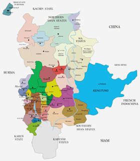
Hsipaw was a Shan state in what is today Burma. Its capital was Hsipaw town. Hsipaw State was perhaps one of the most well known and powerful saopha Shan States.
History
A predecessor state name Dutavadi was said to be founded in 58 BC according to local tradition.
During the Sino-Burmese War (1765–69) the Qianlong Emperor of China invaded the area of Hsipaw. The main Chinese army, led by Ming Rui, was to approach Ava through Hsenwi, Lashio and Hsipaw down the Namtu river. The main invasion route was the same route followed by the Manchu forces a century earlier, chasing the Yongli Emperor of the Southern Ming dynasty. The second army, led by Gen. E'erdeng'e, was to try the Bhamo route again.[1] The ultimate objective was for both armies to clamp themselves in a pincer action on the Burmese capital of Ava.[2] The Burmese plan was to hold the second Chinese army in the north at Kaungton with the army led by Ne Myo Sithu, and meet the main Chinese army in the northeast with two armies led by Maha Sithu and Maha Thiha Thura.[3]
At first, everything went according to plan for the Qing. The third invasion began in November 1767 as the smaller Chinese army attacked and occupied Bhamo. Within eight days, Ming Rui's main army occupied the Shan states of Hsenwi and Hsipaw.[3] Ming Rui made Hsenwi a supply base, and assigned 5000 troops to remain at Hsenwi and guard the rear. He then led a 15,000-strong army in the direction of Ava. In late December, at the Goteik Gorge (south of Hsipaw), the two main armies faced off and the first major battle of the third invasion ensued. Outnumbered two-to-one, Maha Sithu's main Burmese army was thoroughly routed by Ming Rui's Bannermen. Maha Thiha Thura too was repulsed at Hsenwi.[4][5] The news of the disaster at Goteik reached Ava. Hsinbyushin finally realized the gravity of the situation, and urgently recalled Burmese armies from Siam.[6]
Having smashed through the main Burmese army, Ming Rui pressed on full steam ahead, overrunning one town after another, and reached Singu on the Irrawaddy, 30 miles north of Ava at the beginning of 1768. The only bright spot for the Burmese was that the northern invasion force, which was to come down the Irrawaddy to join up with Ming Rui's main army, had been held off at Kaungton.[4]
In 1886 the saopha of Hsipaw was the first Shan prince that submitted to British rule in Burma, which led to Hsipaw becoming a British protectorate in 1887. According to the biography of Sao Nang Hearn Hkam (the chief wife, Madhidevi of Sao Shwe Thaik, the first president of Myanmar and another saopha of Hsenwi), Hsipaw, along with Kengtung and Yawnghwe were the wealthiest and most powerful saopha states in Shan State.[7]
Between 1938 and 1947 Hsipaw was administered by British Burma. The last ruler of the On Baung dynasty that had been ruling Hsipaw abdicated in 1959. The state became part of Shan State and, despite the independence struggle of the latter, eventually part of Burma.
The Saophas played fluctuating roles in regional Shan and national Burmese politics from the 11th century all the way until the 1962 military coup by General Ne Win when all the privileges of the saophas were abolished.
Rulers
The Princes of Hsipaw had the title of 'Saopha'.[8]
Saophas
- 1675 - 1702 Hso Wai Hpa
- 1702 - 1714 Sao Okka Wara
- 1714 - 1718 Sao Okka Seya
- 1718 - 1722 Sao Sam Myo
- 1722 - 1752 Sao Hkun Neng
- 1752 - 1767 Sao Sawra Tawta
- 1767 - 1788 Sao Myat San Te
- 1788 - 1809 Sao Hswe Kya
- 1809 - 1843 Sao Hkun Hkwi
- 1843 - 1853 Sao Hkun Paw
- 1853 - 1858 Sao Kya Htun (d. 1866)
- 1858 - 1866 Hkun Myat Thade
- 1866 - 8 May 1902 Sao Kya Hkeng (deposed 1882-86) (d. 1902) (from Mar 1886, Sao Hkun Hseng)
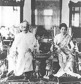
- 8 May 1902 - May 1928 Sao Hke (b. 1872 - d. 1928) (from 2 Jan 1928, Sir Sao *Hke)
- 1928 - Jul 1938 I Sao Ohn Kya (b. 1893 - d. 1938)
- 1938 - 1947 administered by Burma
- 1947 - 1962 Sao Kya Seng (b. 1924 - d. 1962)
See also
References
- ↑ Hall 1960, p. 28.
- ↑ Haskew 2008, pp. 27–31.
- ↑ 3.0 3.1 Kyaw Thet 1962, pp. 314–318.
- ↑ 4.0 4.1 Htin Aung 1967, pp. 178–179.
- ↑ Phayre 1884, pp. 196–198.
- ↑ Harvey 1925, p. 253.
- ↑ History of the Shan States
- ↑ Shan and Karenni States of Burma
External links
| ||||||||||||||||||||||||||||||