Hradec nad Moravicí
| Hradec nad Moravicí | |||
| Town | |||
 Red Castle | |||
|
|||
| Country | Czech Republic | ||
|---|---|---|---|
| Region | Moravian-Silesian | ||
| District | Opava | ||
| Commune | Opava | ||
| River | Moravice | ||
| Elevation | 264 m (866 ft) | ||
| Coordinates | 49°51′39″N 17°52′16″E / 49.86083°N 17.87111°ECoordinates: 49°51′39″N 17°52′16″E / 49.86083°N 17.87111°E | ||
| Area | 44 km2 (17 sq mi) | ||
| Population | 5,470 (2012) | ||
| Density | 124 / km2 (321 / sq mi) | ||
| First mentioned | 1066 | ||
| Mayor | Karel Valušek | ||
| Timezone | CET (UTC+1) | ||
| - summer (DST) | CEST (UTC+2) | ||
| Postal code | 747 41 - 747 84 | ||
  Location in the Czech Republic
| |||
  Location in the Moravian-Silesian Region
| |||
| Wikimedia Commons: Hradec nad Moravicí | |||
| Statistics: statnisprava.cz | |||
| Website: www.muhradec.cz | |||
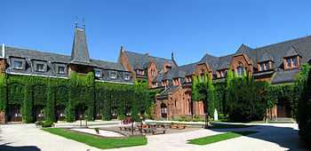
Hradec nad Moravicí (Czech pronunciation: [ˈɦradɛts ˈnadmoravɪtsiː]; German: Grätz) is a town in the Moravian-Silesian Region of the Czech Republic located about 8 km south of Opava. It had about 5,150 inhabitants in 2006. The town is dominated by a castle complex.
According to the 1910 Austrian census, the town had 329 inhabitants, 314 of whom had permanent residence there. The census asked people for their native language: 169 (53.8%) were German-speaking and 144 (45.9%) were Czech-speaking. The largest religious group was Roman Catholics with 327 (99.4%).[1]
Twin cities
References
- ↑ Ludwig Patryn (ed): Die Ergebnisse der Volkszählung vom 31. Dezember 1910 in Schlesien, Troppau 1912.
External links
- (Czech) Official website
- (Czech) Castle
| Wikimedia Commons has media related to Hradec nad Moravicí. |

