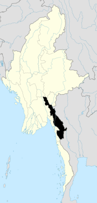
Hpa-An
| Hpa-An ဘားအံမြို့ | |
|---|---|
 Hpa-An Location in Burma | |
| Coordinates: 16°53′26″N 97°38′0″E / 16.89056°N 97.63333°ECoordinates: 16°53′26″N 97°38′0″E / 16.89056°N 97.63333°E | |
| Country |
|
| Division | Kayin State |
| District | Hpa-an District |
| Township | Hpa-an Township |
| Population (2013) | 126,225 |
| • Religions | Buddhism and Christianity |
| Time zone | MST (UTC+6.30) |
| Area code(s) | 58[1] |
Hpa-An (Burmese: ဘားအံမြို့; MLCTS: bha: am mrui. [pʰə ʔàɴ mjo̰]; also called Pa-An) is the capital of Karen State, Myanmar.Population estimates vary widely as no census has been taken in Myanmar since 1983, and the 2014 census has not yet released the populations of cities. The population is said to be around 50,000, but a 2013 population scan by World Gazetteer calculated a population as high as 126 225.[2]
Climate
Hpa-An has a tropical monsoon climate (Köppen climate classification Am). Temperatures are very warm throughout the year, although maximum temperatures are somewhat depressed in the monsoon season due to heavy cloud and rain. There is a winter dry season (November–April) and a summer wet season (May–October). Torrential rain falls from June to August, with over 1,100 millimetres (43 in) falling in August alone.
| Climate data for Hpa-An | |||||||||||||
|---|---|---|---|---|---|---|---|---|---|---|---|---|---|
| Month | Jan | Feb | Mar | Apr | May | Jun | Jul | Aug | Sep | Oct | Nov | Dec | Year |
| Average high °C (°F) | 30.5 (86.9) |
31.9 (89.4) |
33.4 (92.1) |
33.7 (92.7) |
31.3 (88.3) |
28.6 (83.5) |
27.9 (82.2) |
27.6 (81.7) |
28.4 (83.1) |
30.9 (87.6) |
31.3 (88.3) |
31.2 (88.2) |
30.56 (87) |
| Average low °C (°F) | 17.8 (64) |
18.9 (66) |
21.9 (71.4) |
24.5 (76.1) |
24.5 (76.1) |
23.7 (74.7) |
23.3 (73.9) |
23.4 (74.1) |
23.6 (74.5) |
23.5 (74.3) |
21.6 (70.9) |
18.7 (65.7) |
22.12 (71.81) |
| Average precipitation mm (inches) | 4 (0.16) |
5 (0.2) |
6 (0.24) |
42 (1.65) |
412 (16.22) |
875 (34.45) |
1,043 (41.06) |
1,134 (44.65) |
578 (22.76) |
208 (8.19) |
30 (1.18) |
8 (0.31) |
4,345 (171.07) |
| Source: NOAA (1961-1990) [3] | |||||||||||||
Population history
- 1953: 4,100
- 1983: 41,500
- 2013: 126,225
Education
- Computer University, Hpa-An
- Hpa-An Education College
- Hpa-An University
- Technological University, Hpa-An
- Hpa-An Nursing Training School
Religion
The majority of residents are Theravada Buddhists, followed by Baptist, Anglican and Roman Catholic Christians.
Transportation
- Hpa-An Airport
- Highway Bus
- Waterway
Emergency
- State Police HQ
- District Police
- Township Police
- City Police
- State Fire Brigade
- District Fire Brigade
- Township Fire Brigade
- Myanmar Red Cross Society
Administration
- Kayin State peace and Development Council HQ
- District peace and Development Council
- Township peace and Development Council
- Union Solidarity and Development Association
- Myanmar Maternal Children's Welfare Association
- Myanmar Women's Affair Federation
- State Court
- District Court
- Township Court
Media
Television
- MRTV
- Myawaddy TV
- MRTV-3
- MRTV-4
Radio
Sights
Kayin State Cultural Museum is located in Hpa-An.The magnificent Zwegabin Hill is an attractive place for visitors. Kyaukkalatt (Kyauk Kalat Monastery) and Kawtgon Cave (or Kawgoon Cave) is also a place of interest.
Sport
Zwegabin United FC founded in 2010, is based in Hpa-An.The club is competing in Myanmar National League.
References
- ↑ "Myanmar Area Codes". Retrieved 2009-04-10.
- ↑ url=http://www.travelpod.com/travel-blog-entries/ktfc/myanmar_jan06/1137231480/tpod.html
- ↑ "Hpa-An Climate Normals 1961-1990". National Oceanic and Atmospheric Administration. Retrieved January 12, 2013.
External links
| |||||||||||||||||||||||||
