Houndsditch
|
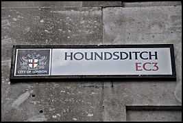
City of London Corporation sign marking the modern Houndsditch | |
| Length | 0.2 mi (0.3 km) |
|---|---|
| Location | London, United Kingdom |
| North end | Outwich Street |
| South end | St. Botolph Street |
Houndsditch is a one-way street in London linking Outwich Street in the north-west to St. Botolph Street in the south-east. It runs through parts of the Portsoken and Bishopsgate Without wards of the City of London, the historic nucleus and modern financial centre of London. It marks the route of an old ditch that ran outside a part of the London Wall, renowned for being used as a site for disposing of waste and, particularly, deceased dogs.
The road forms part of the A1211 route from Barbican to Whitechapel. Traffic continues onto Houndsditch from Outwich Street, a short section of road behind the Heron Tower, and then enters St. Botolph Street at the south-eastern end of Houndsditch. From there, traffic may turn left onto Whitechapel High Street or right onto Aldgate High Street.
History
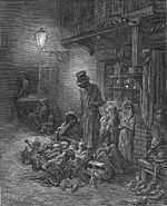
A ditch was first constructed outside the City of London's defensive wall by the Romans but later became filled in and obliterated. The Danes under Cnut the Great constructed a town ditch in order to control access to the city.[1] It was redug in 1211 as a part of the defences, and was then about 75 feet (23 m) in width. The City authorities found it a continual problem to scour and clean the ditch, as many of the adjacent houses found it convenient to dispose of filth and refuse in it. In 1595, levelling the ground was first considered,[2] although the street running alongside the ditch had first been paved in 1503. The name Houndsditche first appears in the 13th century, and appears to relate to the quantity of rubbish and dead dogs thrown in the ditch;[3] previously it seems to have been referred to only by the appellation the Ditch. Several dogs' skeletons were unearthed at Houndsditch in 1989.[4]
By the turn of the 20th century, the street had become famous as a thriving market in clothing and novelties,[5] giving rise to one of London's leading department stores, the Houndsditch Warehouse.,[6] the 'Selfridges of the Jewish Quarter'[7]
In December 1910, anarchists killed three police officers who had interrupted them during an attempted burglary at a jeweller's shop at No. 119, Houndsditch. In January 1911, two of the gang were cornered and subsequently killed in the Siege of Sidney Street.
Notable sites
Approaching Bishopsgate, the modern office blocks do not occupy the full building plots, leaving some small areas empty. These were historically the sites of Plague pits.
Traffic flows one-way south-eastward from Outwich Street down the modern Houndsditch, which continues onto St. Botolph Street, connecting to either Aldgate High Street (west) or Whitechapel High Street (east). The street is home to a number of bars and offices and is partly bounded by the Heron Tower, the tallest building in the City of London.
The nearest London Underground station is Aldgate and the closest mainline railway station is Liverpool Street. The street is served by London Buses routes 42, 78, 100, 135, and 205.
References
- ↑ The Anglo-Saxon Chronicles Earle and Plummer
- ↑ Horsmylle (le) - Hucker's Court, St. Nicholas Lane A Dictionary of London (1918) accessed: 28 May 2008.
- ↑ Stow (ibid)
- ↑ http://www.hidden-london.com/houndsditch.html
- ↑ "People outside Isidore Grunhaus Shop". Retrieved 15 April 2015.
- ↑ "Stoney Lane elevation". Retrieved 15 April 2015.
- ↑ "Houndsditch, City of London". hidden-london.com. Retrieved 15 April 2015.