Hothfield
| Hothfield | |
 Hothfield |
|
| Area | 9.59 km2 (3.70 sq mi) |
|---|---|
| Population | 780 (Civil Parish)[1] |
| – density | 81/km2 (210/sq mi) |
| OS grid reference | TQ970450 |
| Civil parish | Hothfield |
| District | Ashford |
| Shire county | Kent |
| Region | South East |
| Country | England |
| Sovereign state | United Kingdom |
| Post town | Ashford |
| Postcode district | TN26 |
| Dialling code | 01233 |
| Police | Kent |
| Fire | Kent |
| Ambulance | South East Coast |
| EU Parliament | South East England |
| UK Parliament | Ashford |
Coordinates: 51°10′12″N 0°49′08″E / 51.1701°N 0.8190°E
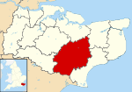
Hothfield is a village and civil parish in the Ashford Borough of Kent, England and is north-west of Ashford, yet south of the M20 motorway which takes a more northerly course.
Geography
In the north west is Hothfield Common, 58 hectares (143 acres) of heathland and lowland valley bogs: a nature reserve managed by Kent Wildlife Trust,[2]
In the south is the private parkland of Hothfield Manor, which is accessible by public footpaths leading to Godinton House. A small part of the neighbourhood of Ram Lane in is in the far northern point of the civil parish. Small tributaries of the West Stour rise in the parish.
Amenities
The village has a shop and post office with internal ATM service (closed Tuesday PM and Sunday PM). Hothfield Common has a children's playground adjacent.
History
The medieval parish church is dedicated to Saint Margaret; it was rebuilt in 1598 after a fire.[3]
Hothfield in Edward Hasted's Topography of Kent (1798) has a substantial amount of information about the history and the then layout of land and settlement.[4]
Transport
The village is immediately for approximately one mile on the south-east of the A20 road and is south of the M20 which has a very small border to the far north.
External links
References
- ↑ Key Statistics; Quick Statistics: Population Density United Kingdom Census 2011 Office for National Statistics Retrieved 10 May 2014
- ↑ "Hothfield Heathlands". Kent Wildlife Trust. Retrieved 4 May 2014.
- ↑ Vigar, John E. "St Margaret's Church, Hothfield". kentchurches.info. Retrieved 4 May 2014.
- ↑ Hasted, Edward (1798). The History and Topographical Survey of the County of Kent (Volume 7). pp. 514–526. Retrieved 4 May 2014.
External links
| Wikimedia Commons has media related to Hothfield. |