Hosur Road
Coordinates: 12°52′27″N 77°39′01″E / 12.874171°N 77.650409°E
| Hosur Road | |
|---|---|
|
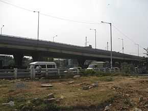
Flyover outside Central Silk Board at the Junction of Hosur Road(NH7) with Outer Ring Road | |
| Route information | |
| Maintained by NHAI, BBMP, BDA | |
| Length: | 32.00 km (19.88 mi) |
| Major junctions | |
| North end: | Brigade Road |
| Outer Ring Road, Bannerghatta Road | |
| South end: | Attibele, Anekal Taluk. |
| Location | |
| States: | Karnataka |
| Highway system | |
Bangalore-Hosur Road is the part of National Highway 7 which connects the city of Bangalore capital of Karnataka, and the Tamil Nadu border town of Hosur in Krishnagiri district. It is a four to eight-lane highway which also has service lanes on either sides at the busier parts. Apart from being a part of the National Highway, the road is also significant because it consist of many industrial and IT business houses. The famous IT industrial park Electronics City is also located alongside Hosur Road.
The segment of road between Madiwala and Electronics City is the busiest. To help ease the traffic, the city traffic police have blocked the movement of trucks in this stretch in the morning and evening rush hours. The city administration is thinking of various steps to handle the ever increasing traffic on this road.
- Construction of peripheral roads (e.g. Nandi corridor, Hosur road) is ongoing. These roads will offer an alternate route for people who stay in the south-east and south-west sections of the city to reach Electronics City without having to go through the busy stretch.
- Plans are also there for construction of a peripheral ring road which would divert traffic from the border town of Attibele in Anekal taluk, Bangalore rural district.
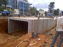
The National Highways Authority of India has constructed a 10-kilometer-long elevated highway from Madiwala and Electronics City. This toll road has made travel to Electronics City a lot easier. The Bruhat Bengaluru Mahanagara Palike and Bangalore Development Authority have planned a series of flyovers and underpasses to make this arterial road signal free.[1]
Elevated expressway
| Bangalore Elevated Tollway | |
|---|---|
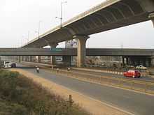 The Bangalore Elevated Tollway as seen over NICE Road | |
| Carries | 4 lanes of road traffic |
| Crosses | Electronics City, Singasandra, Bommanahalli, Bangalore–Mysore Infrastructure Corridor |
| Locale | Bengaluru |
| Official name | Bangalore Elevated Tollway |
| Website | blrelevated.co.in |
| Characteristics | |
| Design | RCC precast structure |
| Total length | 9.985 kilometers (6.204 mi) [2] |
| Height | 17 meters (56 ft) |
| History | |
| Opened | January 22, 2010 |
| Statistics | |
| Toll | Yes |
The Bangalore Elevated Tollway is a 9.985 kilometers (6.204 mi) long elevated, tolled, access-controlled expressway in the city of Bengaluru, Karnataka, India. The project is a part of the BETL (Bangalore Elevated Tollways Ltd), project as part of the National Highways Development Project and the Elevated Highways Project. It was initiated in early 2006, and was inaugurated on 22 January 2010.[3]
It starts from Bomanahalli after the Central Silk Board flyover and goes on up to Electronics City. It goes above the BMIC flyover on Hosur Road, at a height of 17 meters (56 ft), thus making it, Bangalore's tallest flyover.[4]
See also
- NICE Road
- Outer Ring Road
- Inner Ring Road, Bangalore
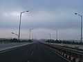
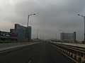
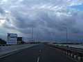
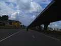
Gallery
-
Bangalore elevated tollway on Bangalore-Hosur road.
-
Bangalore elevated tollway on Bangalore-Hosur road NH7
-
Eway near Bosch
-
Hosur Road Elevated Expressway
-
EC eway Up ramp
-

Night Vision
References
- ↑ MANASI PARESH KUMAR (Oct 27, 2009). "Hosur Road widening is in full swing". Bangalore: Bangalore Mirror. Retrieved 27 March 2011.
- ↑ "Completed Stretches of NHDP Phase 3". National Highways Authority of India. Retrieved 18 May 2012.
- ↑ Expressway Elevates Commuting-Source-Deccan Herald
- ↑ Sowmya Aji Mehu (Sep 9, 2005). "56-foot-high highway to fly over BMIC road". Bangalore: Times of India. Retrieved 31 March 2011.
External links
| Wikimedia Commons has media related to Hosur Road. |