Horsley, Northumberland
| Horsley | |
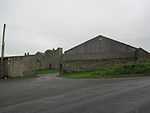
 North Farm, Horsley |
|
 Horsley |
|
| OS grid reference | NZ095665 |
|---|---|
| Unitary authority | Northumberland |
| Ceremonial county | Northumberland |
| Region | North East |
| Country | England |
| Sovereign state | United Kingdom |
| Post town | NEWCASTLE UPON TYNE |
| Postcode district | NE15 |
| Dialling code | 01661 |
| Police | Northumbria |
| Fire | Northumberland |
| Ambulance | North East |
| EU Parliament | North East England |
| UK Parliament | Hexham |
|
|
Coordinates: 54°59′35″N 1°51′11″W / 54.993°N 1.853°W
Horsley is a small village 10 miles (16 km) west of Newcastle upon Tyne and 10 miles (16 km) east of Hexham. The A69 road used to pass through the village but now bypasses the village just to the north.
Governance
Horsley is in the parliamentary constituency of Hexham.
Landmarks

Two miles north-west of the village are the remains of a medieval manor house and tower house at Welton Hall, now located within a farm complex. The tower house dates from the late fourteenth or early fifteenth century and is roofless. The manor house is even older, but has been much altered and rebuilt.[1]

Two miles north-east of Horsley is the site of the Roman fort of Vindobala, of which little is now visible. Nearby is Rudchester Hall, a medieval pele tower, much altered and extended in Gothick style in the 18th and 19th centuries.[2]
References
External links
![]() Media related to Horsley, Northumberland at Wikimedia Commons
Media related to Horsley, Northumberland at Wikimedia Commons