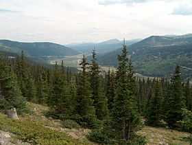
Hoosier Pass
| Hoosier Pass | |
|---|---|
|
View south from Hoosier Pass, towards Alma | |
| Elevation | 11,542 ft (3,518 m)[1] |
| Traversed by |
|
| Location | Park / Summit counties, Colorado, U.S. |
| Range | Mosquito Range |
| Coordinates | 39°21′42″N 106°03′45″W / 39.36167°N 106.06250°WCoordinates: 39°21′42″N 106°03′45″W / 39.36167°N 106.06250°W |
| Topo map | USGS Alma |
Hoosier Pass elevation 11,542 ft (3,518 m) is a high mountain pass in the Rocky Mountains of central Colorado in the United States.

The pass is located on the Continental Divide at the northern end of the Mosquito Range, in a gap between Mount Lincoln (west) and Hoosier Ridge (east). It sits on the boundary between Park (south) and Summit (north) counties.
The pass provides a route between the headwaters of the Blue River (tributary of the Colorado River) to the north and the headwaters of the South Platte River in South Park to the south. It is traversed by State Highway 9 between the towns of Breckenridge (north) and Fairplay (south). The highway over the pass provides an alternative route from Denver to the ski areas near Breckenridge and Keystone. It is generally open all year round, is traversable by all vehicles in good weather, but is occasionally closed during winter storms. The road over the pass has a smooth approach on the south side but has several switchbacks on the north side with a grade of 8%.
This pass is the highest point on the TransAmerica Trail, a transcontinental bicycle route that stretches from Yorktown, Virginia to Astoria, Oregon.
Another pass
There is another Hoosier Pass in Colorado (el. 3143 m./10,313 ft.) located in Teller County, near Cripple Creek.
References
- ↑ "Hoosier Pass". Geographic Names Information System. United States Geological Survey. Retrieved 2011-02-02.
