Hook, East Riding of Yorkshire
| Hook | |
 Church Lane |
|
 Hook |
|
| Population | 1,292 (2011 census)[1] |
|---|---|
| OS grid reference | SE761255 |
| – London | 155 mi (249 km) S |
| Civil parish | Hook |
| Unitary authority | East Riding of Yorkshire |
| Ceremonial county | East Riding of Yorkshire |
| Region | Yorkshire and the Humber |
| Country | England |
| Sovereign state | United Kingdom |
| Post town | GOOLE |
| Postcode district | DN14 |
| Dialling code | 01405 |
| Police | Humberside |
| Fire | Humberside |
| Ambulance | Yorkshire |
| EU Parliament | Yorkshire and the Humber |
| UK Parliament | Brigg and Goole |
Coordinates: 53°43′15″N 0°50′52″W / 53.720859°N 0.847782°W
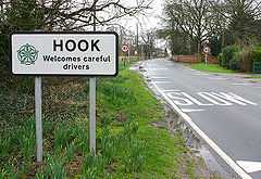
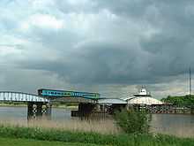
Hook is a village and civil parish in the East Riding of Yorkshire, England. It is situated approximately 1.5 miles (2.4 km) north-east of Goole town centre and lies on the west bank of the River Ouse.
According to the 2011 UK census, Hook parish had a population of 1,292,[1] an increase on the 2001 UK census figure of 1,141.[2]
The parish was part of the Goole Rural District in the West Riding of Yorkshire from 1894 to 1974, then in Boothferry district of Humberside until 1996.
The church dedicated to St Mary the Virgin was designated in 1967 by English Heritage as a Grade II* listed building.[3]
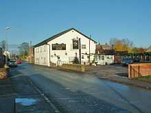
The village has a nearby local school: Hook Church Of England Primary school. There is also a small local post office and two public houses. The village a number of building sites for the purpose of housing development.
Nearby Goole has facilities including Tesco, Morrisons and Asda supermarkets, several chain-shops, schools, a hospital, and a railway station with services to Hull, Doncaster and Leeds.
References
- ↑ 1.0 1.1 "Key Figures for 2011 Census: Key Statistics: Area: Hook CP (Parish)". Neighbourhood Statistics. Office for National Statistics. Retrieved 5 February 2013.
- ↑ "2001 Census: Key Statistics: Parish Headcounts: Area: Hook CP (Parish)". Neighbourhood Statistics. Office for National Statistics. Retrieved 17 May 2008.
- ↑ Historic England. "Church of St Mary (1160360)". National Heritage List for England. Retrieved 16 August 2013.
- Gazetteer — A–Z of Towns Villages and Hamlets. East Riding of Yorkshire Council. 2006. p. 7.
| Wikimedia Commons has media related to Hook. |
| ||||||||||||||||||||||||||