Hon-Kawagoe Station
Hon-Kawagoe Station 本川越駅 | |
 | |
|---|---|
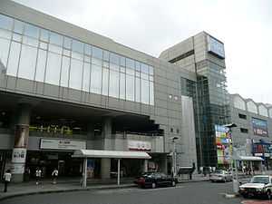
| Hon-Kawagoe Station, September 2009 | |
| Location | |
| Prefecture | Saitama (See other stations in Saitama) |
| City | Kawagoe |
| Neighborhood etc. | 1-22 Shintomi-chō |
| Postal code | 350-0043 |
| (in Japanese) | 埼玉県川越市新富町1-22 |
| History | |
| Year opened | 1895 |
| Former name | Kawagoe Station |
| Present name since | 1940 |
| Rail services | |
| Operator(s) | Seibu Railway |
| Line(s) | Seibu Shinjuku Line |
| Statistics | 48,920 passengers/day (FY2013) |
Hon-Kawagoe Station (本川越駅 Honkawagoe-eki) is a railway station on the Seibu Shinjuku Line in Kawagoe, Saitama, Japan, operated by Seibu Railway. This is one of three main stations of the city; the other two are Kawagoe Station and Kawagoeshi Station.
The station acquired the secondary name Toki no Kane to Kura no Machi (時の鐘と蔵のまち) in October 2012.
Lines
Hon-Kawagoe Station is the terminus of the 47.5 km Seibu Shinjuku Line from Seibu Shinjuku Station in Tokyo.
The station is approximately 10 minutes' walk from Kawagoeshi Station on the Tōbu Tōjō Line, and 15 minutes' walk from Kawagoe Station on the JR Kawagoe Line and Tōbu Tōjō Line).
Adjacent stations
| « | Service | » | ||
|---|---|---|---|---|
| Seibu Shinjuku Line | ||||
| Sayamashi | Koedo limited express | Terminus | ||
| Sayamashi | Commuter express | Terminus | ||
| Minami-Ōtsuka | Express | Terminus | ||
| Minami-Ōtsuka | Semi express | Terminus | ||
| Minami-Ōtsuka | Local | Terminus | ||
History
The station opened as Kawagoe Station on the Kawagoe Railway on March 21, 1895.[1] The station name was changed to the present name on July 22, 1940, following the opening of Kawagoe Station on the Kawagoe Line of Japanese Government Railways.[2] On October 20, 2012 the station acquired the secondary name Toki no Kane to Kura no Machi (時の鐘と蔵のまち) in order to encourage more tourists to visit the area. The name is a reference to the nearby 19th-century clock tower and storehouses.[3]
Station numbering was introduced on all Seibu Railway lines during fiscal 2012, with Hon-Kawagoe Station becoming "SS29".[4]
Passenger statistics
In fiscal 2013, the station was the 18th busiest on the Seibu network with an average of 48,920 passengers daily.[5]
The passenger figures for previous years are as shown below.
| Fiscal year | Daily average |
|---|---|
| 2009 | 48,518[6] |
| 2010 | 47,680[6] |
| 2011 | 47,138[7] |
| 2012 | 48,253[5] |
| 2013 | 48,920[5] |
Surrounding area
Stations
- Kawagoeshi Station (Tobu Tojo Line)
- Kawagoe Station (Tobu Tojo Line/JR Kawagoe Line)
Civic/culture
- Kawagoe City Office
- Kawagoe City Museum
- Kawagoe City Art Gallery
- Kita-in Temple
- Hikawa Shrine
- Renkeiji Temple
Education
- Saitama Prefectural Girls' High School
- Saitama Prefectural Kawagoe High School
- Yamamura Gakuen High School
- Hoshino Gakuen High School & Junior High School
- Kawagoe Technical High School[8]
Other
Bus services
The following long-distance express bus services operate from the south side of the station.
- Haneda Airport, operated by Airport Transport Service (Limousine Bus)[9] and Seibu Bus[10]
- Tokyo Disney Resort, operated jointly by Tokyo Bay City Bus and Tobu Bus West[11]
References
- ↑ Terada, Hirokazu (July 2002). データブック日本の私鉄 [Databook: Japan's Private Railways]. Japan: Neko Publishing. p. 202. ISBN 4-87366-874-3.
- ↑ Seibu Railway Kaisha Yōran (2007), p. 114 (Japanese).
- ↑ 本川越駅に副駅名「時の鐘と蔵のまち」を表示します! [An additional secondary name "Toki no Kane to Kura no Machi" will be displayed at Hon-Kawagoe Station] (pdf) (in Japanese). Japan: Seibu Railway. October 16, 2012. Retrieved 18 July 2014.
- ↑ 西武線全駅で駅ナンバリングを導入します [Station numbering to be introduced at all Seibu stations] (pdf). News Release (in Japanese). Japan: Seibu Railway. 23 February 2012. Retrieved 2 April 2013.
- ↑ 5.0 5.1 5.2 駅別乗降人員 2013(平成25)年度 1日平均 [Average daily station usage figures (fiscal 2013)] (PDF) (in Japanese). Japan: Seibu Railway. Retrieved 18 July 2014.
- ↑ 6.0 6.1 駅別乗降人員 2010(平成22)年度 1日平均 [Average daily station usage figures (fiscal 2010)] (PDF) (in Japanese). Japan: Seibu Railway. Retrieved 18 July 2014.
- ↑ 駅別乗降人員 2011(平成23)年度 1日平均 [Average daily station usage figures (fiscal 2011)] (PDF) (in Japanese). Japan: Seibu Railway. Retrieved 18 July 2014.
- ↑ Kawagoe Technical High School (Japanese)
- ↑ 本川越駅・川越駅⇔羽田空港 [Hon-Kawagoe/Kawagoe - Haneda Airport]. Airport Limousine (in Japanese). Japan: Airport Transport Service Co., Ltd. Retrieved 22 July 2012.
- ↑ 西武 空港連絡バス [Seibu Airport Bus Links] (in Japanese). Japan: Seibu Bus Co., Ltd. Retrieved 23 November 2012.
- ↑ 小江戸川越~東京ディズニーリゾート・新浦安線 [Koedo Kawagoe to Tokyo Disney Resort & Shin-Urayasu] (in Japanese). Japan: Tokyo Bay City Bus. April 2013. Retrieved 26 April 2013.
External links
| Wikimedia Commons has media related to Hon-Kawagoe Station. |
- Hon-Kawagoe Station information (Seibu Railway) (Japanese)
- Hon-Kawagoe Station information (Saitama Prefectural Government) (Japanese)
Coordinates: 35°54′50″N 139°28′52″E / 35.91376389°N 139.4811833°E