Holbrook, Suffolk
| Holbrook | |
 All Saints Church, Holbrook |
|
 Holbrook |
|
| Population | 2,317 (2001) |
|---|---|
| District | Babergh |
| Shire county | Suffolk |
| Region | East |
| Country | England |
| Sovereign state | United Kingdom |
| EU Parliament | East of England |
Coordinates: 51°59′02″N 1°09′32″E / 51.984°N 1.159°E
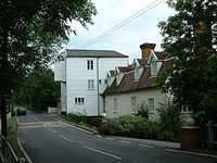
Holbrook is a village situated close to the northern shore of the Stour estuary in Suffolk, England. It is located on the Shotley peninsula in Babergh district, around 5 miles (8.0 km) south of Ipswich.
To the south of the village is the Royal Hospital School, which moved to this site in 1933 after having been housed at Greenwich Hospital since 1693.
Lower Holbrook is a hamlet between the villages of Holbrook and Harkstead.[1]
Facilities
The village has two pubs, the Compasses and the Swan, a Co-op store, a newsagent, a hairdresser,a tea shop and a village hall. The area is served by a primary school and Holbrook High School, which shares a site with the Peninsula Sports Centre. The parish church is dedicated to All Saints.[2] The village also has Methodist church.[3]
History
During the Battle of Britain, a German military aircraft crashed into a field near the village. Contemporary newspaper accounts identified the aircraft as a Messerschmitt.
References
- ↑ Philip's Street Atlas Suffolk, 2007 edition. p. 106.
- ↑ Suffolk Churches December 2008. Retrieved 2009-2-28.
- ↑ "Holbrook". eamethodist.org.uk. Retrieved 10 July 2013.
External links
| Wikimedia Commons has media related to Holbrook, Suffolk. |
- Village website
- All Saints' Church Suffolk Churches
- ""East Anglian Film Archive: "Holbrook" search results - eafa.org.uk"". Retrieved 1 May 2012.
- "The East of England Geodiversity Partnership (Holbrook Bay) - geoeast.org.uk". Retrieved 3 June 2012.
- Holbrook, Suffolk at genuki