Hockenhorn
| Hockenhorn | |
|---|---|
 | |
| Elevation | 3,293 m (10,804 ft) |
| Prominence | 348 m (1,142 ft)[1] |
| Parent peak | Finsteraarhorn |
| Location | |
 Hockenhorn Location in Switzerland | |
| Location | Bern/Valais, Switzerland |
| Range | Bernese Alps |
| Coordinates | 46°25′42″N 7°44′39″E / 46.42833°N 7.74417°ECoordinates: 46°25′42″N 7°44′39″E / 46.42833°N 7.74417°E |
| Climbing | |
| First ascent | August 1840 (Arthur Thomas Malkin) |
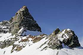
The Hockenhorn is a mountain of the Bernese Alps, located on the border between the Swiss cantons of Bern and Valais. It summit is 3,293 metre high and lies between the upper Kandertal and the Lötschental. On its southern (Valais) side lies a glacier named Milibachgletscher.
The summit of the Hockenhorn is accessible by a trail starting at the Lötschen Pass. The southern side of the mountain is part of a ski area. The closest locality is Lauchernalp above Kippel.
References
External links
| Wikimedia Commons has media related to Hockenhorn. |