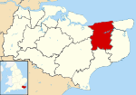
Hoath
| Hoath | |
 Holy Cross Church, Hoath |
|
 Hoath |
|
| Area | 6.51 km2 (2.51 sq mi) |
|---|---|
| Population | 551 (Civil Parish)[1] |
| – density | 85/km2 (220/sq mi) |
| OS grid reference | TR200641 |
| District | City of Canterbury |
| Shire county | Kent |
| Region | South East |
| Country | England |
| Sovereign state | United Kingdom |
| Post town | CANTERBURY |
| Postcode district | CT3 |
| Dialling code | 01227 |
| Police | Kent |
| Fire | Kent |
| Ambulance | South East Coast |
| EU Parliament | South East England |
| UK Parliament | Canterbury |
Coordinates: 51°20′02″N 1°09′47″E / 51.334°N 1.163°E
Hoath is a semi-rural village and civil parish in the City of Canterbury local government district. The hamlets of Knaves Ash, Maypole, Ford, Old Tree, Shelvingford and Stoney Acre are included in the parish.
Amenities
Within Hoath there is a small primary school, a camp site called Southview Camping, a pub/restaurant (the Prince of Wales), a small church and village hall.
Hoath has a small general aviation airfield (ICAO: EGHB) west of the village near Maypole.
History
Hoath was recorded in the Domesday Book. A Chantry either in or connected with Hoath is recorded in the 14th century, ('Hothe' in the parish of 'Reculvere'), with John Gardener as the chaplain, successor to Henry atte Were. [2]
It had a small convenience shop of its own from at least the 19th century to the 21st century.
References
- ↑ Key Statistics; Quick Statistics: Population Density United Kingdom Census 2011 Office for National Statistics Retrieved 21 November 2013
- ↑ Plea Rolls of the Court of Common Pleas; National Archive; CP 40/541, year 1396; http://aalt.law.uh.edu/AALT6/R2/CP40no541a/bCP40no541adorses/IMG_0652.htm; first entry, with "Kant" in the margin; the dispute was whether a situation should be investigated in the secular or ecclastical Courts
External links
| Wikimedia Commons has media related to Hoath. |
- www.hoath.org - village website with news, upcoming events and a history of the village
- Maypole Airfield official site
