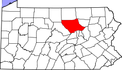
History of the Townships of Lycoming County, Pennsylvania
Lycoming County was formed from Northumberland County on April 13, 1795. At the time it was formed the county was much larger than it is today. It took up most of the land that is now north central Pennsylvania.
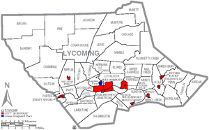
As of 2007, Lycoming County has forty-two townships. Lycoming County's townships include one census-designated place (CDP) and fifty villages. CDPs are geographical areas designated by the U.S. Census Bureau for the purposes of compiling demographic data. Villages are marked with signs by the Pennsylvania Department of Transportation.[1] Neither CDPs nor villages are actual jurisdictions under Pennsylvania law and their territory is legally part of the township(s) where they are located.


Anthony Township
Anthony Township was formed from part of Lycoming Township on September 7, 1844 by the Pennsylvania General Assembly. It is named in honor of Joseph B. Anthony who was a judge in Lycoming County at the time.
When colonial settlers first arrived in what is now Anthony Township they were outside the western boundary of what was then the Province of Pennsylvania. These settlers were not under the jurisdiction or protection of any type from any of the Thirteen Colonies. They became known as the Fair Play Men. These men established their own form of government, known as the "Fair Play System", with three elected commissioners who ruled on land claims and other issues for the group. In a remarkable coincidence, the Fair Play Men made their own declaration of independence from Britain on July 4, 1776 beneath the "Tiadaghton Elm" on the banks of Pine Creek.
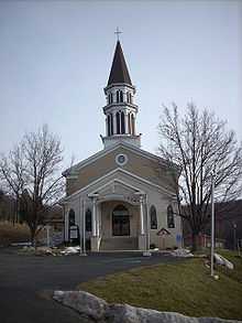
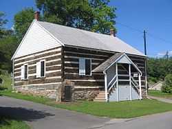
A German Baptist congregation was incorporated on February 8, 1879, under the title of the "German Baptist Church of Anthony Township". It was one of the first German Baptist churches founded in America along with two other churches in Lycoming County, one on Blooming Grove Road north of Williamsport and the other in Fairfield Township near Montoursville. These churches were more commonly known as the Dunker or Dunkard Churches for their practice of immersing believers three times, once in the name of the Father, once in the name of the Son, and once in the name of the Holy Spirit.
A spur of the plank road along Larrys Creek was built into Anthony Township, but it is not known how far it extended. (Landis claims it may have run nearly as far north as the covered bridge in Cogan House Township).
Armstrong Township
Armstrong Township was formed from part of Clinton Township in 1842. It is named in honor of James Armstrong a prominent lawyer. The population of Armstrong Township was 7,385 at the 1890 census. That number has dropped drastically to just 717 as of the 2000 census.
The first European settlers arrived in Armstrong Township in 1773. Thomas Hartley, Michael Graybill, George Leffler, and John Kern all received warrants for land on February 11, 1773. Hartley then purchased the properties of Graybill, Leffler and Kern on March 31, 1773. This was to avoid a Province of Pennsylvania law that stated that no one man could purchase more than one tract of land. Marcus Huling appears to have been the first permanent settler in Mosquito Valley, which makes up the greatest portion of Armstrong Township. Huling settled in the eastern portion of Mosquito Valley, near where Culbertson's Path crossed. Huling and family cleared land, built a cabin, a sawmill, and distillery in 1795. Huling's son, Thomas, carried on the family businesses until his death. Interestingly, although the Huling's were apparently successful businessmen they never saw fit to settle their debt on the land that they had developed. Upon Thomas Huling's death the land was foreclosed and was left to be reclaimed by nature until the arrival of German farmers in 1832.
Mosquito Valley was cleared by the lumber companies that made nearby Williamsport the "Lumber Capital of the World." Lumberjacks harvested the old-growth forests of white pine and hemlock. They then floated the logs down Mosquito Run to the sawmills close to the mouth of the creek. As the valley was cleared of trees, farmers moved into the area and began several successful orchard and dairy operations.
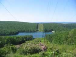
Armstrong Township is not limited to Mosquito Valley alone. Bald Eagle Mountain runs through the northern most portions of it. From this ridge several mountains streams find their source. The lumber barons from Williamsport flocked to Mosquito Run in the south and western sections of the township and to Hagerman's Run in the eastern portion of the township. The barons built summer cottages on both streams, fished for trout in the waters, and built small dams for recreational swimming and ice skating. They also built several trout hatcheries in Mosquito Valley. The Williamsport Municipal Water Authority quickly saw the value of the fresh water that was in abundant supply in both Mosquito and Hagerman's Runs. It acquired water rights to the streams and eventually bought up most of the farmland in the southwestern portion of Armstrong Township in the early 20th century as part of its watershed. Visitors to the "water company" lands can see the stone remains of the early settlers homesteads spread throughout the watershed. This mass purchase of farmland in Armstrong County has accounted for the steep decline in population since 1890. Mosquito Run and Hagerman's Run still provide drinking water for Williamsport.
Bastress Township
Bastress Township was formed from part of Susquehanna Township on December 13, 1854 by the Pennsylvania General Assembly. The township is named in honor of Solomon Bastress, of Jersey Shore, who was a former member of the legislature and an associate judge.
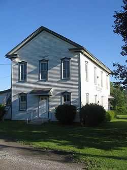
The first settlers were German Roman Catholic farmers. They migrated to the area beginning in 1837 under the leadership of Father Nicholas Steinbacher. Together they established the parish of the Church of the Immaculate Conception in 1840. The original log church was replaced in by a stone structure in 1853. The parish also established a Catholic school soon after the settlement of Bastress. Immaculate Conception parish and school stand today as a reminder of the German Catholic heritage of the residents of Bastress Township.
Bastress has changed very little since its founding. The community is largely rural and many of the residents are descendants of the first settlers. Since the 1890 census it has grown from a population of 236 to just 574.
Brady Township
Brady Township was formed from Washington Township on January 31, 1855. It was named for the Brady family, several of whom lived within its limits. Until 1861, Brady Township also included what is now Gregg Township, Union County.
One of the most prominent early residents of Brady Township was Judge William Piatt. Piatt was born and raised in the area that is now Brady Township. His father, John Piatt, moved to the southern part of Lycoming County from New Jersey and established a tannery. William was born on January 29, 1795 and followed his father into the tannery business. He soon took an interest in the local political seen and was elected to the Pennsylvania General Assembly in 1830. He served as a legislator for three terms. Piatt became an associate judge in 1855. Piatt also served Lycoming County and Brady Township as a county auditor and as a president of both a turnpike and a bridge company.
Brown Township
Brown Township was formed on May 3, 1815 by the Pennsylvania General Assembly from parts of Mifflin and Pine Townships. Pine Creek divides the township, nearly in half and it is the center of history in Brown Township. Pine Creek was a major waterway in the settlement of north central Pennsylvania and in the lumber era that swept through Pennsylvania in the mid-to-late 19th century. Early pioneers were attracted to its remoteness and abundance of fish and game.
Jacob Lamb, formerly of Milton was the first documented settler to the area. He arrived in late 1794 by paddling with his family and household supplies in ten canoes, up the West Branch Susquehanna River and Pine Creek to the mouth of Slate Run. Here, Lamb built his home. Jacob Lamb also constructed the first saw and gristmills in the area.
Over the years Brown Township grew slowly, but it never gained a large population. It is largely a remote area, covered with mountains and a thriving second growth forest. It is popular today with outdoor recreation enthusiasts. The population was 885 by the 1890 census and declined to 111 people by the 2000 census.
Cascade Township
Cascade Township was formed from parts of Hepburn and Plunketts Creek Townships on August 9, 1843. It is named for the series of waterfalls or cascades that are abundant in the many mountain streams of Cascade Township.
Many of the early settlers in Cascade Township were Irish Catholic. Under the leadership of Michael Kelly they established the village of Kellyburg in one of the most remote parts of Lycoming County. Michael Kelly also cut a road deep into Cascade Township from a sawmill along Lycoming Creek. He built a gristmill and a sawmill in the township. Kelly who had helped establish Cascade Township left the area in 1877 following a bitter defeat in the sheriff election of 1872. He moved to Kansas where he lived until he died in 1883. Michael Kelly also helped his fellow Catholics establish the mission parish of St. Mary's.[2]
Clinton Township
Clinton Township was formed from part of Washington Township by the Pennsylvania General Assembly during its December 1825 sessions. It is named for De Witt Clinton who was the governor of New York at the time.
Following the American Revolution and the Big Runaway the pioneers returned to Clinton Township and reestablished their homesteads. By this time most of the Native Americans had either been killed off or fled to the west. The settlers encountered some struggles over the years, most notably in the winter of 1787. This winter was especially harsh in Clinton Township. Nearly all the livestock was either frozen to death or they died of starvation. The supplies of food stored after the harvest were quickly depleted and the people began to starve. Hunters struggled through the deep snow. Even those that were able to use snowshoes to walk on top of the snow struggled to find any game, which also struggled to survive the harsh winter. When the winter finally broke the residents were able to harvest tremendous amounts of shad in Black Hole Creek and in the West Branch Susquehanna River with a seine that was delivered to them by the father-in-law of Major Ten Brook, Mr. Emmons. Mr. Emmons arrived from New Jersey with additional supplies including salt, wheat, corn, and garden seeds. He is credited with saving the lives of many of the early residents of Clinton Township. Emmons returned again in 1788 with another wagon load of supplies, while camping he was killed by a tree that fell on the wagon where he was sleeping.[2]
One of the most prominent physical features in Clinton Township is Penny Hill. This hill which is in the eastern portion of the township was named for a dog named Penny. Penny was apparently fond of wandering up and down the hill during the late 1780s and early 1790s. She was owned by a man named David Tolbert. Tolbert's dog was seen so often on the hill that the residents of the area began to call it Penny Hill. Today Penny Hills is bisected by U.S. Route 15. It overlooks West Branch Susquehanna River and is covered by a number of family residences and several small farms.
Cogan House Township
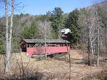
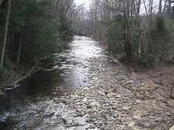
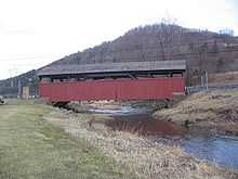
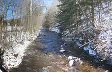
Cogan House Township was formed from parts of Jackson and Mifflin Townships on December 6, 1843. The source of Larrys Creek is in Cogan House Township, just south of the hamlet of Steam Valley.[3] It flows west-southwest through the village of Cogan House, and then under the Larrys Creek Covered Bridge. The bridge is also known as the "Buckhorn Covered Bridge" (for a nearby mountain) or the "Cogan House Covered Bridge" (for the village and township). A petition from the citizens of Cogan House Township for a bridge to be built was filed on September 4, 1876.[4] The 90-foot-long (27 m) Burr arch truss bridge was built in 1877 and rehabilitated in 1998,[5] and is on the National Register of Historic Places.[6] Larrys Creek was vitally important to the economic development of Cogan House Township. During the height of the lumber era that swept through Pennsylvania in the mid-to-late 19th century, Larrys Creek was used to float logs from the hills of the township to the lumber industry in nearby Williamsport on the West Branch Susquehanna River.
The township is named for David Cogan, a pioneer who settled on Larrys Creek in 1825. Cogan was one of the few settlers in the area for many years. He grew tired of living alone in the wilderness and abandoned his homestead in 1842 as did a neighbor named Carter. Cogan and Carter's houses were used by hunters and travelers. The name Cogan's House was given to the area, hence the name Cogan House.
Cummings Township
Cummings Township was formed by the Pennsylvania General Assembly in 1832 from parts of Mifflin and Brown Townships. Early industry in the county included quarries of flag and building stone and lumber.
The Little Pine Valley in Cummings Township was used by the Iroquois and Algonkian tribes as a hunting ground. Historians believe that there may have been a Shawnee village and burial ground just to the north of Little Pine State Park.
By the mid-19th century the demand for lumber reached the Little Pine area, where White pine and hemlock covered the surrounding mountainsides. Lumbermen came and harvested the trees and sent them down the creeks to the West Branch Susquehanna River to the log boom and sawmills at Williamsport. James and John English were the first to build a sawmill in the area in the Little Pine Area. They built two sawmills in 1809 on Little Pine Creek. In 1816, the village of English Mills sprang up around the two sawmills. The lumber era at Little Pine lasted until 1909, when the last log raft was floated down Little Pine Creek. Remnants of the lumber era can be seen today in and around the park.
Waterville is the most significant population center in Cummings Township. Michael and Henry Wolf arrived in the area from Berks County in 1817. The helped to establish Waterville by building a sawmill and clearing some land for farming. A post office was established in Waterville in 1849. Other early business establishments were two stores and a hotel, which stands today.
Eldred Township
Eldred Township is one of the smallest townships in Lycoming County. A petition was filed proposing the formation of the new township from Hepburn Township in 1858. The court directed an election to be held at Warrensville, on October 12, 1858. The question of division was hotly contested, resulting in 109 votes for to 91 against the proposition. On the November 16, 1858, Judge Jordan made a decree erecting the township, and it was named Eldred, in honor of C. D. Eldred, who was then an associate on the bench.
The first white settlers in Eldred Township were mostly Quakers, attracted by the land speculations of Robert Morris, and others in Muncy Township. Among these settlers were the Winners, Wilsons, and Marshalls. The neighborhood of their settlement is now known by the title of "Quaker Hill."
In 1892, in the northern part of the township, David Kiess & Brother owned and ran a sawmill; J. W. Milnor, Sr., also had one in the same section and in the southeastern part of the township there was one run by C. D. Heim. All these mills were located on and fed by Mill Creek. There were two gristmills in Warrensville: one, owned by J. K. Crawford, was run by water; the other, owned by C. Aderhold, had steam and water both.
Warrensville is the only village in the township. The story of the origin of its name is as follows: In 1842, when there was talk of applying for a postoffice, several persons met in the store of John Hoffman, on Mill creek, and the question Warrensville, in honor of General Warren, was proposed, of a name came up. while others suggested Livingston. A vote was taken and Warrensville carried. The postoffice was established July 25, 1842, named Warrensville, and Samuel Torbert was appointed postmaster.
The land on which Warrensville stands was cleared in 1802 by Samuel Carpenter. He erected a grist and saw mill and carding machine, which were the first improvements of the kind in the settlement. They proved of great service to the early settlers. These original works have long since passed out of existence. The village of Warrensville was laid out in 1841 by John Weisel, but never has been incorporated.
In 1892 it contained two stores and one Temperance Hotel, kept by Isaac M. Else, as well as a tannery, carried on by E. W. Lundy, two wagon makers and two blacksmith shops.
Fairfield Township
The exact date of the formation of Fairfield Township is not known, but court records point to sometime between August 1825 and December 1826. A petition for the division of Muncy Township was read in court in August 1825. Historical records do not record when the township was formed, but court documents cite Fairfield Township as the residence of a defendant in a lawsuit in a Columbia County court session in 1826.[2]
John Andrew Shulze retired to Fairfield Township following his 1823-1829 term as Pennsylvania's governor. Shulze bought 500 acres (2 km²) in western Fairfield Township, now part of Montoursville for $12,000. His plan was to spend his retirement farming in the West Branch Susquehanna Valley. Shulze quickly made am impact in Fairfield Township. He built a brick house on his farm and donated 1-acre (4,000 m2) of land for the construction of Union Church which was shared by the Lutheran and Presbyterian congregations of Montoursville and Fairfield Township. Ultimately Shulze's time in Fairfield Township can be described as a sad failure. His repeated attempts at farming her unsuccessful. He also lost a lawsuit filed by William Cameron of Lewisburg for $3,835.49. Shulze was apparently unable to pay the suit and his property was seized and sold to pay his debt. Governor Shulze then took up residence in Montoursiville, lost even more lawsuits and eventually moved to Lancaster in 1846 where he lived until his death in 1852.[2]
Fairfield Township's population has grown since the 1890 census when 468 citizens were counted. The census of 2000 counted 2,659 citizens. Fairfield Township has many residential neighborhoods that are contiguous with the neighboring borough of Montoursivlle.
Franklin Township
Franklin Township, named for Benjamin Franklin, was formed from part of Moreland Township in 1822. It included what is now Jordan Township until that was formed thirty-two years later. Another portion of Franklin Township was cut away in 1828 to form Penn Township.
The earliest settlers to Franklin Township were farmers. They arrived in the early 19th century and cleared the hills and valleys. Many of the farms established by these early settlers are still thriving today. Other important business ventures in Franklin Township included a large tannery on Little Muncy Creek just south of Lairdsville and the lumber industry which swept throughout north central Pennsylvania during the mid-to-late 19th century. Thousands of acres of virgin forests were stripped to the ground. The logs were floated down the streams to one of the many sawmills that were spread along the banks of Little Muncy Creek. Today the forests of Franklin Township have regrown, providing an excellent habitat for White-tailed deer, black bear and turkey.
Enos Hawley, born in Chester County, was one of the first citizens to Lycoming County to publicly state an opposition to slavery. He was a member of the Society of Friends. The Quakers were firmly against slavery and were noted for the assistance they provided the abolitionist movement in the years preceding the Civil War. Hawley was raised in Franklin Township in the vicinity of Lairdsville, which is the only village in the township. Hawley went on to serve as postmaster in the nearby borough of Muncy.
Gamble Township
Gamble Township was formed from parts of Lewis and Cascade Townships on January 30, 1875. An election of the citizens of the proposed township was 152-0 in favor of its creation. The drive for the formation of Gamble Township was led Ira Parker, Abraham Swartz, and J.C. Green. They started a petition and gathered the necessary signatures. Their petition was presented to Judge James Gamble who authorized the election. The results of the balloting were certified by Judge Huston Hepburn. The township is named for the judge who ordered the election.[2]
The first settler in Gamble Township was John Rose, for who Rose Valley is named. Rose was born in Scotland in 1772. He migrated to the United States in 1794 and settled in what is now Gamble Township. Rose was accompanied to the valley by is first wife and a man named Andrew Tulloh. Rose and Tulloh cleared some land for farming but did not remain in the valley. They both moved to Williamsport in their later years. The departure of John Rose did not bring about the end of agricultural development in Gamble Township. New settlers, a majority of them Germans, continued to clear Rose Valley. Here they established dairy farms and orchards, some of which are thriving today.
Salt mining and the lumbering were the primary industries found in Gamble Township during the mid-to-late 19th century. Several salt mines were built within the township. Thousands of acres of virgin forest were cleared to meet the demands for lumber during the lumber era that swept throughout Pennsylvania. Williamsport, which is just south of Gamble Township, was known at the "Lumber Capital of the World."
Today Gamble Township is a largely rural area with scattered dairy farms, orchards, and family homes. The population has risen by just 100 since the 1890 census when count stood at 754.
Hepburn Township
Hepburn Township was formed from part of Loyalsock Township in 1804. It is named for William Hepburn who was a former state senator and one of the founding fathers of Lycoming County and Williamsport which is the largest city in Lycoming County. Hepburn Township was originally much larger in size than it is today. Lewis, Gamble, Eldred Township, and Cascade Townships all are formed from territory that was at least formerly part of Hepburn Township.[2]
An Indian village known as Eeltown played a prominent role in the early history of what is now Hepburn Township. This village located on Lycoming Creek near the present village of Hepburnville was an important village on the Sheshequin Path. The Indian name for Eeltown is unknown, but the whites named it for the plentiful eels that could be found in the waters of Lycoming Creek.[7]
Hepburn Township was settled by three distinct groups of European migrants. The western section along Lycoming Creek was largely settled by the Scots-Irish, the middle section known as Blooming Grove was settled by a German religious group, the Dunkard Brethren, and the eastern section of the township was settled by the Quakers.[7] John and Gottlieb Heim were among the first Dunkards to settle in Hepburn Township. The Heims were imprisoned in Württemberg, Germany as conscientious objectors. A condition of their release from prison was that they would agree to leave Germany forever. Upon their release John and Gottleig moved to the United States. They settled in Lycoming County and founded a religious community and village known as Blooming Grove. Soon other Dunkards from Germany were to join the Heim brothers. They built log cabins and quickly cleared the land for farming. In addition to clearing the land the Dunkards were also free to worship God in a manner that they saw fit. Their faith was banned in Germany. The newly arrived settlers worked hard to clear the land and credited their success on their faith in God. The new farms prospered almost immediately, they "bloomed like flowers". Hence the name Blooming Grove.[2]
Balls Mills is a village in Hepburn Township. It is named for John Ball who migrated from England to the United States in 1893. He settled in Hillsgrove Township in Sullivan County.[7] There he built a sawmill and was beginning to have success when he drowned while bathing.[2] His son, William, then moved west to Hepburn Township and founded Balls Mills in 1818. He built a fulling mill soon after building his home. The Ball family quickly had success and expanded their milling operations to include a clover mill, a sawmill, a woolen mill, and a grain cradle manufacturing operation. A cradle is attached to a scythe to gather the harvested grains. The cradles were sold not just in Lycoming County but throughout the United States. The first major shipment to the west arrived in St. Louis, Missouri in 1866.
Jackson Township
Jackson Township was once part of Lycoming Township. At the time Lycoming Township stretched from the West Branch Susquehanna River to the northern border of Lycoming County. The residents of the northern part of the township became dissatisfied with their representation in township matters. Most of the officers of the townships were from the southern most portions near the river and they tended to forget about their neighbors to the north. The concerned citizens of the northern portions of Lycoming Township petitioned that a township for their interests be formed from Lycoming Township. The Pennsylvania General Assembly agreed and Jackson Township was formed in September 1824. The township was named for Andrew Jackson who was then known as the hero of the Battle of New Orleans in the War of 1812. He was not to become President until 1829.
Peter Sechrist was one of the first settlers to arrive in Jackson Township. He moved there from Liverpool, Pennsylvania in 1811. Sechrist cleared the land for a farm and also constructed a saw and gristmill. His mills were the first of their kind in the area and his child, Daniel, was the first white child born in the area. Other earlier settlers, seeking their fortune, arrived from York County. Two sets of brothers, Jacob and Daniel Beck and George and Daniel Miller first stopped in Williamsport before moving further to the north. They cleared some dense wilderness and established their homesteads in what is now eastern Jackson Township.
The population of Jackson Township was 619 according to the 1890 census. It as since declined to 414 residents as of the 2000 census. The area is largely mountainous and is covered with a thriving second growth forest.
Jordan Township
Jordan Township was formed from the eastern part of Franklin Township on February 7, 1854. It was named in honor of Alexander Jordan who was president judge of the district court at the time of the formation of the township. The first permanent settler arrived in Jordan Township in 1812. William Lore cleared a parcel of land and established a homestead, others soon followed his footsteps. The lumber industry was very important in Jordan Township for the first 70 years of its history. The hills and valleys were cleared of their virgin forests by the end of the 19th century. Today much of those forests forming a thriving second growth forest.
Lewis Township
Lewis Township was formed from part of Hepburn Township in 1835. It is named for Ellis Lewis who was the president judge of the local district court at the time. The township was expanded in on December 10, 1846 when part of Cascade Township was added to Lewis Township. This was done at the request of the residents of the area who geographically cut off from the rest of Cascade Township.
Lewis Township was largely uninhabited until after the Revolutionary War. A squatter named A.M. Slack is believed to have been the first permanent settler. He built a cabin and cleared some land in the area that is now the village of Bodines. The village of Trout Run has its beginnings during the construction of the Williamson Road. This road which stretched from Williamsport, Pennsylvania to Painted Post, New York helped to open north central Pennsylvania to settlement. Charles Williamson, the builder of the road, established a supply depot at Trout Run.[2]
Much of Lewis Township is covered with steep slopes that were carved into the Allegheny Plateau by the streams that drain into the West Branch Susquehanna River. The geography of the township has limited the development of the township. A narrow valley along Lycoming Creek is where most of the settlement of Lewis Township has occurred. James Kyle arrived in the area sometime around 1800. He owned 260 acres (1.1 km2) along Lycoming Creek. Kyle took out an advertisement in the Lycoming Gazette. The ad placed on March 14, 1810 read as follows.
| “ | (For sale:) A valuable farm situated on Lycoming creek, twelve miles (19 km) from Williamsport, containing 260 acres (1.1 km2), between 30 acres and 40 acres of which are cleared, with 6 acres of meadow, a thriving young orchard of apple trees, and a nice peach orchard. A square log house and kitchen, a good log barn, one of the best mill seats on Lycoming, on which there is a grist mill. In a word, the place is fit for almost any public business, as the great road (Williamson) leading to the State of New York passes through it. | ” |
Kyle's farm was eventually sold to Robert Allen. Robert and his family were among the most successful and prominent early settlers. Allen was born in Northumberland on August 6, 1797. His father, John Allen, was a native of County Down, Ireland and his mother was from Scotland. John Allen moved from Northumberland to a section of land along Lycoming Creek between Cogan Station and Hepburnville in Hepburn Township. He died in 1819 and his farm was divided among his children. Robert Allen sold his share of the farm to his brothers and moved further north along Lycoming Creek and bought the land that was formerly owned by James Kyle. Allen and his wife Mary Ann Hews improved the Kyle Farm. They rose to a position of prominence as the owners of an inn that was frequently busy with visitors who were moving along the Williamson Road. Allen was also employed as a surveyor and civil engineer. He spent several years working for the United States Government in the Northwest Territory especially in what is now Michigan along the Detroit River and Lake Huron. Allen died in 1849 and his wife died in 1883. Her parents Henry and Martha Hews were part of the failed "English Settlement" in Pine Township. They had migrated to Pennsylvania from Chard, Somerset, England. After struggling the survive in Pine Township, Henry Hews cleared and established several successful farms in Tioga County and northern Lycoming County before finally settling near Trout Run where his daughter met and married Robert Allen.
Lewis Township has changed little over the years. The population has risen to 1,139 as of the 2000 census up from 985 in the census of 1890. Trout Run is on U.S. Route 15 which follow the old Williamson Road. This highway is currently part of the Interstate 99 project.
Limestone Township
Limestone Township was established on December 4, 1824 by a decree of the Pennsylvania General Assembly. It was formed from parts of Nippenose and Wayne Townships. Limestone Township was originally known as Adams Township in honor of United States President John Adams until April 14, 1835 when the name as changed to what has deemed to be a more appropriate title.
The first European settlers in the Limestone Township area arrived as early as 1789. The early settlers thought that the land was barren due to the fact that the base of valley was largely free of trees. It was covered up dense thickets of thorny bushes. At first the land sold for as little as fifty cents and acre. After the initial settlers cleared the shrubbery and planted wheat, the land was found to be quite fertile and the price of the land rose dramatically to $5.00 per acre and by the 1890s the land was selling for as much as $100.00 an acre. Later settlers to Limestone Township established the communities of Collomsville, Oriole and Oval. These small towns were the locations of small taverns, general stores and sawmills. Much of the farmland in the southeastern portion of Limestone Township was purchased by the Williamsport Water Authority in the early 20th century as part of its watershed. Visitors to the "water company" lands can see the stone remains of the early settlers homesteads spread throughout the watershed.
Loyalsock Township
Loyalsock Township was formed from Muncy Township in February 1786 by the Northumberland County court. This was nine years prior to the formation of Lycoming County. The township was originally bounded by the West Branch Susquehanna River to the south, Loyalsock Creek was the eastern limit and Lycoming Creek was the western limit. As for the northern limit, this was undefined, it may have extended as far north as New York state. The city of Williamsport was formed in large measure from a great part of Loyalsock Township. Seventy-five percent of Williamsport's lands came from Loyalsock.[2]
Isaac and William McKinney, father and son, built the McKinney Iron Works along Lycoming Creek in western Loyalsock Townshop between 1825 and 1830, when they built a forge, in an area known as Heshbon Park. Their operation was expanded in 1836 with the construction of an iron furnace and further still in 1841 when a rolling mill was added to the complex. Iron ore was transported down the West Branch Susquehanna River Valley and up Lycoming Creek to the iron works from Centre County. The McKinney's effort was ultimately unsuccessful. The efforts of two more iron masters also failed. The iron works was largely destroyed by a flood in 1865.
Today a great part of Loyalsock Township is part of the Williamsport Metropolitan area. The flood plain between Williamsport and Montoursville is densely populated with family homes and a shopping district known as the "Golden Strip" along East Third Street. The northern and western parts of the township are less heavily populated but still there are many family homes and small businesses. The population of Loyalsock Township has grown to 10,876 (2000 census) this is up from 2,498 (1890 census).
Lycoming Township
Lycoming Township was formed from part of Old Lycoming Township. A petition from the residents of the northern part of what was Lycoming Township was submitted on April 26, 1858. The petition asked that Lycoming Township be divided into northern and southern portions. A vote held in the Newberry section of Williamsport agreed with the petitioners. A judge decreed that the northern portion be called "Lycoming Township" and the southern part be named "Old Lycoming Township on December 2. 1858. The dividing line begins where Beauty's Run flows into Lycoming Creek and follows a line of westward to Woodward and Anthony Townships.
McHenry Township
McHenry Township was tentatively formed from parts of Cummings, Brown and Cogan House Townships on November 15, 1856. It was originally known as Kingston Township. Soon afterwards the name was changed to McHenry in honor of a Jersey Shore surveyor, Alexander H. McHenry.[2] The formal establishment of the township remained in limbo for nearly five years. Some of the residents in the area were opposed to the formation of a new township. In fact it took sixteen years for what is now McHenry Township to finally be formed. The initial proposal was placed before the court in 1845 and again in 1855, this was followed by the 1856 case and was finally settled on August 21, 1861 when it was formed from Cummings and Brown Township.
The first warrant for land in what is now McHenry Township was issued to John Nixon on May 17, 1785. John English was a squatter on the land as early as 1784. McHenry Township was settled by Claudius Boatman and Comfor Wanzer's families in 1785. Abraham Harris was the next settler in the area arriving in 1802. Boatman migrated from France. He initially lived in the Mifflinburg before moving further up the West Branch Susquehanna River and Pine Creek to western Lycoming County. Boatman and his wife Esther had a rather large family. Most of them married and remained in McHenry Township upon reaching adulthood. One daughter, Fanny, married John English the original McHenry Township pioneer. Another daughter, Rebecca, married and lived a long life despite being scalped as a child.[2] Esther Boatman served as a nurse and rural physician for the pioneers along Pine Creek. The descendants of Claudius Boatman remain in fairly large numbers in western Lycoming County.
Lumbering was the primary industry in McHenry Township during the mid-to-late 19th century. Thousands of acres of virgin forest were cleared to meet the demands for lumber during the lumber era that swept throughout Pennsylvania. Williamsport which is just south and east of McHenry Township, was known at the "Lumber Capital of the World." Logs were floated down Pine Creek and into the West Branch Susquehanna River to various sawmills along both streams and in Williamsport.
McHenry Township is a very rural and remote section of Lycoming County. The hills and valleys are now covered with a thriving second growth forest. The population as of the 2000 census was just 145.
McIntyre Township
McIntyre Township was formed from territory taken from Lewis Township by the Pennsylvania General Assembly in 1848. It is named for Archibald McIntyre who was one of the founders of the Williamsport and Elmira Railroad.
The first pioneers arrived in the McIntyre Township area in 1794 near what is now the village of Ralston. John Smithkontz cleared a parcel of land along Lycoming Creek near the mouth of Pleasant Stream in 1805.
.jpg)
The New York Iron and Coal Company created the first business venture in what was to become McIntyre Township in when they constructed a sawmill on Lycoming Creek. The New York Iron and Coal Company also built an iron furnace near the mouth of Frozen Run in 1831. They began to make iron using iron ore that was mined nearby. The company also established a charcoal making operation for the fuel that was needed to keep the furnaces fired. The iron industry had little success in McIntyre. The ore was difficult to clean, it could only be separated from the dirt that was mixed in when it was frozen. And the ore that they did manage to extract produced iron that proved to be very brittle. The reason that several companies attempted to succeed in what proved to be a failing enterprise was the fact that the furnace was within easy distance of the Williamsport and Elmira Railroad which connected the industrial centers of Williamsport and Elmira, New York.
The McIntyre Coal company was founded by Jervis Langdon in 1870. He set up a coal mining operation in the mountains in the northeastern section of McIntyre Township. Coal mining had taken place on a small scale in the earlier years of the township, but Langdon was the first to open a large-scale operation. The coal company constructed a steep (45 degrees) and long (2,300 ft) incline plane to get the coal from the mine to the waiting railroad cars. The village of McIntyre sprang up around the coal mines. At one time it was home to 300 households, had a church, school, store, sawmill, a boot and shoe shop, and a public hall. The McIntyre Coal Company ceased operation in 1886. The mine was abandoned and the town was abandoned shortly after the mine.
McNett Township
McNett Township, in the northeastern corner of Lycoming County, was formed by the Pennsylvania General Assembly on January 26, 1878 from McIntyre Township. The formation was a result of a successful petition and election by the citizens of the northeastern corner of Lycoming County who were under the leadership of H. I. McNett, for whom the township was named.
McNett Township has always been a remote portion of Pennsylvania. Farming and industry is at a minimum. Most of the land is mountainous and is covered with a thriving second growth forest. The population which was 619 persons in the 1890 census has fallen to just 211 at the 2000 census.
Mifflin Township
Mifflin Township was formed in 1803 by dividing Lycoming Township. It is named in honor of Thomas Mifflin the first governor of Pennsylvania.
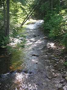
Mifflin Township is located within the Larrys Creek watershed. This area was densely covered with trees and brush until about 1790 when the first settlers attempted to clear some of the land that surrounds Larrys Creek. John Murphy was the first settlers to establish a permanent homestead. He cleared some land along the creek and built a home. His daughter, Sarah, is thought to have been the first white child to have been born in Mifflin Township. Murphy was soon followed by other settlers who also built cabins, cleared some land for farming and built sawmills. Lumber was soon to become the dominant industry in Mifflin Township.
As timber and lumber became a major industry in the mid-19th century, Larrys Creek, in Mifflin Township, was a source of power for sawmills and other mills. The first sawmill on the creek was built in 1799. The relatively low flow of water in the creek did not allow rafts of logs to be floated downstream to the river and the lumber boom at Williamsport.
This and the lack of logging railroads along the creek lead to the development of many small sawmills. Twelve sawmills were on the Second Fork, six on the First Fork, one each on Canoe Run and the rest were on Larrys Creek itself. By 1903 just two mills were still standing and only one of those was operating.
Lumbering removed the tree trunks, but left many flammable limbs, branches, and stumps behind. On May 2, 1872 a large forest fire destroyed the villages of Carter and Gould, 6 miles (10 km) north of Salladasburg on Larrys Creek in Mifflin Township. There are large tracts of second growth forest and small lumber companies still operate in the township today.
Mill Creek Township
Mill Creek Township was formed from part of Muncy Township on February 25, 1879 by the order of a judge who certified the results of an election regarding a petition to form the new township by the residents of what was the northern portion of Muncy Township. The election held on December 10, 1878 was a close one. 122 citizens voted in favor of creating Mill Creek Township and 104 voted against the measure. The township is named for Mill Creek a tributary of Loyalsock Creek.
Moreland Township
Moreland Township was formed from part of Muncy Creek Township in 1813. It was divided into three townships in 1822. One part kept the name Moreland and the other two parts were called, Penn and Franklin Townships.

There are several stories about how Moreland Township got its name. One story states that an early pioneer to the West Branch Susquehanna River Valley was climbing up and down the hills and upon reaching the top of a hill exclaimed, "more land!". Another story relates to the "sloppiness" of the earliest land surveys. An acre was not necessarily measured accurately. These particular acres were larger than they were supposed to be. The early settlers liked to say that they got "more land" to the acre here than they could have elsewhere. The last story, which seems to be the most likely reason, relates to an arcane definition of moreland, meaning "a hilly country."
A veteran of the American Revolutionary War was the first settler in Moreland Township. Colonel George Smith migrated to Moreland Township from Montgomery County in 1790. He built a gristmill there in 1796. Smith and his wife were the parents of 6 children, 3 boys and 3 girls. The marriage of his daughter, Annie to a Quaker named William Farr causes some controversy in the early history of Moreland Township. William Farr came from a strict Quaker family and they did not look kindly upon his choice of bride. The local Society of Friends congregation insisted that Farr confess that he had done wrong in marrying outside his faith. Farr refused to do so, he insisted that his Baptist wife, Annie, was a good Christian woman. Farr was forced to choose between his Quaker faith and his Baptist wife. He chose his wife and converted to the Baptist faith. Colonel Smith's son, Jonathan also had a marriage that proved to be interesting. He married Annie Simpson. Annie Simpson was the sister of John Simpson of Ohio. John Simpson was the grandfather of Ulysses S. Grant. Grant achieved fame as a general for the Union during the U.S. Civil War and later became the 18th President of the United States. This family bond meant that many of the residents of Moreland Township in the mid-19th century were second cousins to the man who served as their President.
Muncy Creek Township
Muncy Creek Township was formed when Muncy Township was divided for the second time in 1797. The township is named for Muncy Creek a tributary of the West Branch Susquehanna River that flows threw it. Some of the oldest settlements of Lycoming County are in Muncy Creek Township.[7] The township also played an important role in the development and regular use of the Pennsylvania Canal along the West Branch Susquehanna River. The hamlet of Port Penn rose up along the section of the canal that passed through Muncy Creek Township. This hamlet, since largely abandoned, was a very busy and sometimes dangerous place.[7]
Muncy dam was built across the river at Muncy Creek Township. This dam provided the water that was needed to fill the canal along a stretch of canal that began at Port Penn and ended at Sunbury. The dam, canal and towing path were all constructed for a considerable amount of money. Around these construction projects, the hamlet of Port Penn was built.[8] Upon completion of the canal in 1834 it was already a thriving community featuring a manufacturer of canal boats. Other businesses in Port Penn included hotels and taverns that provided housing and food for the men working on the canal, and a blacksmith and a saddle maker. There was a butcher that also operated had a grocery business, a weaver, a wagon builder, a shoemaker, an ice business, as well as several teachers, masons and general merchants.[8]
Port Penn quickly gained a reputation was being a dangerous place that attracted "unsavory" characters.[7] Gambling and prize fighting were two popular past times. Large amounts of alcohol were consumed by the participants furthering the danger. An organized group of counterfeiters had an operation in a cabin in Muncy Creek Township that passed fake coins onto the boatmen and others that passed by Port Penn on the canal. A riot took place during the construction of the canal that resulted in several deaths. A man named Barney McCue is responsible for at least two murders at Port Penn, one in 1870 and another four years later in 1874. Many children drowned in the canal and river. The railroad that largely replaced the canal was not less dangerous as several lives were claimed on the rails. Even the so-called "Last Raft" to be floated down the West Branch took several lives at Port Penn. The raft hit the railroad bridge and sent 45 passengers into the river, seven of which died.[8]
The canal in Muncy Creek Township brought vast amounts of goods that were stored in warehouses in Port Penn and Muncy. The farmers and industrialists of Lycoming County used these warehouses to store their goods before they were sent south on the canal. The chief exports of the county were hogs, wheat, flour, lumber, dried and salted meats, leather and whiskey. Whiskey was a very big business. At least 13 distilleries in the area produced and output of 1,200 to 1,500 gallons of whiskey a day. Muncy Creek Township also was home to a thriving commercial fishing industry. The dam was an ideal point to catch fish. The bottleneck in the river caused by the dam and canal locks caused the fish to be forced into one easy to reach location. Baskets were placed along the dam and locks and tremendous amounts of fish and eels were easily caught.[7] The dams and locks at Port Penn were destroyed by numerous floods in the West Branch Susquehanna River Valley during the late 19th century. This caused the canal to be abandoned as it was replaced by the railroads. Port Penn was since faded away. There are several homes in the area, but as a hamlet it no longer exists. Parts of Port Penn have been annexed by the borough of Muncy and others are in Muncy Creek Township. Lycoming College and the Muncy Historical Society have spearheaded an effort to uncover the history of Port Penn.[8]
Muncy Township
Muncy Township named for the Munsee tribe, was the first township in the county north of the West Branch Susquehanna River to be formed (predating even Lycoming County itself). It was originally formed as a part of Northumberland County on April 9, 1772.[2] Muncy Township, as one of the seven original townships of Northumberland County was once an immense township. It had an indefinite northern border. The southern border of the township was the West Branch Susquehanna River. The eastern boundary may have been Muncy Creek and the western boundary was, like the northern boundary, indefinite. Loyalsock Township was the first township to be formed from Muncy Township in 1786. This division encompassed the land between Loyalsock and Lycoming Creeks. The township was divided several more times. Muncy Creek Township was formed in 1797, Shrewsbury Township in 1804, Penn Township in 1821, Wolf Township in 1834 and lastly in 1878 when Mill Creek Township was formed.[2]
Samuel Wallis was one of the first permanent settlers in Muncy Township. Known as the "Land King" Wallis operated Muncy Farms which was for its time a large and very successful farm. Wallis first came to the West Branch Susquehanna Valley in 1768 as a surveyor. He was born in Harford County, Maryland in 1730 to a wealthy Quaker family. Wallis received a good education and inherited a large fortune. He sought to expand his fortune in various ways. He worked for a while as a shipping merchant in Philadelphia and became a surveyor. While working as a surveyor Wallis was introduced to what would become his home in 1768. He gave up his job as a surveyor and began acquiring land up and down the West Branch Valley. His holdings are said to have extended as far west as Pine Creek from his base of operations in Muncy Township. Wallis held title to the land that has since become, Muncy, Muncy Creek Township, Muncy Township, Montoursville, Loyalsock Township, Williamsport, Woodward Township, Piatt Township, Porter Township and Jersey Shore. Wallis' home was one of, if not the, first houses to be built in what is now Lycoming County. Samuel Wallis was such an important figure in the early history of Muncy Township that Fort Muncy was built on his land. This fort served as an outpost for the colonial army of Pennsylvania providing a safe haven for settlers from various Indian attacks.
Samuel Wallis married Lydia Hollingsworth in Philadelphia on March 1, 1770. They settled at Muncy Farms soon after the marriage and continued to farm while Wallis continued to expand his land holdings. Wallis was forced to flee Muncy Farms during the "Big Runaway." During the American Revolutionary War, settlements throughout the Susquehanna valley were attacked by Loyalists and Native Americans allied with the British. Wallis returned as soon as it was safe and continued to farm. He also built a gristmill along Carpenter's Run. The construction of this mill was entrusted to Colonel Henry Antes of Nippenose Township. Antes was the operator of the most successful mill in the area along Antes Creek.
Samuel Wallis and James Wilson a signer of the Declaration of Independence and Supreme Court appointee of George Washington became involved with Theophilus Cazenove and the Holland Land Company. This company bought up much of the land that his now northwestern Pennsylvania and western New York near the Great Lakes. Wallis worked as a surveyor and assessor for the land company and Wilson was heavily invested in the operation. Wilson owed a tremendous debt to Wallis and others. He fled to Edenton, North Carolina to escape his debts. Wallis followed him there in an effort to reach a settlement. They reached a preliminary agreement and agreed to meet again. Both men died before the debts could be settled. Wallis contracted yellow fever on his return from North Carolina and died in Philadelphia on October 14, 1798. Wilson died in Edenton, North Carolina on August 21, 1798. Wallis' heir were unable to collect Wilson's debt. Wallis himself left a large debt behind. The heirs were forced to sell Samuel Wallis' land for a fraction of his value to Henry Drinker. Drinker gave the land to his daughter and son-in-law, Elizabeth and Charles Hall. Muncy Farms became known as Hall's Farms.
Pennsdale is a village in Muncy Township. It was founded by a group of Quakers in 1799. They built a meetinghouse there. The first meetings were held in Samuel Wallis's home as early as 1791. The Quakers continue to hold meetings in Pennsdale.
Nippenose Township
Nippenose Township was formed as part of Northumberland County in 1786 by a session of the Northumberland County court that was held in Sunbury. It did not become part of Lycoming County until Lycoming County was also formed from Northumberland County in 1795. Nippenose Township was originally much larger than it is today. It spread over parts of what are now, Clinton, Centre and Lycoming Counties. The population of Nippenose Township was 588, in 1890, compared to the slightly higher population of 729 as the 2000 census.
The story behind the name of Nippenose Township is unclear. There are two competing stories. One states that it is named for the Indian phrase, "Nippeno-wi", meaning a warm and genial summer like place. The other story behind the name is traces back an old Indian named Nippenose. The early settlers told the story of the old man who lingered in the valley after it was settled by whites. Apparently this man's nose had been "nipped" by exposure to the frost, hence the name "Nippenose."
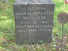
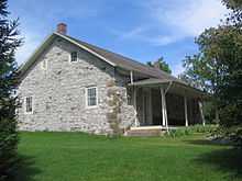
The first colonial settlers arrived in the Nippenose area in 1769. Henry Clark was the first to arrive with a "warrant" to the land from the colonial Pennsylvania government. One of the most prominent early settlers was Colonel John Henry Antes. He is thought to have arrived as early as 1772. He last name is featured prominently in place names in Nippenose Township. Antes Creek the main creek in the valley and Antes Fort a small village both bear his name. Antes built stockade around his home, his neighbors came to call it "Antes Fort" and the name has lived on to today. Colonel Antes also built a grist mill at the mouth of Antes Creek on the West Branch Susquehanna River in 1777. This mill was burned during the Revolutionary war. Colonel Antes fled the area during the "Big Runaway."
When things finally calmed down in 1792, Colonel Antes returned to Nippenose Township and rebuilt his mill this second mill was a vital link the economy of Nippenose Township until 1873 when a new mill was built in its place. Antes furthered his enterprises by building a carding and fulling mill on the banks of Antes Creek in 1810. Antes died in 1820. Ownership of the mills was passed onto his son-in-law Elias P. Youngman. Youngman and his sons expanded the business yet again in 1835 by adding machinery that was able to clean clover seed. Clover seed was very expensive at the time, a bushel of the seed sold for as much as $24.00. Clover was very important to farmers for providing ground cover and as a food supply for their grazing dairy cows.
The village of Antes Fort rose up around the train station that was built in Nippenose Township to service the borough of Jersey Shore which is the north and across the West Branch Susquehanna River from Nippenose Township. Antes Fort went through several name changes. The surveyor who drew up the towns plans called it "Granville". This name was seldom uses as the locals preferred to call it "Jersey Shore Station". The name Antes Fort was not bestowed on the village until 1861 when the United States Post Office established a branch there and named it in honor of Colonel Antes' stockade.
Old Lycoming Township
Old Lycoming Township is a township in Lycoming County that is actually older than the county. It was formed as part of Northumberland County on August 22, 1785, ten years before the formation of Lycoming County. The original boundaries of the township encompassed much of the territory that was previously governed by the Fair Play Men. The land between Lycoming and Pine Creeks was outside of the legal boundaries of Pennsylvania until 1784 and the second Treaty of Fort Stanwix. The Fair Play Men operated a system of self-government from 1773 to 1785. Their claims to the land had no legal bearing in the state of Pennsylvania when it was finally legally part of the state. These men had some troubles gaining the title to the land that they had cleared and defended for so long. Some of them were able to keep their lands and others chose to move further west.[2]
Most of the settlers, who fled during the Big Runaway, did not return to their farms until after Sullivan's Expedition had driven off the Indian and Loyalist threat. John McMeens a native of South Carolina was one of the first to return to the area. He had settled along the river in 1776. He fled during the Big Runaway and returned in 1791. McMeens rose to a position of prominence in Lycoming County. He was a county commissioner, state commissioner and served on the initial committee that explored to possibility of building the Pennsylvania Canal that improved navigation on the Susquehanna River. McMeens also represented the area in the Pennsylvania General Assembly from 1814 to 1818.
Derick Updegraff arrived in Old Lycoming Township from York County in 1787. He settled on land that had previously been improved during the Fair Play Men era. He was not able to claim legal control of his 500 acres (2 km²) until 1793 as the result of a lawsuit over the land filed by the man who had previously claimed it. Updegraff and his sons improved the land by clearing more land and building what was one of the largest barns in Lycoming County.
Today Old Lycoming Township includes the census designated area of Garden View. Garden View serves as a suburb to Williamsport with many family homes and an extensive stretch of commercial and light industrial development along Lycoming Creek Road.
Penn Township
Penn Township was formed in 1828 when Muncy Township was divided for the fourth time. It is named for Penn Township, Berks County, Pennsylvania in Berks County which is name for William Penn the founder of Pennsylvania. Tobias and Isaac Kepner had migrated to eastern Lycoming County from Berks County and wanted their new home to have the same name as their old home.[2] Much of the history of Penn Township can be found in the history of the Big Runaway and Muncy Township. Lumbering was the dominant industry in Penn Township during the mid-to-late 19th century. A man made lake, Beaver Lake,[9] was built to supply water power for a sawmill. The sawmill has long since disappeared but the lake remains.
Piatt Township
Piatt Township was formed from part of Mifflin Township by the Pennsylvania General Assembly on April 30, 1857. The new township encompassed what was the southernmost part of Mifflin Township. Piatt Township is named for William Piatt, who was an associate judge in Lycoming County when the township was created.[2]
Larrys Creek, which bisects Piatt Township, is named for Larry Burt, the first settler in the area, who lived near the mouth of the creek near what is now the hamlet of Larrys Creek. He traded with the indigenous peoples and according to tradition had a Native American wife. Larry Burt was already there when surveyors came through in 1769 (after the land was purchased in the first Treaty of Fort Stanwix), but disappeared sometime soon after, perhaps moving west with the Native Americans who left the area.
Other settlers soon followed Larry Burt to the what it now Piatt Township. They settled along the banks of Larrys Creek near where the creek flows into the West Branch Susquehanna River. Peter Duffy was one of the most prominent of the early settlers. He settled with his family at the mouth of Larrys Creek in August 1784. Duffy's journey from County Kildare, Ireland was a long and difficult struggle. He left from Dublin in July 1775 during the early years of the American Revolution. Duffy was an acquaintance of Major John Pitcairn. Pitcairn was with the Royal Marines and was part of the British force that was occupying Boston, Massachusetts at the outset of the Revolution. Pitcairn was killed at the Battle of Bunker Hill. This left Peter Duffy with a bit of a problem. He no longer had a point of contact in the Thirteen Colonies.
Duffy and his family landed in Philadelphia in August 1775. After a short stay in the Philadelphia area, he and his family moved further inland to Lancaster County. The family spent seven years in the Lancaster area before moving to Coxestown, know known as Susquehanna Township, just north of Harrisburg in Dauphin County. The Duffy's owned a home along the banks of the Susquehanna River for about a year before it was flooded and accidentally burned in the winter of 1784. Peter Duffy did not lot this stop him. He gathered is family and migrated further still into the Pennsylvania frontier. The Duffy Family was joined by the Stewart Family on their trip from Dauphin County to Lycoming County. Both families settled down to the east of what is now Jersey Shore. The Stewarts settled on the southern side of the West Branch Susquehanna River in Nippenose Township and the Duffys settled on the opposite shore in Piatt Township.
Peter Duffy built his home near where the Great Shamokin Path crossed Larrys Creek. This path became and important road in the settlement of the West Branch Susquehanna River Valley. Early pioneers trekked up the road as they continued to move ever westward. Peter Duffy opened an inn that soon became an important stopping point for the pioneers. Duffy was unable to enjoy his prominence for very long. Late one evening, while returning from a hunt, a pack of wolves attacked Peter Duffy along the Great Shamokin Path. Duffy was able to fend off the wolves and returned safely home, but the cold and the extreme effort he put into defending himself left him weakened. He came down with a severe and fatal cold.
Duffy's widow Martha was left to manage the inn with the help of her children. Soon after Peter's death, their first-born son, James also died. James Duffy was attending a wedding party at Culbertson's Mill in Duboistown in February 1807 when he was accidentally killed. Martha Duffy was left with her four remaining children. Her second daughter, Catharine, had married and moved with her husband to Meadville in Crawford County. The oldest daughter, Mary Ann, took over management of the inn. Bernard operated the family owned sawmill on Pine Creek, Margaret managed the Duffy family home, and Peter, the son, managed the family farm. These four Duffy children never married and spent the rest of their lives living together in the family home in Piatt Township.
The area of land along the West Branch and Larrys Creek was previously known as "Level Corner". Many of the early settlers were attracted to this area of fertile farmland. Isaac Smith migrated to Piatt Township, from Chester County. Smith was a millwright and farmer. Robert Covenhoven was another prominent early settler. He was a veteran of the American Revolution having fought at the Battles of Trenton and Princeton. Covenhoven had returned to the West Branch Valley just before the Big Runaway. Upon hearing of the approaching raiding Indians and Loyalist, Covenhoven rode west along the ridge of Bald Eagle Mountain to warn settlers at Fort Antes (opposite what is now Jersey Shore) and the western part of the valley.[2] Covenhoven is listed as a Fair Play Man and one of the signers of the Tiadaghton Declaration of Independence. Following the Great Runaway Covenhoven continued to serve as a scout for the Patriot forces on the Pennsylvania Frontier. At the conclusion of the war he settled with his wife at Level Corner. They raised a family of three sons and five daughters. Covenhoven live a long life before dying at the age of 90. He is buried in Northumberland where he went to live with his daughter Nancy after his wife Mercy's death.
Pine Township
Pine Township was formed from parts of Brown, Cummings and Cogan House Townships on January 27, 1857. It was originally going to be called Kingston Township, for the Kingston House what was in English Center, but the name was changed to Pine in recognition of the vast stands of pine trees that covered much of the township.
The geography and geology of Pine Township have played an important role in its history. Pine Township lies within the southern limits of the most recent ice age. This land was once covered with glaciers. As the glaciers receded they scoured the land creating a moraine, knob-like hills, and kettle holes. Some of these kettles are at the top of the hill. This has caused the unusual formation of a swamp at the top of a hill. The effects of glaciation created soil characteristics that limited successful farming and steep hillsides that also cut down on the amount of farmable land. Therefore trees have thrived in Pine Township. The old-growth forests were harvested in the mid-to-late 19th century during the lumber era that swept throughout the hills and valleys of Pennsylvania. Massive stands of hemlock and pine were chopped down and floated down Little Pine and Pine Creeks to the sawmills of Williamsport. Since the end of the lumbering era a thriving second growth forest has grown throughout Pine Township.
John Norris and his wife were among the first to settle in Pine Township. They opened a "seminary" or school for girls in the wilderness. During the years it was opened it was one of very few schools in such a remote part of the country to focus on educating teenaged girls.
A failed colony known as "English Settlement" plays a role in the history of northern Lycoming County. The Reverend John Hey, who claimed to be part of the "Independent Church of England" dreamt of acquiring a vast amount of land in the wilderness and establishing a utopia. Hey and some investing partners acquired 110,859 acres (449 km2) of land for $21,757 in 1805. Hey next travelled to England to convince his country to settle his new colony. Fifteen families agreed to move to Pine Township. When they arrived they did not find the paradise that was described to them by John Hey. What they found was a wilderness of massive trees, rocks and rocky soil. The Englishmen were not prepared for this. They had no experience with clearing any land for farming and the land that they managed to clear was too rocky for farming. The English Settlement was abandoned ten years after its founding. The folks that managed to survive moved to more fertile land in the nearby area.
The villages of Oregon Hill and English Center were founded by survivors of the failed English Settlement. Oregon Hill was the location of two churches, a blacksmith shop, and two stores along with several homes. The settlers of Oregon Hill were surprised to find that the land in the area was fertile unlike much of the surrounding land. English Center on Little Pine Creek was a milling town.[2]
Plunketts Creek Township
Plunketts Creek Township was formed from parts of Franklin Township, Lycoming County and what is now Davidson Township, Sullivan County by the Pennsylvania General Assembly during its December sessions of 1836. The township was once much larger in size, more than a few townships in both Lycoming and Sullivan Counties have been carved from what was once Plunketts Creek Township. The township is named for Plunketts Creek which is a tributary of Loyalsock Creek. The creek is in turn named for Colonel William Plunkett who was a frontier doctor during the pre-Revolution years in the Province of Pennsylvania. He was noted for his skill in dressing the wounds of pioneers who had been scalped by both the French and Indians during the French and Indian War. The township was to originally be called Plunkett Township. The residents of the township did not approve of this name. They questioned William Plunkett's loyalty. It was said that he sympathized with the cause of the Tories during the Revolution. A compromise was reached by naming it Plunketts Creek Township.[2]
The first white man to live in Plunketts Creek Township was a man with the surname of Paulhamus. Tradition states that he was deserter during the Revolutionary War. He fled from the Red coats and cleared a small piece of land in the wilderness along Loyalsock Creek near the mouth of Bear Creek. Paulhamus was a squatter on the land from 1770 until 1776 when it is thought that he was forced to rejoin the British Army. Permanent settlers did not arrive in Plunketts Creek Township until 1818. Three men Donelly, Smith and Payne found the cabin that had been abandoned by Paulhamus. They expanded Paulhamus' improvements and began farming, fishing and hunting in the area.
Logging was the principal industry in Plunketts Creek Township during the mid-to-late 19th century. Thousands of acres of virgin forest were harvested and floated down Loyalsock Creek and its tributaries to one of the many sawmills that had sprung up throughout Lycoming County. There were several sawmills in Barbours, a village along Loyalsock Creek, in Plunketts Creek Township.
Thomas E. Proctor operated a tannery along Loyalsock Creek in what is now known as Proctorville. The tannery, opened in 1868, was rather large. It employed several hundred workers at its peak operation.[2]
Porter Township
Porter Township named for David R. Porter Pennsylvania governor (1839–1845), was formed from part of Mifflin Township on May 6, 1840.
Dr. James Davidson, a veteran of the American Revolution, served as a doctor for General Anthony Wayne's army, was one of the first and most successful settlers in the Porter Township area. He settled in the Sunbury just after the Revolution. After several years in that vicinity he bought a farm along the West Branch Susquehanna River in what is now western Lycoming County. Here he farmed and also served as the only doctor in the area for many years. Dr. Davidson built one of the first brick houses in the West Branch Susquehanna Valley. He also served as a judge for Lycoming County after it was formed in 1795.
Shrewsbury Township
Shrewsbury Township was formed from part of Muncy Township by the Pennsylvania General Assembly in 1804. It was originally much larger in size and included a large part of what is now Sullivan County until 1847. It is named for Shrewsbury Township, New Jersey. Some of the first settlers, The Little and Bennett families, migrated to Lycoming County from New Jersey and wanted their new home to have the same name as their old home. Peter Corson, also from New Jersey was one of the first settlers to establish a home in the area and he was quite successful. Corson and his wife had 5 sons and 3 daughters and within less than 100 years they had descendants that were numbered by the hundred.
In the late 19th century, Highland Lake, in the northern part of Shrewsbury Township was popular summer vacation destination. There were three large hotels on the lake as well as several summer cottages. The cottage holders included Pennsylvanians from as far away as Philadelphia which is approximately 100 mi (160 km) southwest of Shrewsbury Township.
Industry and farming are and always have been very limited in Shrewsbury Township. It is a very mountainous area. The population as of the 2000 census has declined to 433 residents from 570 at the census of 1890.
Susquehanna Township
Susquehanna Township was established during the December 1838 sessions of the Pennsylvania General Assembly. It was formed from parts of Nippensoe and Armstrong Townships.
Susquehanna Township was first surveyed in 1769. The surveyors named it "Upper Bottom" to distinguish from a piece of land further to the east that was named "Lower Bottom", present day Duboistown and South Williamsport. The first settlers arrived in 1801 and cleared the alluvial plain near the West Branch Susquehanna River and began farming. The village of Nisbet, a collection of about a dozen homes, rose up around the railroad station of the same name. Two grist mills and a small textile mill were built on Mill Run during the early days of Susquehanna Township.
Susquehanna Township has grown somewhat since it was founded. The village of Nisbet underwent an expansion during the 1950s and 1960s and now serves as a bedroom community for Williamsport and Jersey Shore. Much of the land on the alluvial plain is still farmed. Farmer rent out small portions of their property for the docking of recreational boats on the West Branch Susquehanna River.
Upper Fairfield Township
The history of Upper Fairfield Township begins in 1851 when some dissatisfied citizens of the southern portion of Fairfield Township asked to be separated from the neighbors to the north. The citizens of the northern portion were strongly against division, but the township was divided against their wishes on September 12, 1851.
Upper Fairfield Township was called Pollock Township during its first two years of existence. It was named for Judge James Pollock, who was the president of district court that ordered the township to be divided. Since the citizens of Upper Fairfield Township where against the division in the first place, they were less than pleased with the name of their new township. Pollock was a controversial figure in the early days of Upper Fairfield. The citizens asked the court that the named be changed and the Pennsylvania General Assembly ordered that Pollock Township's name be changed to Upper Fairfield Township on January 29, 1853.
Washington Township
Washington Township was formed as part of Northumberland County in 1786. It originally extended from White Deer Hole Creek north to the West Branch Susquehanna River with its eastern boundary also formed by the west branch. The western limit was ambiguous, but most historians assumed that the western boundary followed a line that extended to the south opposite the mouth of Pine Creek in what is now eastern Clinton County. Washington Township is older than Lycoming County. Therefore it was one of the original townships in Lycoming County. Seven additional townships were created from land that was originally part of Washington Township. They are Armstrong, Bastress, Brady, Clinton, Limestone, Nippenose, and Susquehanna Townships.[2] The township is named for the hero of the American Revolution and the 1st President of the United States, George Washington.
Historically, two paths of the native indigenous peoples ran along parts of White Deer Hole Creek in Washington Township. Settlers arrived by 1770, but fled in 1778 during the American Revolutionary War during The Big Runaway. They returned and the creek served as the southern boundary of Lycoming County and Washington Township when it was formed in 1795. A logging railroad ran along the creek from 1901 to 1904 for timber clearcutting and small-scale lumbering continues.
The Great Island Path was a major trail that ran north along the Susquehanna River from the Saponi village of Shamokin at modern Sunbury, fording the river there and following the west bank of the West Branch Susquehanna River north until White Deer Hole valley. The path turned west at Allenwood and followed White Deer Hole Creek until about the present location of Elimsport in Washington Township. There it headed northwest, crossed North White Deer Ridge and passed west through the Nippenose valley, then turned north and crossed Bald Eagle Mountain via McElhattan Creek and ran along the south bank of the river to the Great Island (near the present day city of Lock Haven).
Beginning with the first settlers, much of the land along White Deer Hole Creek in Washington Township was slowly cleared of timber. Small sawmills were built in the 19th century, and a much larger lumber operation was run by the Vincent Lumber Company from 1901 to 1904. They built a narrow gauge 42 inches (1,067 mm) railroad from Elimsport 5 miles (8 km) west into timber, and a line east to Allenwood in Union County and the Reading Railroad there. The lumber railroad ran parallel to the creek, with the end of the track near the Fourth Gap. It was incorporated on June 24, 1901 (around the time of construction) as the "Allenwood and Western Railroad". The lumbering operation ceased in 1904 when the forests were gone. The railroad was torn up, and its one second-hand Shay locomotive was moved to the Vincent Lumber Company operation at Denholm (in Juniata County).[10]
From 1900 to 1935, much of what is now Tiadaghton State Forest was purchased by Pennsylvania from lumber companies that had no further use for the clear-cut land. In the 1930s there were seven Civilian Conservation Corps camps to construct roads and trails in the forest.[11]
Small-scale lumbering continues in the Washington Township, but the forest is certified as well-managed "in an environmentally sensitive manner" and lumber from it qualifies for a "green label".[11] A sawmill owned and operated by Amish is on Pennsylvania Route 44 in Elimsport. It burned down on May 10, 2006 (causing $500,000 in damages) but was expected to be back in operation in a month.[12] Despite this small-scale lumbering, as of 2006 the forests have grown back and are mixed oak, with blueberry and mountain laurel bushes. White Deer Hole Creek and its tributaries also have stands of hemlock and thickets of rhododendron along them.[13]
Watson Township
Watson Township was formed in January 1848 from parts of Porter and Cummings Townships. It is named for Oliver Watson who was the president of a bank in nearby Williamsport at the time.
Watson Township is and always has been a largely unpopulated area. It is mountainous and covered with a thriving second growth forest. During the late 19th century much of the land was stripped of its virgin forests. At the time central Pennsylvania, and the city of Williamsport was the center of the lumber industry in the United States. Trees were cut down and floated down Pine Creek, which flows through Watson Township. There were several sawmills along Pine Creek in the township. Other early attempts at industry included an iron forge. There were several deposits of iron ore in Watson Township. The ore proved to be of low quality and the investors in the iron furnaces struggled to turn a profit. The furnaces were abandoned and little evidence of their existence remains.
Wolf Township
Wolf Township was formed from part of Muncy Township by the Pennsylvania General Assembly in September 1834. The township is named for George Wolf who was the governor of Pennsylvania from 1829 to 1835. The boroughs of Hughesville and Picture Rocks are on land that was taken from Wolf Township.
Wolf Township today has grown to a population of 2,707 residents as of the 2000 census. This is up from 734 residents at the census of 1890.
The geology of Wolf Township played a role in its history. Limestone was quarried west of Hughesville for use as lime. Lime is used in large quantities as building and engineering materials (including limestone products, concrete and mortar) and as chemical feedstocks, among other uses. Lime industries and the use of many of the resulting products date from prehistoric periods in both the Old World and the New World. Wolf Township was also the home to several Pennsylvania Bluestone quarries. Pennsylvania Bluestone has many uses, from cut dimensional stone used in patios, walkways and stair treads to architectural stone used in buildings. It is also used for wallstone, decorative boulders, natural steps and other landscape features. The name "Pennsylvania Bluestone" is due to its predominantly blue color and because the majority of stone is quarried in Pennsylvania.
David Aspen was the first white settler to live within the borders of what is now Wolf Township. He was scalped during the Big Runaway, when his and other settlements throughout the Susquehanna valley were attacked by Loyalists and Native Americans allied with the British. Abraham Webster was another of the early settlers to be attacked, only he survived and returned to Wolf Township twelve years after the Big Runaway. His entire family had been killed but he returned with a new wife and re-established his home.
The earliest industrial venture in Wolf Township was a gristmill constructed in 1816. A wool carding mill was built in 1842. There were also several sawmills in the township that were part of the lumber industry that covered much of Pennsylvania during the late 19th century.
Woodward Township
Woodward Township was formed on November 23, 1855 by dividing Anthony Township. It is named for Apollos Woodward who was an associated judge in Williamsport at the time.[2] The population of Woodward Township has grown to 2,397 as of the 2000 census. This is up from 817 during the 1890 census. The township, which is bisected by Quenshukeny Run, is semi-rural in nature. The northern parts of the township are less heavily populated than the southern parts which lie on U.S. Route 220 and serve as a suburb for Williamsport and Jersey Shore.
When Woodward township was first settled by migrants from Europe it was outside the boundaries of the Province of Pennsylvania. These settlers were not under the rule or protection of the colonial government in Philadelphia. Together they formed their own form of government that was administered by a group of pioneers known as the Fair Play Men. These early settlers banded together to provide law and order to a land that was wild and dangerous.
Brattan Caldwell, a native of County Kildare, Ireland, migrated to the Thirteen Colonies in 1770. He arrived in Philadelphia and from there moved to Lancaster County. He joined with other pioneers and they followed the Susquehanna River and West Branch Susquehann River into the frontier. Brattan Caldwell and the other settlers arrived in what is now Woodward Township in 1772. They cleared land along the river's tributaries. Caldwell married Elcy Hughes in the winter of 1775 on the south side of the river in Nippenose Township. This part of the West Branch Susquehanna River Valley was under the jurisdiction and protection of the colonial government of Pennsylvania. The Hughes' were married by a Northumberland County Justice of the Peace. It was the first marriage to take place in the settlements west of Lycoming Creek.[2] Brattan Caldwell and his family fled to Lancaster County during The Big Runaway of the American Revolution and did not return to their land until after Sullivan's Expedition. Caldwell obtain legal rights to the land he has settled in 1784 following the Treaty of Fort Stanwix.
Linden is the only village in Woodward Township. It sprung up as a shanty town during the construction of the Pennsylvania Canal. The contractors building the canal built the shanties for the laborers who were building the canal.
References
- ↑ Lycoming County Economic Development and Planning Services, GIS Division (2005). "Lycoming County, Pennsylvania" (PDF). Map. Archived from the original on 2007-08-10. Retrieved 2007-09-17. Note: Official Lycoming County Map showing cities, boroughs, townships, and villages, but not smaller settlements
- ↑ 2.0 2.1 2.2 2.3 2.4 2.5 2.6 2.7 2.8 2.9 2.10 2.11 2.12 2.13 2.14 2.15 2.16 2.17 2.18 2.19 2.20 2.21 2.22 2.23 2.24 Meginness, John Franklin (1996) [1892]. "Chapter 34". History of Lycoming County, Pennsylvania: including its aboriginal history; the colonial and revolutionary periods; early settlement and subsequent growth; organization and civil administration; the legal and medical professions; internal improvement; past and present history of Williamsport; manufacturing and lumber interests; religious, educational, and social development; geology and agriculture; military record; sketches of boroughs, townships, and villages; portraits and biographies of pioneers and representative citizens, etc. etc. (1st ed.). Chicago, Illinois: Brown, Runk & Co. ISBN 0-7884-0428-8. Retrieved 2007-03-31.
(Note: ISBN refers to Heritage Books July 1996 reprint. URL is to scan of 1892 version with some OCR typos).
- ↑ USGS. "United States Geological Survey Topographic Map, White Pine Quad". www.topozone.com. Retrieved 2007-02-28.
- ↑ Landis, Milton W. (October 1966). "The Larrys Creek Covered Bridge in Cogan House Township". Now and then (The Journal of the Muncy, Pennsylvania Historical Society) XV (5): 258.
- ↑ Kane, Trish. "Pennsylvania - Lycoming County Covered Bridges". Retrieved 2007-02-28.
- ↑ "National Register of Historic Places - PENNSYLVANIA (PA), Lycoming County". Retrieved 2007-02-28.
- ↑ 7.0 7.1 7.2 7.3 7.4 7.5 7.6 Lloyd, Thomas W. (1929). History of Lycoming County Pennsylvania. Indianapolis, Indiana: HISTORICAL PUBLISHING COMPANY. Retrieved 2007-04-28.
- ↑ 8.0 8.1 8.2 8.3 "History of Port Penn, Muncy Canal". Muncy Historical Society. Retrieved 2007-04-28.
- ↑ United States Geological Survey. "Beaver Lake, USGS Sonestown (PA) Topo Map". TopoZone. Retrieved 2007-04-23.
- ↑ Taber, Thomas T., III (1987). Railroads of Pennsylvania Encyclopedia and Atlas. Thomas T. Taber III. ISBN 0-9603398-5-X.
- ↑ 11.0 11.1 Pennsylvania Department of Conservation and Natural Resources : Bureau of Forestry (November 2004). "A Public Use Map for Tiadaghton State Forest" (Map / Brochure).
- ↑ Holmes, Philip A. (May 13, 2006). "Fire claims Route 44 sawmill". Williamsport Sun-Gazette. Retrieved 2006-11-20.
- ↑ Pennsylvania Department of Conservation and Natural Resources : Bureau of Forestry (2002). "Central Mountains Shared Use Trails System: Union, Lycoming and Clinton Counties, Bald Eagle and Tiadaghton State Forests" (Map / Brochure).
| |||||||||||||||||||||||||||||||||||||