Hiraya, Nagano
| Hiraya 平谷村 | |
|---|---|
| Village | |
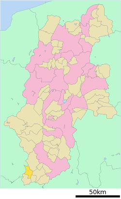 Location of Hiraya in Nagano Prefecture | |
 Hiraya Location in Japan | |
| Coordinates: 35°19′N 137°38′E / 35.317°N 137.633°ECoordinates: 35°19′N 137°38′E / 35.317°N 137.633°E | |
| Country | Japan |
| Region |
Chūbu Kōshin'etsu |
| Prefecture | Nagano Prefecture |
| District | Shimoina |
| Area | |
| • Total | 77.40 km2 (29.88 sq mi) |
| Population (2003) | |
| • Total | 645 |
| • Density | 8.3/km2 (22/sq mi) |
| Time zone | Japan Standard Time (UTC+9) |
| Website | Village of Hiraya |
Hiraya (平谷村 Hiraya-mura) is a village located in Shimoina District, Nagano Prefecture, Japan.
As of 2003, the village has an estimated population of 645 and a density of 8.33 persons per km². The total area is 77.40 km².
Hiraya contains Mount Ōkawairi and the mouth of the Yahagi River.
Despite being a small and isolated village, it has a small family-oriented ski resort, and a fishing pond, which is stocked with several kinds of trout.
Hiraya is also known for its corn.
External links
![]() Media related to Hiraya, Nagano at Wikimedia Commons
Media related to Hiraya, Nagano at Wikimedia Commons
- Hiraya official website (Japanese)