Hinode, Tokyo
| Hinode 日の出町 | |
|---|---|
| Town | |
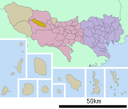 Location of Hinode in Tokyo Metropolis | |
 Hinode Location in Japan | |
| Coordinates: 35°44′32″N 139°15′27″E / 35.74222°N 139.25750°ECoordinates: 35°44′32″N 139°15′27″E / 35.74222°N 139.25750°E | |
| Country | Japan |
| Region | Kantō |
| Prefecture | Tokyo Metropolis |
| District | Nishitama |
| Area | |
| • Total | 28.08 km2 (10.84 sq mi) |
| Population (August 2011) | |
| • Total | 16,603 |
| • Density | 590/km2 (1,500/sq mi) |
| Time zone | Japan Standard Time (UTC+9) |
| Website | Town of Hinode |
Hinode (日の出町 Hinode-machi) is a town located in Nishitama District, Tokyo Metropolis, Japan. As of 2005, it had a population of 16,023 and an area of 28.08 km², with a population density of 570.6/km².
Geography
The highest mountain is Mount Hinode at 902 m. The Hirai and Ōguno Rivers drain the town. Hinode borders the cities of Ōme and Akiruno, both of which are also in Tokyo.
History
The village of Hinode was formed in 1955 with the merger of the villages of Hirai and Ōguno. Hinode became a town in 1974.
Industry
Forestry and timber production are important industries. Cryptomeria and hinoki are economically important. Hinode produces 200,000 coffins annually, ranking first in Japan.
Education
Hinode has three public elementary schools (Hirai, Honjuku, and Ōguno) and two public middle schools (Hirai and Ōguno).
Tokyo Metropolitan Government Board of Education operates Mizuho High School in nearby Mizuho. The school district operates the following high schools in Akiruno:
The school district operates the following high schools in Ōme:
Transportation
The Hinode Interchange of the Ken-O Expressway is in Hinode.
Topics
- Former Japanese prime minister Yasuhiro Nakasone had a cottage, Hinode Sansō in this town, and in 1983, when he was in the post, Nakasone invited US president Ronald Reagan there, and held US-Japan summit with friendly relationship. And, after his resign, Nakasone also met at his cottage, Chun Doo-hwan (ex-president of South Korea), Mikhail Gorbachev (ex-president of Soviet Union) and other many foreign VIPs, include several US ambassadors. Nakasone gave the historic place to the town in 2006, and it has opened as a public park now.
References
External links
![]() Media related to Hinode, Tokyo at Wikimedia Commons
Media related to Hinode, Tokyo at Wikimedia Commons
- Hinode official website (Japanese)