Hillsborough Parish, New Brunswick
| Hillsborough | |
|---|---|
| Parish | |
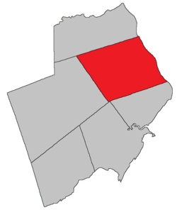 Location within Albert County. | |
| Coordinates: 45°55′N 64°42′W / 45.92°N 64.70°WCoordinates: 45°55′N 64°42′W / 45.92°N 64.70°W | |
| Country |
|
| Province |
|
| County | Albert County |
| Established | 1786 |
| Area[1] | |
| • Land | 303.73 km2 (117.27 sq mi) |
| Population (2011)[1] | |
| • Total | 1,395 |
| • Density | 4.6/km2 (12/sq mi) |
| • Pop 2006-2011 |
|
| • Dwellings | 630 |
| Time zone | AST (UTC-4) |
| • Summer (DST) | ADT (UTC-3) |
Hillsborough is a Canadian parish in Albert County, New Brunswick.[2]
Delineation
Hillsborough Parish is situated in the eastern section of Albert County and is bordered to the north by Coverdale Parish, to the east by Petitcodiac River and south by Hopewell Parish, and to the west by the Elgin Parish.
Hillsborough Parish is defined in the Territorial Division Act as:
History
Albert County: established as a Nova Scotian township in 1765 and became part of New Brunswick as the Parish of Hillsborough (Westmorland County) in 1786: named for Wills Hill (1718-1793), Earl of Hillsborough and the lord commissioner of trade and plantations: Hillsborough Parish included Coverdale Parish until 1828
Located on W side of the Petitcodiac River, 2.26 km NW of Surrey: Hillsborough Parish, Albert County: formerly called German Village for Henry Steeves and a group of German settlers who arrived in 1765 from Pennsylvania: renamed with the creation of the post office: PO Hillsborough from 1840: in 1866 Hillsborough was a community with approximately 167 families: Richard E. Steeves was postmaster and David Wallace was a mill owner: the Albert Mining Company was located nearby: in 1871 Hillsborough had a population of 900: in 1898 Hillsborough was a seaport, a port of entry and a settlement on the Salisbury and Hillsborough Railway with 1 post office, 8 stores, 2 hotels, 1 tannery, 1 carriage factory, nearby gypsum mines and a population of 700: Hillsborough was incorporated as a village in 1966[3]
Communities
Parish population total does not include incorporated municipalities (in bold).
|
|
|
Bodies of water & Islands
This is a list of rivers, lakes, streams, creeks, marshes and Islands that are at least partially in this parish
- Petitcodiac River
- Grays Island
- Stoney Creek
Demographics
Population
LanguageMother tongue language (2006)[5]
| |||||||||||||||||||||||||||||||||||||||
Access Routes
Highways and numbered routes that run through the parish, including external routes that start or finish at the parish limits:[6]
|
|
|
|
See also
References
- ↑ 1.0 1.1 2011 Statistics Canada Census Profile: Hillsborough Parish, New Brunswick
- ↑ New Brunswick Provincial Archives - Hillsborough Parish
- ↑ New Brunswick Provincial Archives, Government of New Brunswick.
- ↑ Statistics Canada: 2001, 2006 census
- ↑ Profile: Hillsborough Parish, New Brunswick
- ↑ Atlantic Canada Back Road Atlas ISBN 978-1-55368-618-7
 |
Havelock Parish | Coverdale Parish | | |
| Elgin Parish | |
Petitcodiac River Dorchester Parish (Westmorland County) | ||
| ||||
| | ||||
| Harvey Parish | Hopewell Parish |
| ||||||||||||||||||