Highways in Poland


Polish public roads are grouped into four categories related to the republic's administrative division. Motorways and expressways are part of the national road network. Voivodeship roads are provincial-level roads administered by the individual governments of the voivodeships. Powiat and gmina roads are administered by county and municipal authorities. Poland has 412,264 km (256,170 mi) of public roads, of which 131,863 km (81,940 mi) are unsurfaced (2011):[1]
- National roads: 18,801 km (11,680 mi), 1.9 km (1 mi) unsurfaced
- Voivodeship roads: 28,476 km (17,690 mi), 63.2 km (39 mi) unsurfaced
- Powiat roads: 127,743 km (79,380 mi), 11,379 km (7,070 mi) unsurfaced
- Gmina roads: 237,244 km (147,420 mi), 120,419 km (74,820 mi) unsurfaced
As of December 2013, there are 2,820.0 kilometres (1,750 mi) of motorways[2] (autostrady, singular - autostrada) and expressways[2] (drogi ekspresowe, singular - droga ekspresowa) in use.
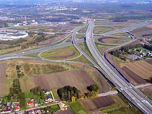
List of Polish motorways and expressways
![]() Motorways in Poland are identified by the letter A, followed by a number (e.g. A1). Under current plans, by 2015 three motorways will span the country, with two routes running along an east to west axis (A2 running centrally and A4 running southerly) and one motorway traversing a north to south axis (with A1 running centrally). In addition, three shorter motorway stretches (A6, A8, A18) complete the planned motorway network. The only complete motorway stretch is A8. All others are currently under construction or in various stages of planning. As of September 2013, 1,389 km (860 mi) of motorways are in use.[2]
Motorways in Poland are identified by the letter A, followed by a number (e.g. A1). Under current plans, by 2015 three motorways will span the country, with two routes running along an east to west axis (A2 running centrally and A4 running southerly) and one motorway traversing a north to south axis (with A1 running centrally). In addition, three shorter motorway stretches (A6, A8, A18) complete the planned motorway network. The only complete motorway stretch is A8. All others are currently under construction or in various stages of planning. As of September 2013, 1,389 km (860 mi) of motorways are in use.[2]
![]() Expressways in Poland are limited-access roads, divided into either dual or single carriageways. Expressway on-ramp signs in Poland are marked by a white car inside a blue background, while numbered designations are white on a red background, with the letter S preceding the number. Major expressways (in various stages of use, construction, or planning) include S3, S5, S7, S11, S17 and S19 running north to south, and S6, S8, S10, S12 and S74, running east to west. As of September 2013, nearly 1,269 km (790 mi) of expressways are currently in use.[2]
Expressways in Poland are limited-access roads, divided into either dual or single carriageways. Expressway on-ramp signs in Poland are marked by a white car inside a blue background, while numbered designations are white on a red background, with the letter S preceding the number. Major expressways (in various stages of use, construction, or planning) include S3, S5, S7, S11, S17 and S19 running north to south, and S6, S8, S10, S12 and S74, running east to west. As of September 2013, nearly 1,269 km (790 mi) of expressways are currently in use.[2]
Under the government of Prime Minister Marek Belka, the Council of Ministers regulations issued in May 2004 detailed plans for a network of motorways and expressways totaling to 7,200 km (4,470 mi) across the republic, including nearly 2,000 km (1,240 mi) of designated motorways.[3] Further cabinet regulations under Prime Minister Jarosław Kaczyński published in February 2007 added S2 and S79 to the network, planned to facilitate high speed traffic in and out of Warsaw.[4] In October 2009, the cabinet under Donald Tusk supplemented plans for the construction of S61 to serve the northeastern region of the country to connect with Lithuania.[5]
The following table summarizes the planned motorway and expressway network with approximate lengths. As of September 2013, nearly 252 km (160 mi) of motorways and 395 km (250 mi) of expressways are in various stages of construction.[2]
.jpg)


| Motorways | |||||||
| Sign | Course | Total length | Existing | Under construction | Tender | Environmental decision (DŚU) | |
|---|---|---|---|---|---|---|---|
| Gdańsk (S6) – Gorzyczki (border) | 565.1 km | 332.8 km | 58.89% | 108.2 km | 123.8 km | ||
| Świecko (border) – Kukuryki (border) | 622.6 km | 475 km | 76.29% | 147,6 km | |||
| Jędrzychowice (border) – Korczowa (border) | 672 km | 528 km | 78.57% | 144 km | |||
| Kołbaskowo (border) – Rzęśnica (S3) | 28.5 km | 24.2 km | 84.91% | 4.3 km | |||
| Bielany Wrocławskie (S8) – Wrocław (S8) | 22.3 km | 22.3 km | 100% | ||||
| Olszyna (border) – Krzyżowa (A4) | 78.5 km | 7 km; 71.5 km (north carriageway) |
45.16% | 71.5 km (south carriageway) | |||
| In total | 1989 km | 1389.3 km | 69.85% | 252.2 km | ' | 347.2 km | |
| Expressways | |||||||
| Sign | Course | Total length | Existing | Under construction | Tender | Environmental decision (DŚU) | |
| Pyrzowice (A1) – Cieszyn (border) | 121.4 km * | 63.8 km | 52.55% | 17.6 km | |||
| Konotopa (A2) – Nowy Konik (A2) | 34.1 km | 14.3 km | 39.2% | 19.8 km | |||
| Świnoujście – Lubawka (border) | 478.2 km * | 227.85 km | 47.64% | 95.4 km | 170.3 km | ||
| Grudziądz (A1) – Wrocław (A8) | 367.7 km * | 76.15 km | 20.71% | 29.3 km | 66.4 km | 195.95 km | |
| Goleniów (S3) – Gdańsk (A1) | 346.5 km * | 55.55 km | 16.04% | 189.95 km | |||
| Gdańsk (A1) – Rabka-Zdrój | 709 km * | 258.5 km | 36.45% | 11.1 km | 84.5 km | 224.1 km | |
| Wrocław (A8) – Białystok (S19) | 564.9 km * | 246.4 km | 43.62% | 195.1 km | 19.2 km | 104.2 km | |
| Szczecin (A6) – Płońsk (S7) | 459.8 km * | 52.3 km | 11.37% | 28.4 km | |||
| Koszalin (S6) – Pyrzowice (A1) | 560.3 km * | 55.75 km | 9.95% | 5.3 km | 139.2 km | ||
| Piotrków Trybunalski (A1) – Dorohusk-Jagodzin (border) | 319.7 km * | 53 km | 16.58% | 30.7 km | 12.1 km | ||
| Łódź (A2) – (S8) | 40.1 km | 9.6 km | 23.94% | 3.3 km | 27.2 km | ||
| Warszawa (S8) – Hrebenne-Rawa Ruska (border) | 322.3 km * | 54.1 km | 16.79% | 30.7 km | 100.9 km | ||
| Kuźnica Białostocka-Bruzgi (border) – Barwinek (border) | 594.7 km * | 25.05 km | 4.21% | 14.6 km | 19.5 km | 107.56 km | |
| Elbląg – Grzechotki (border) | 48.6 km | 48.6 km | 100% | ||||
| Olsztyn – Olsztynek (S7) | 18.5 km | 5.2 km | 28.11% | 13.3 km | |||
| Ostrów Mazowiecka (S8) – Budzisko (border) | 234.5 km * | 19.25 km | 19.25 km | ||||
| Bielsko-Biała – Zwardoń (border) | 48.4 km | 23.3 km | 50.21% | 15.6 km | 8.5 km | ||
| Sulejów (S12) – Nisko (S19) | 192.2 km * | 6.8 km | 3.54% | 9.7 km | |||
| Warszawa-Lotnisko (S2) – Warszawa-Marynarska | 4.3 km | 4.3 km | 100% | ||||
| In total | 5472.1 km | 1269.35 km | 23.20% | 394.75 km | 298.3 km | 1374.4 km | |
History of Highway Planning prior to the Second World War

The first plans for the creation of a national highway network in Poland were conceived in the interwar period. The main promoter of this concept was Professor Melchior Wladyslaw Nestorowicz of the Warsaw University of Technology, who organized three Road Congresses, during which a group of specialists discussed the creation of the network. On March 5, 1939, in the trade magazine Drogowiec, Professor Nestorowicz proposed a very ambitious plan for the construction of almost 5,000 kilometres of category I and II roads, based on similar programmes in Germany and Italy.[6] Nestorowicz sketched a map of the future system with the following routes:
First class roads consisted of the following motorways:
- Warsaw - Łódź - 100 km
- Warsaw – Poznań - Polish-German border - 350 km
- Warsaw beltway - 130 km
- Poznań beltway - 80 km
- Gdynia – Bydgoszcz – Łódź – 500 km
- Łódź beltway - 90 km
- Bytow - Free City of Danzig border - 50 km
- Katowice – Kraków – Lwów - 375 km
- Warsaw – Lublin - Lwów – Sniatyn - Polish-Romanian border - 550 km
- Puławy – Sandomierz – Przemyśl - 175 km
A total of 2,400 km (1,500 mi)
Second class roads consisted of the following motorways:
- Piotrków Trybunalski - Kielce - Sandomierz - 180 km
- Warsaw – Kielce – Kraków - 180 km
- Łódź - Kalisz - Polish-German border north of Wrocław - 130 km
- Warsaw – Grodno – Vilnius – Polish - Lithuania - Latvian border near Daugavpils - 575 km
- Grodno - Nowogrodek - Polish-Soviet border near Minsk - 190 km
- Bydgoszcz – Poznań – Częstochowa - 350 km
- Katowice – Cieszyn – Polish-Czechoslovak border - 60 km
- Ostrołęka - Polish-East Prussian border - 50 km
- Grodno - Polish-Lithuanian border - 40 km
- Grodno - Brzesc nad Bugiem - Krasnystaw - 300 km
- Warsaw – Brzesc nad Bugiem - 170 km
A total of 2,295 km (1,430 mi)
The current planned network consists of six highways (A1, A2, A4, A6, A8, A18) and 19 express roads.[5]
Total length of highways in Poland (end of the year)
1945-1976 - 133 km
1977 - 169 km
1978 - 169 km
1979 - 190 km
1980 - 190 km
1981 - 190 km
1982 - 190 km
1983 - 255 km
1984 - 278 km
1985 - 321 km
1986 - 327 km
1987 - 327 km
1988 - 348 km
1989 - 366 km
1990 - 381 km
1991 - 399 km
1992 - 399 km
1993 - 403 km
1994 - 405 km
1995 - 440 km
1996 - 453 km
1997 - 456 km
1998 - 490 km
1999 - 502 km
2000 - 592 km
2001 - 630 km
2002 - 639 km
2003 - 727 km
2004 - 781 km
2005 - 848 km
2006 - 1013 km
2007 - 1083 km
2008 - 1282 km
2009 - 1454 km
2010 - 1560 km
2011 - 1865 km
2012 - 2448 km
2013 - 2820 km
2014 - 3196 km (forecast)[7]
See also
References
- ↑ TRANSPORT Activity Results in 2011 Główny Urząd Statystyczny
- ↑ 2.0 2.1 2.2 2.3 2.4 Polish motorways and expressways stats on skyscrapercity(Polish)
- ↑ Dz.U. 2004 nr 128 poz. 1334(Polish)
- ↑ Dz.U. 2007 nr 35 poz. 220(Polish)
- ↑ 5.0 5.1 Dz.U. 2009 nr 187 poz. 1446(Polish)
- ↑ Prof. M. W. Nestorowicz, Problem budowy dróg samochodowych (autostrad) w Polsce
- ↑ http://www.skyscrapercity.com/showthread.php?t=1142261
External links
| Wikimedia Commons has media related to Highways in Poland. |
- General Directorate for National Roads and Motorways (in Polish, some information also in English)
| ||||||||||||||
| ||||||||||||||